Of all the paths you take in life, make sure a few of them are dirt.
-JOHN MUIR
June 18, 2024:
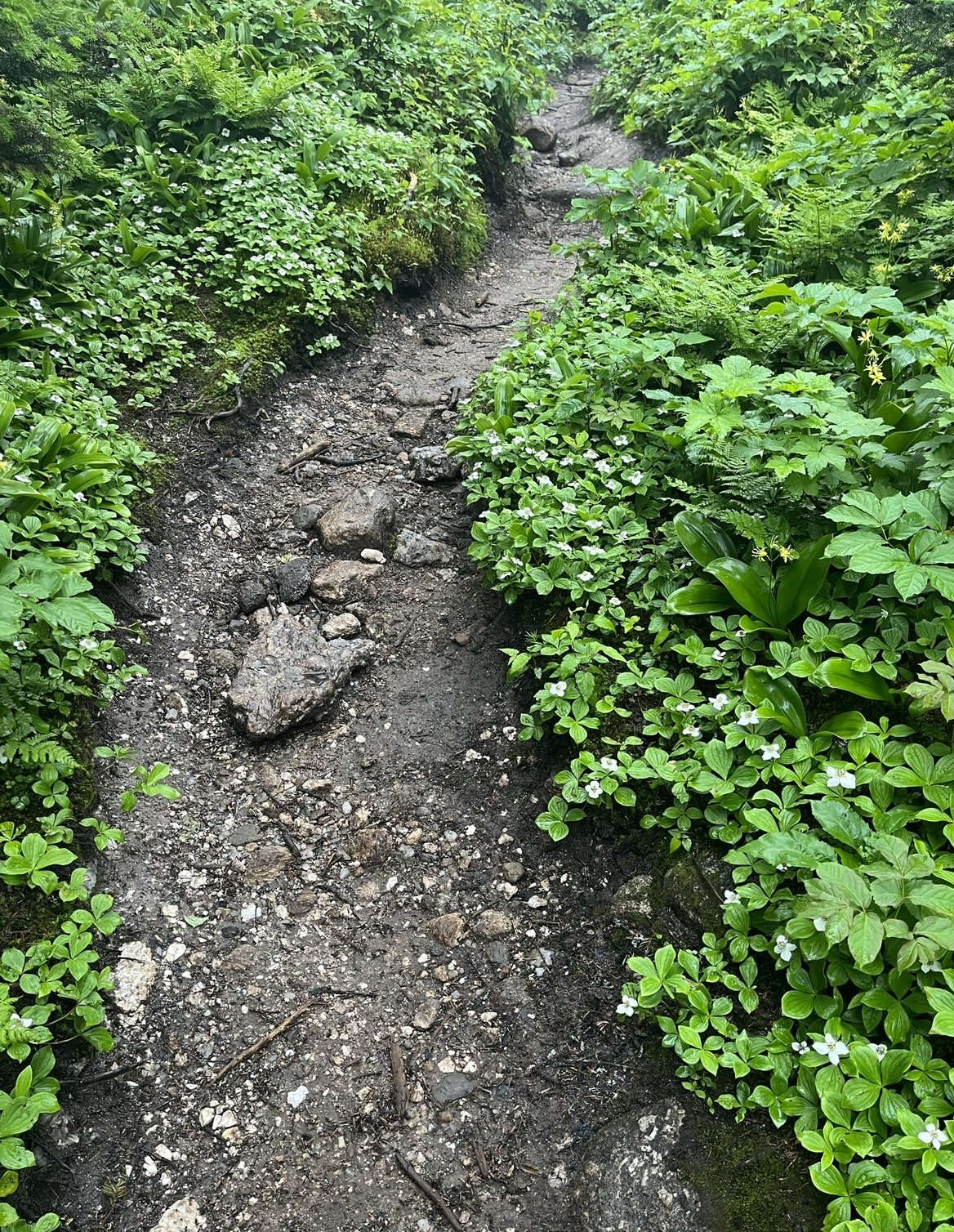
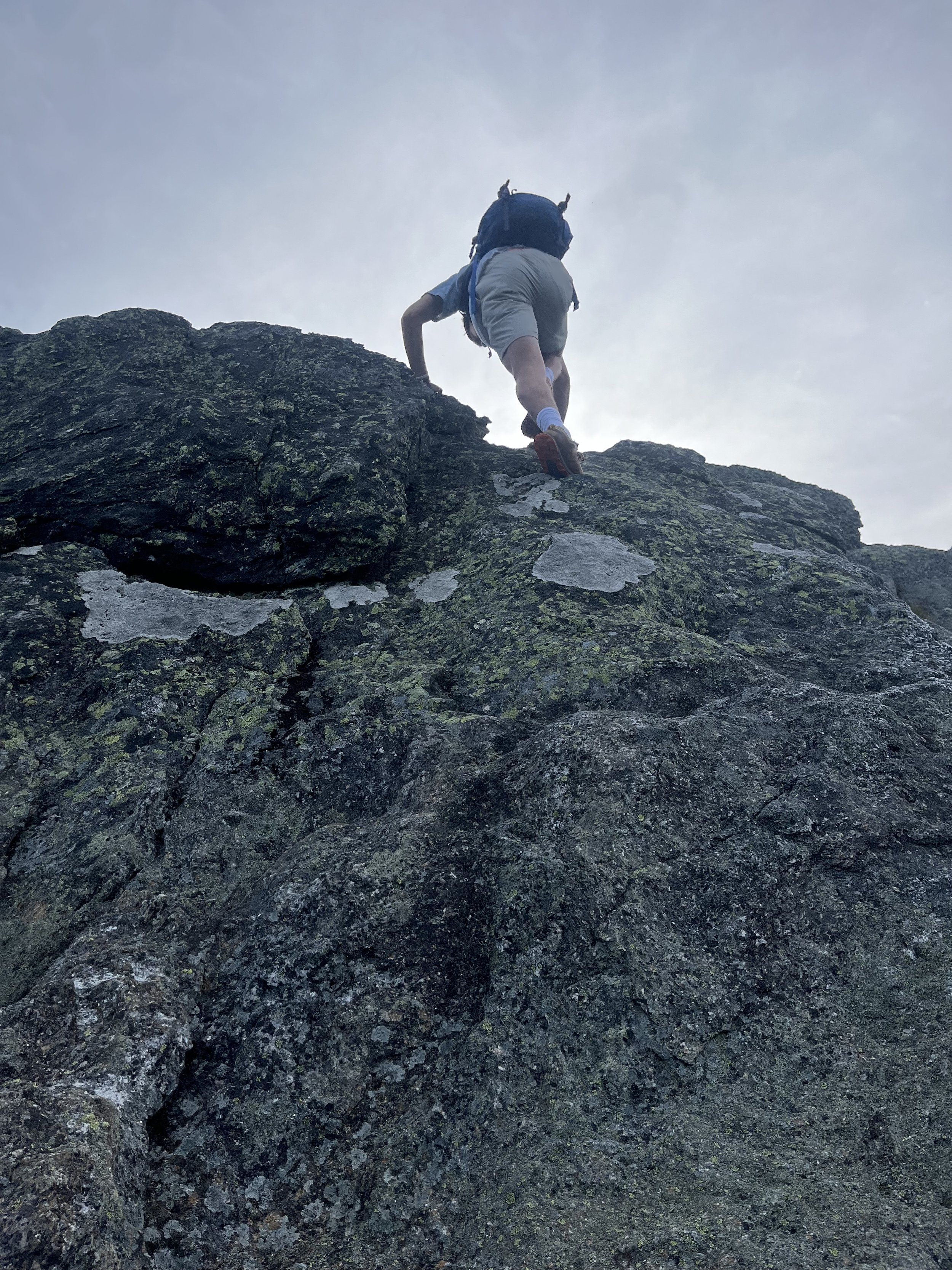
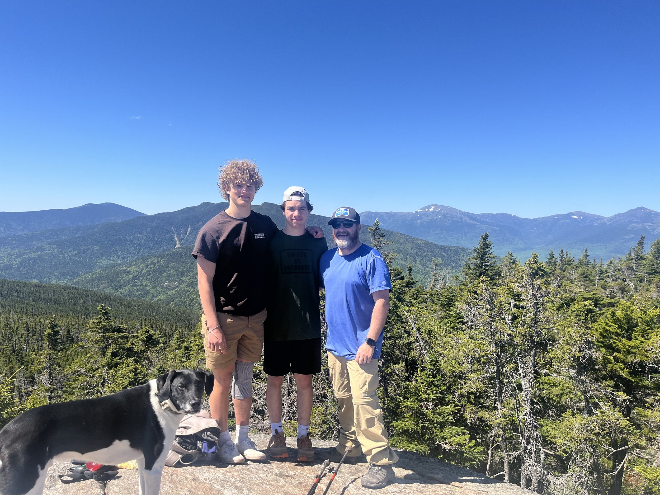
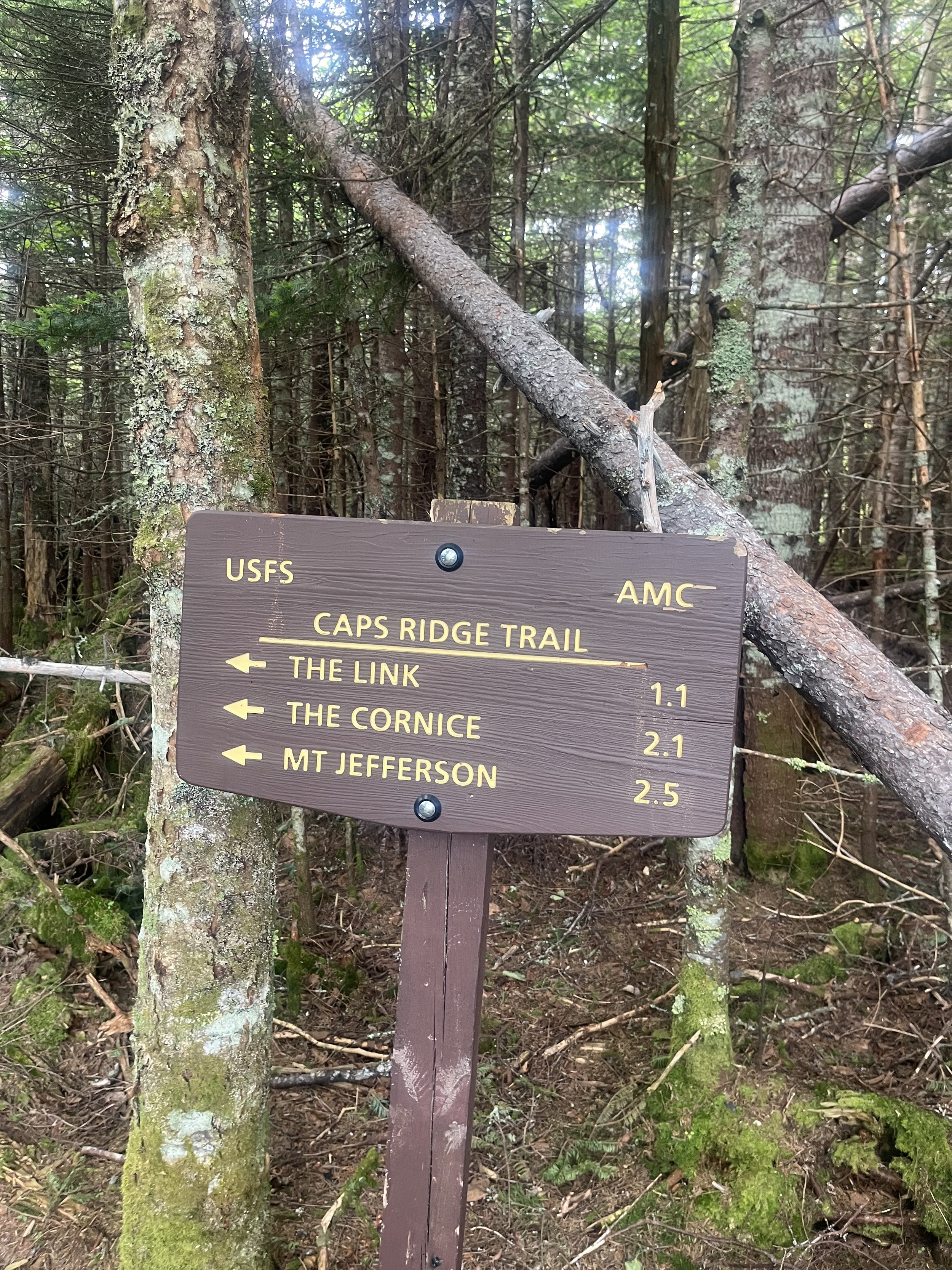
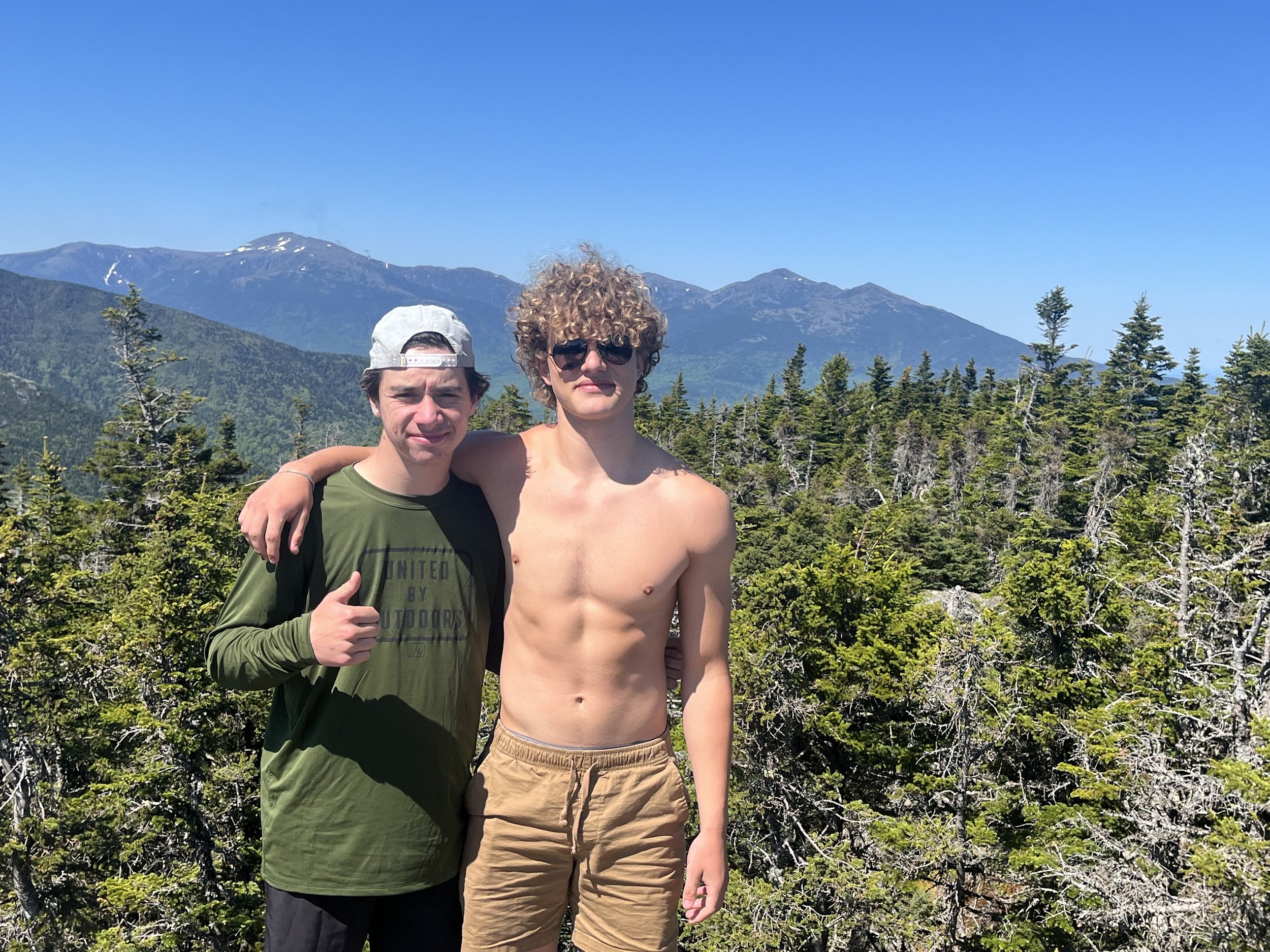
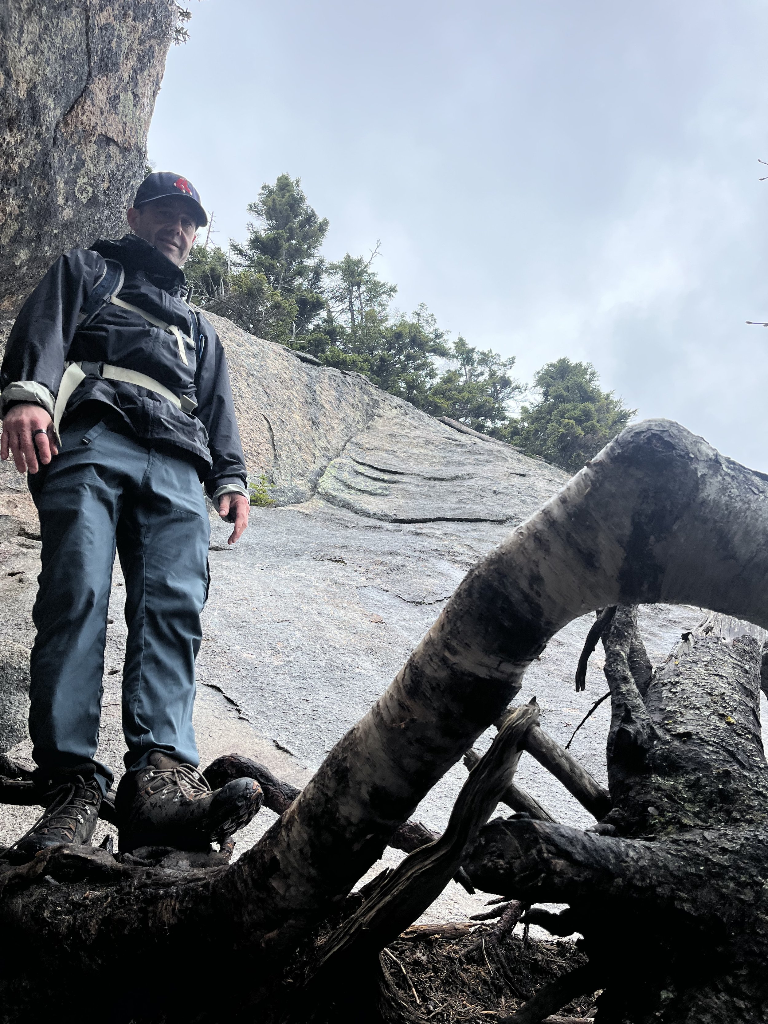
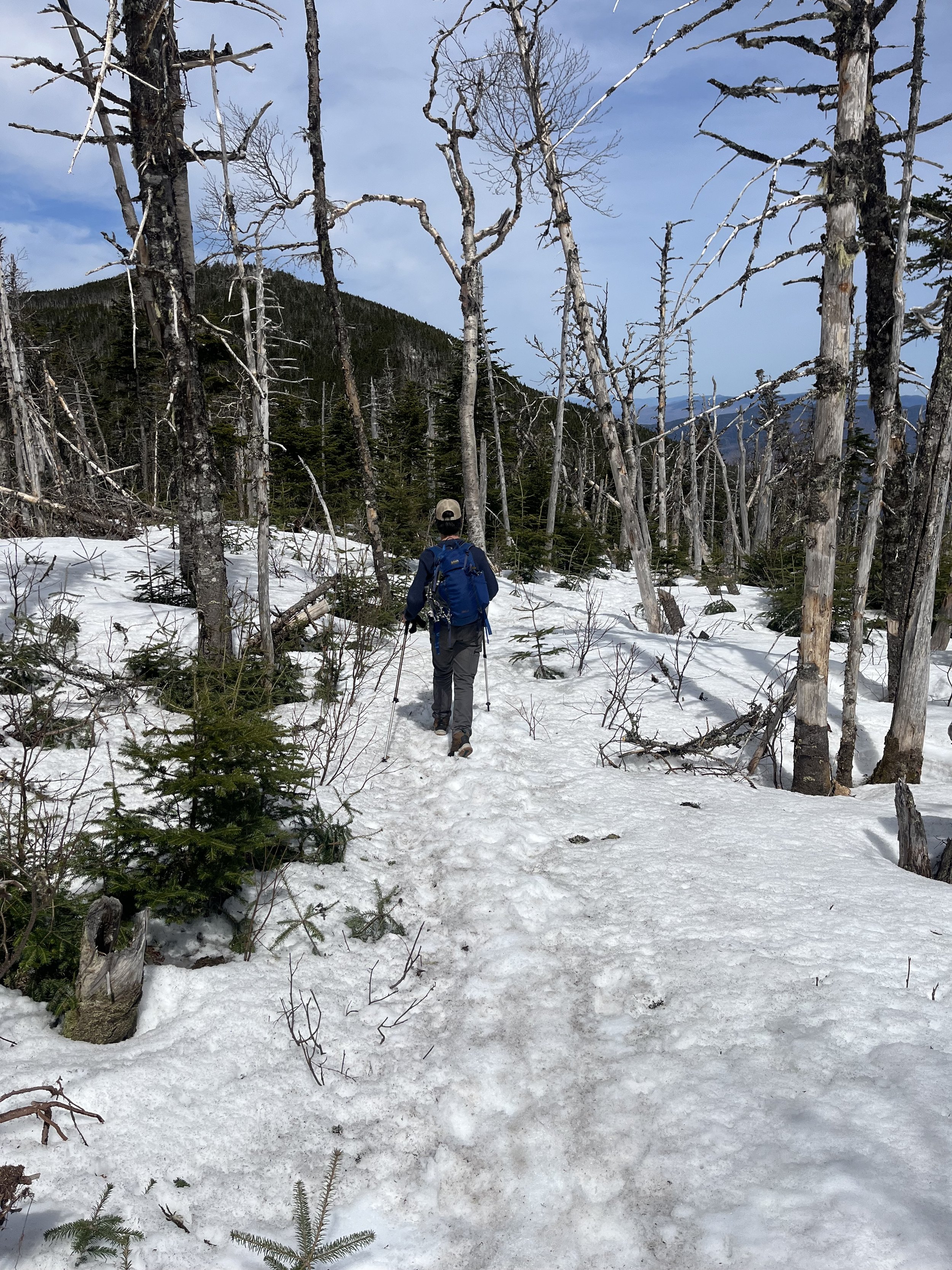
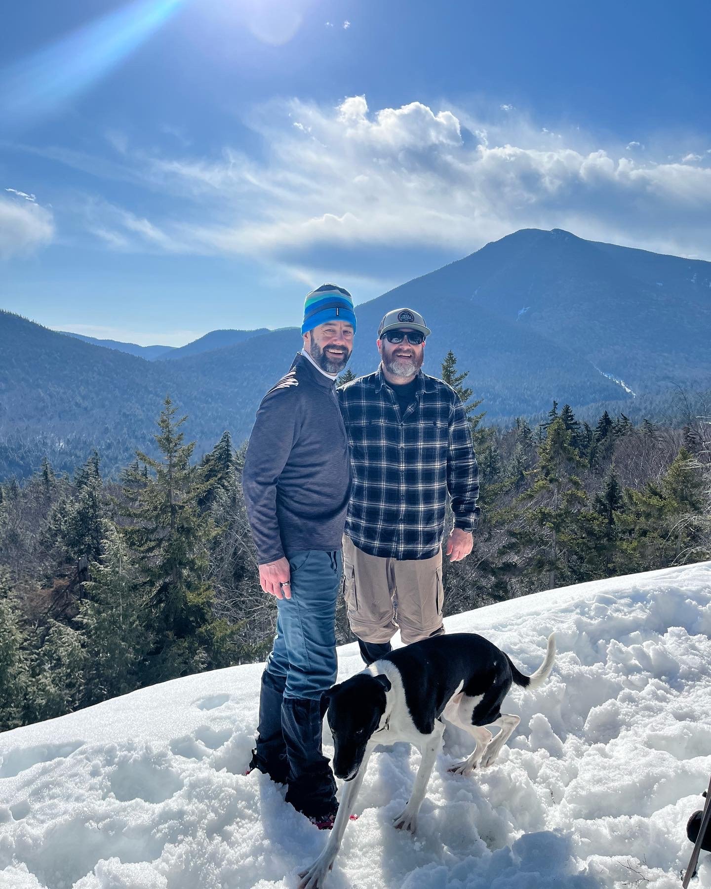
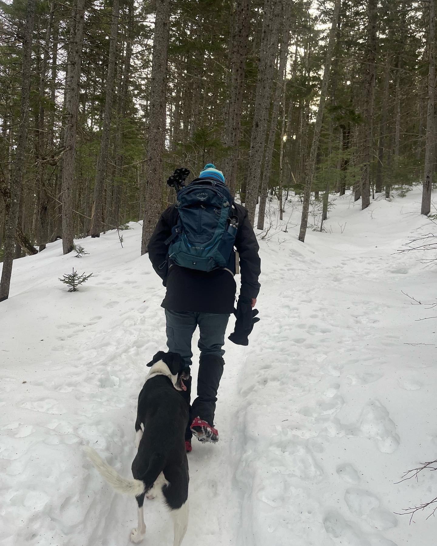
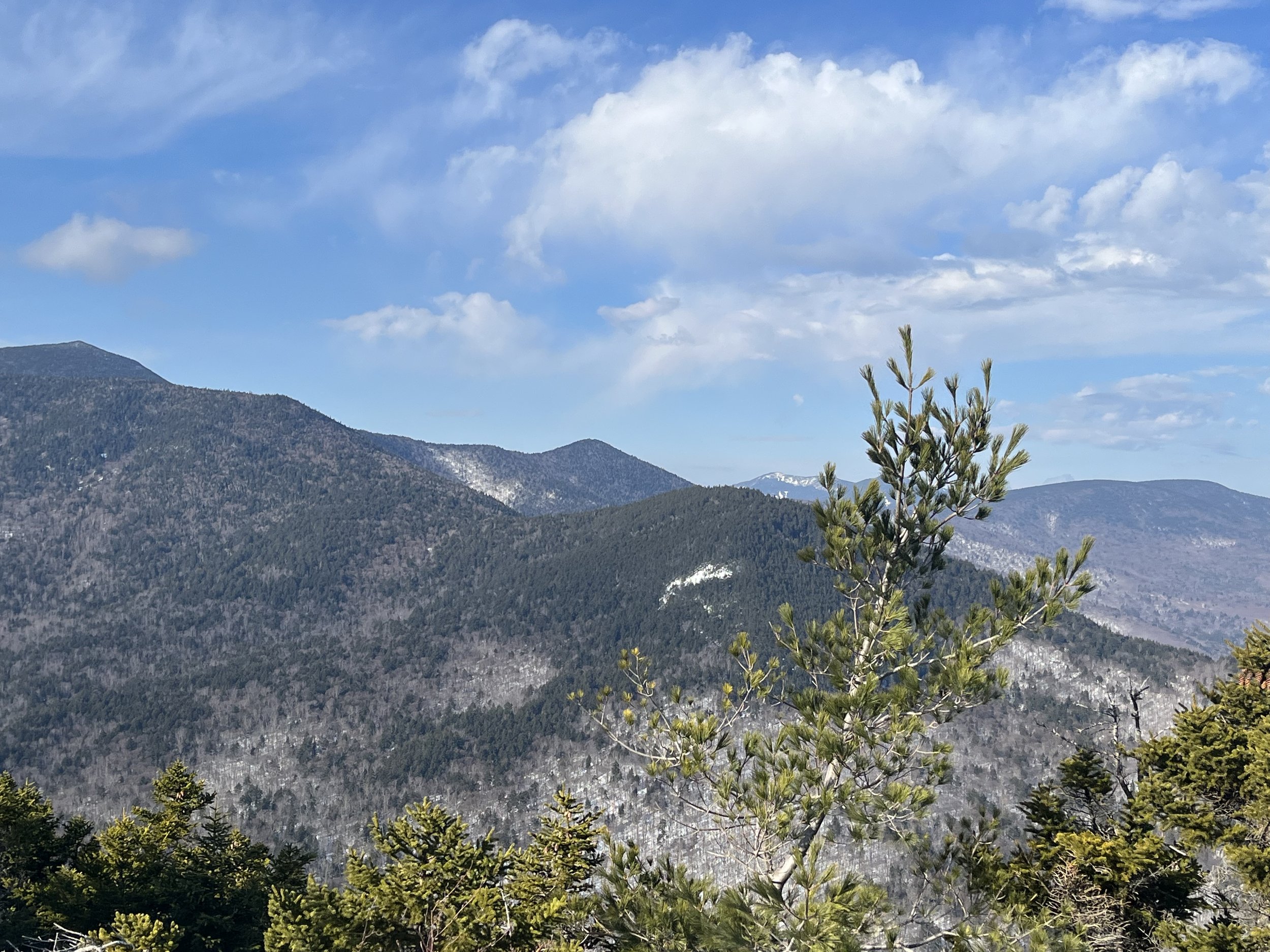
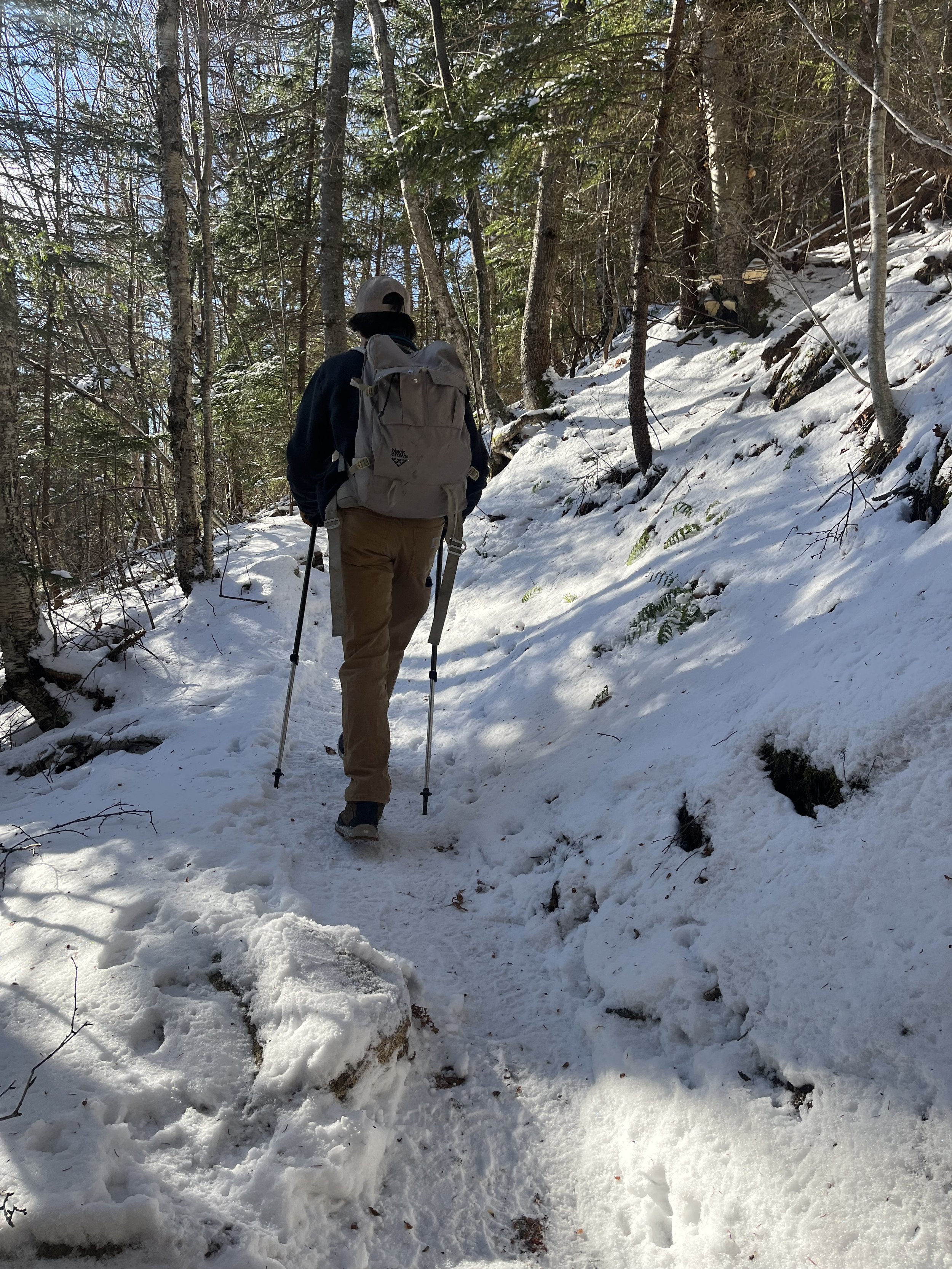
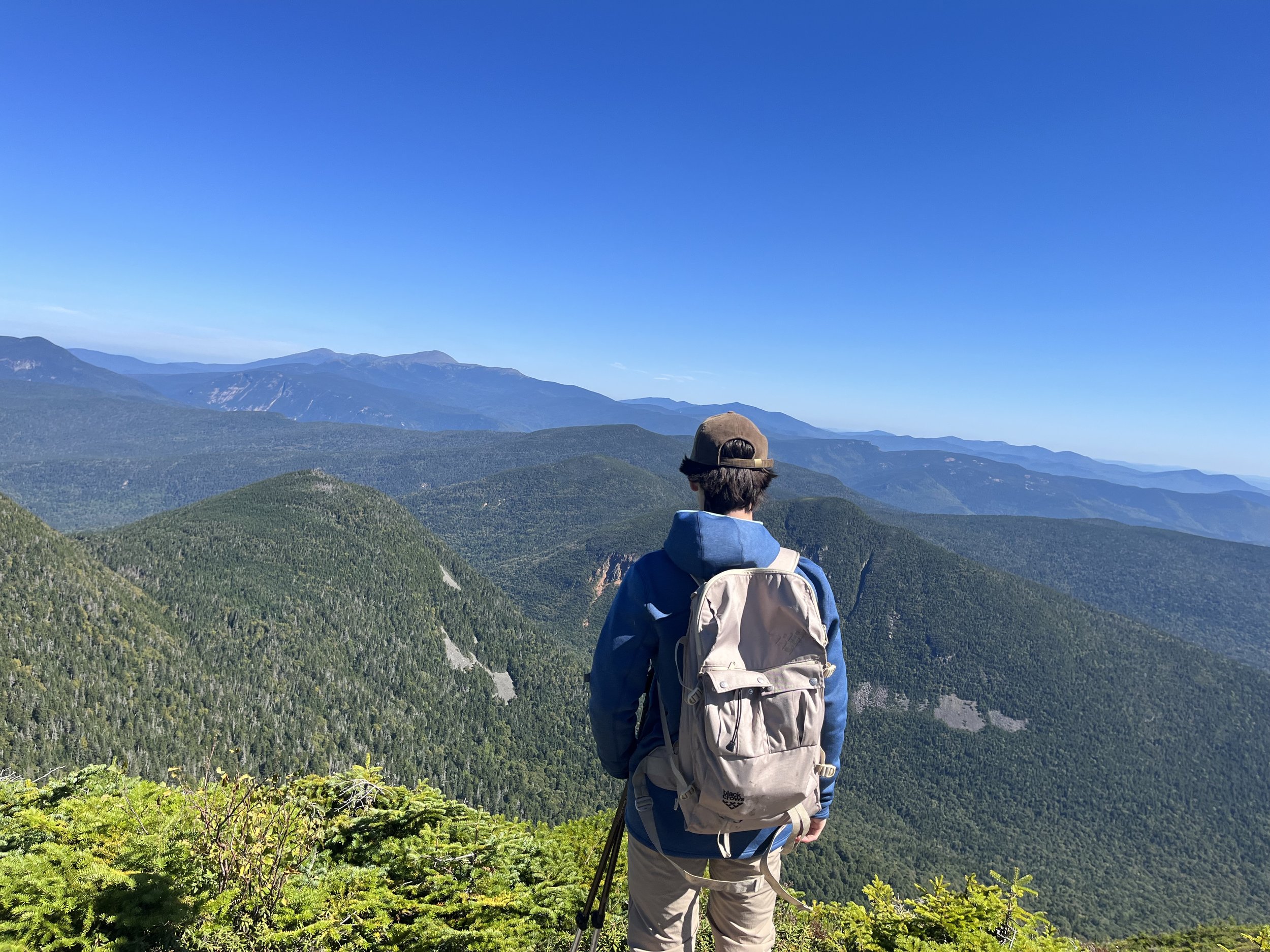
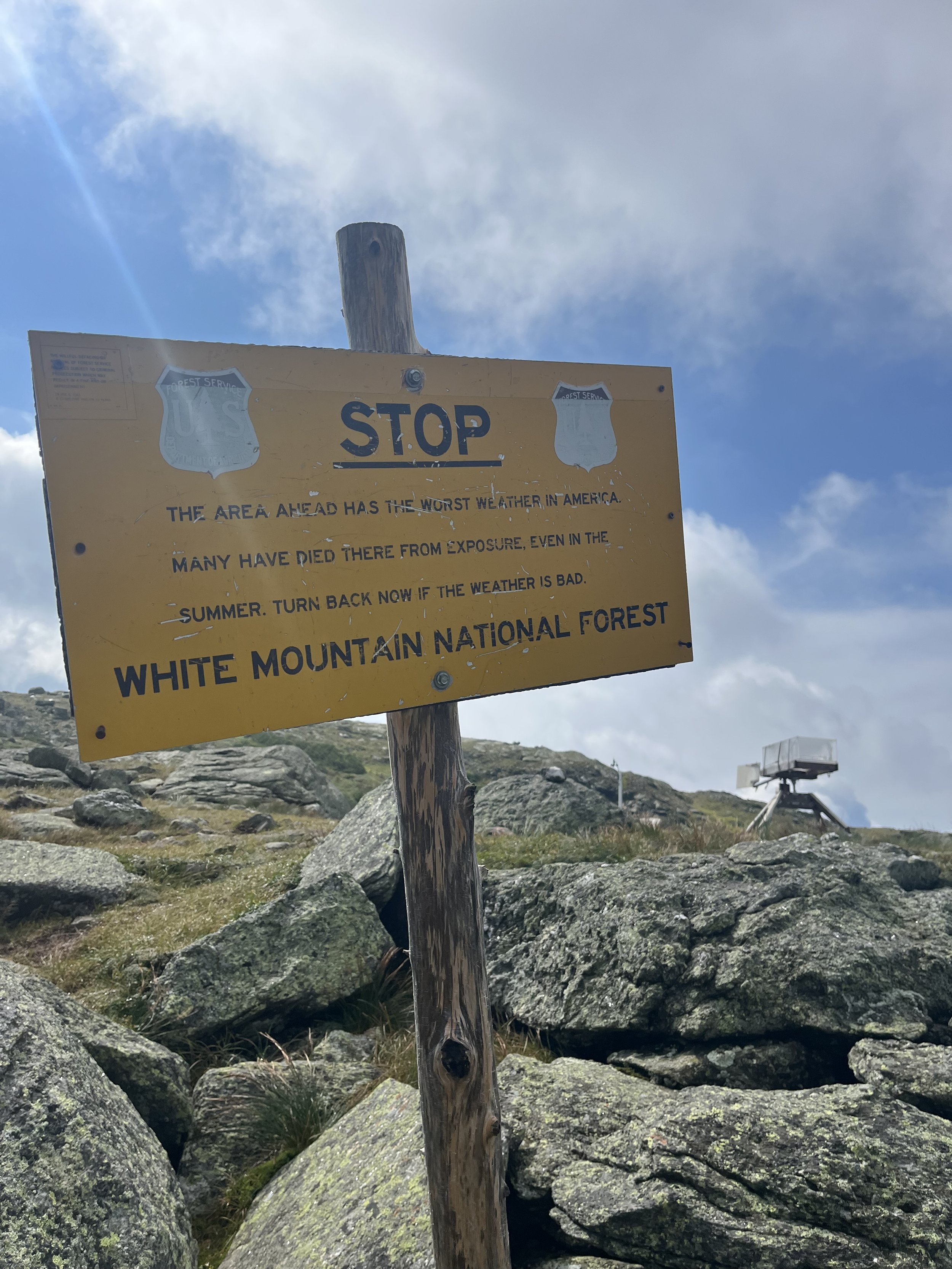
What a day!!! This was a hike we had been itching to do (no pun intended with the amount of flies we experienced). We started on the trail around 6:50am, it would be myself, Kyle, Rocky and friend Bryan (BO). We all agreed to just do the out and back due to the lack of knowledge of this trail and the time we were allotted. This is a 4.3 mile hike with roughly 2700’ of elevation gain which starts at an elevation of 3000’ to reach the 5710’ summit.
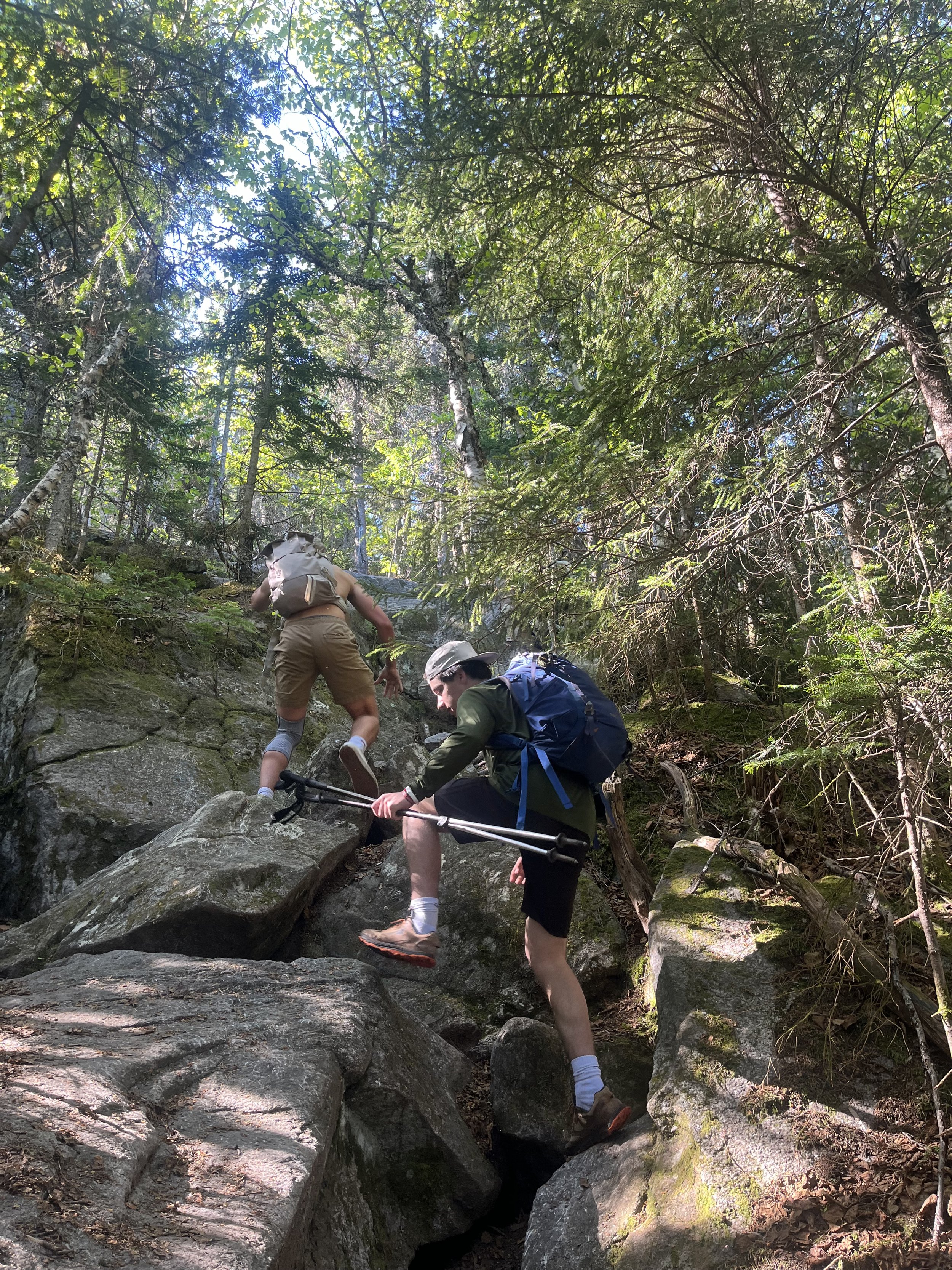
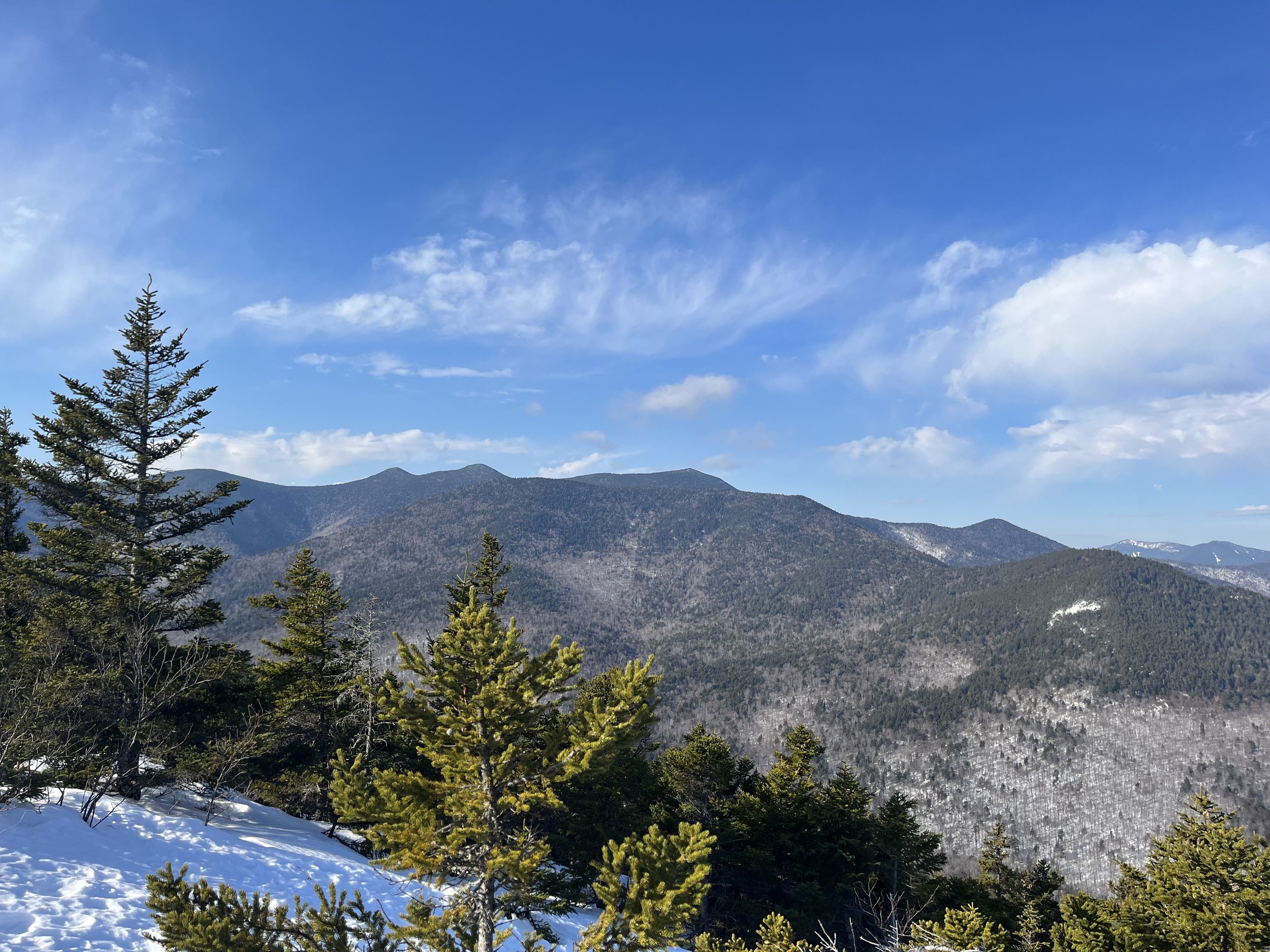
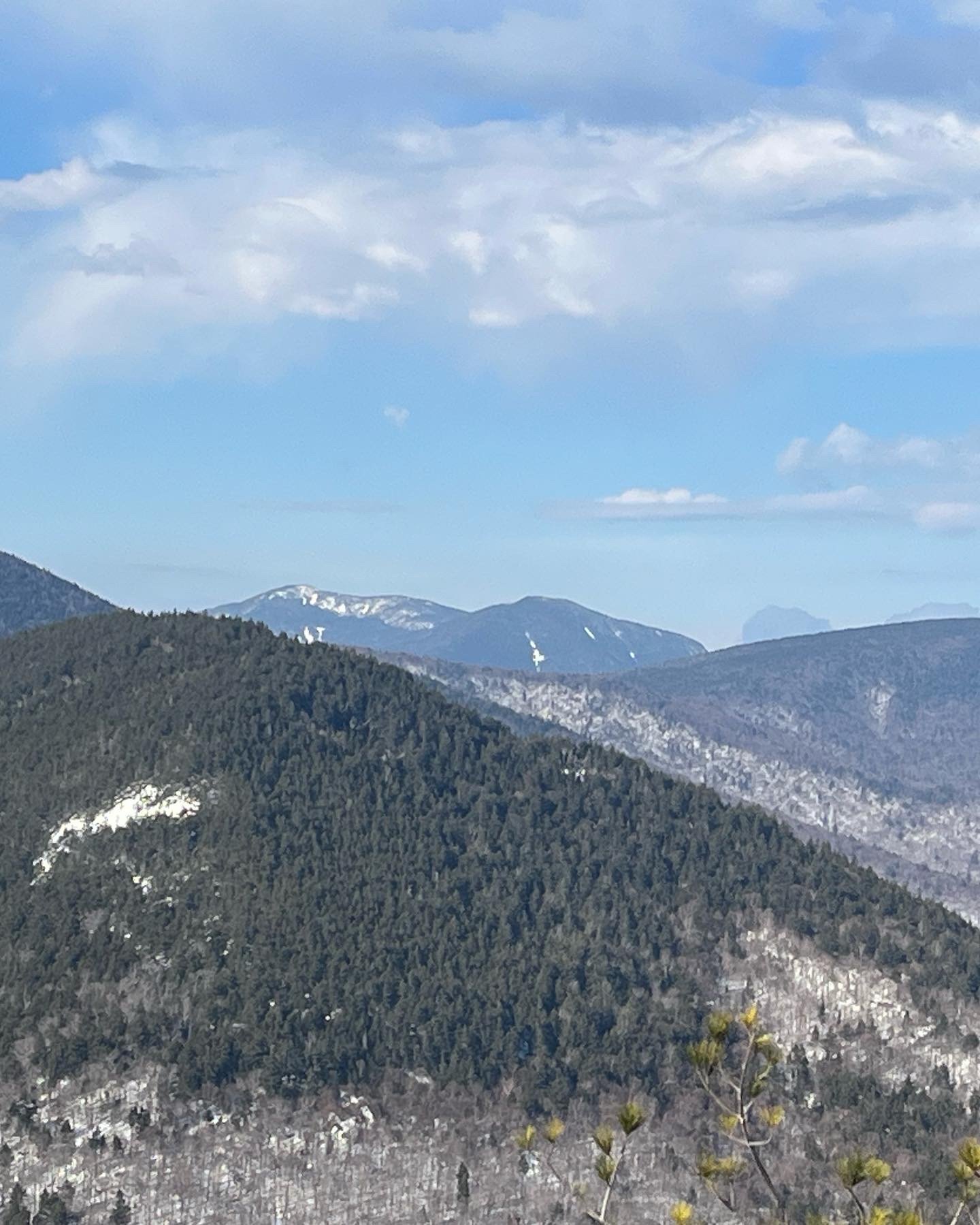
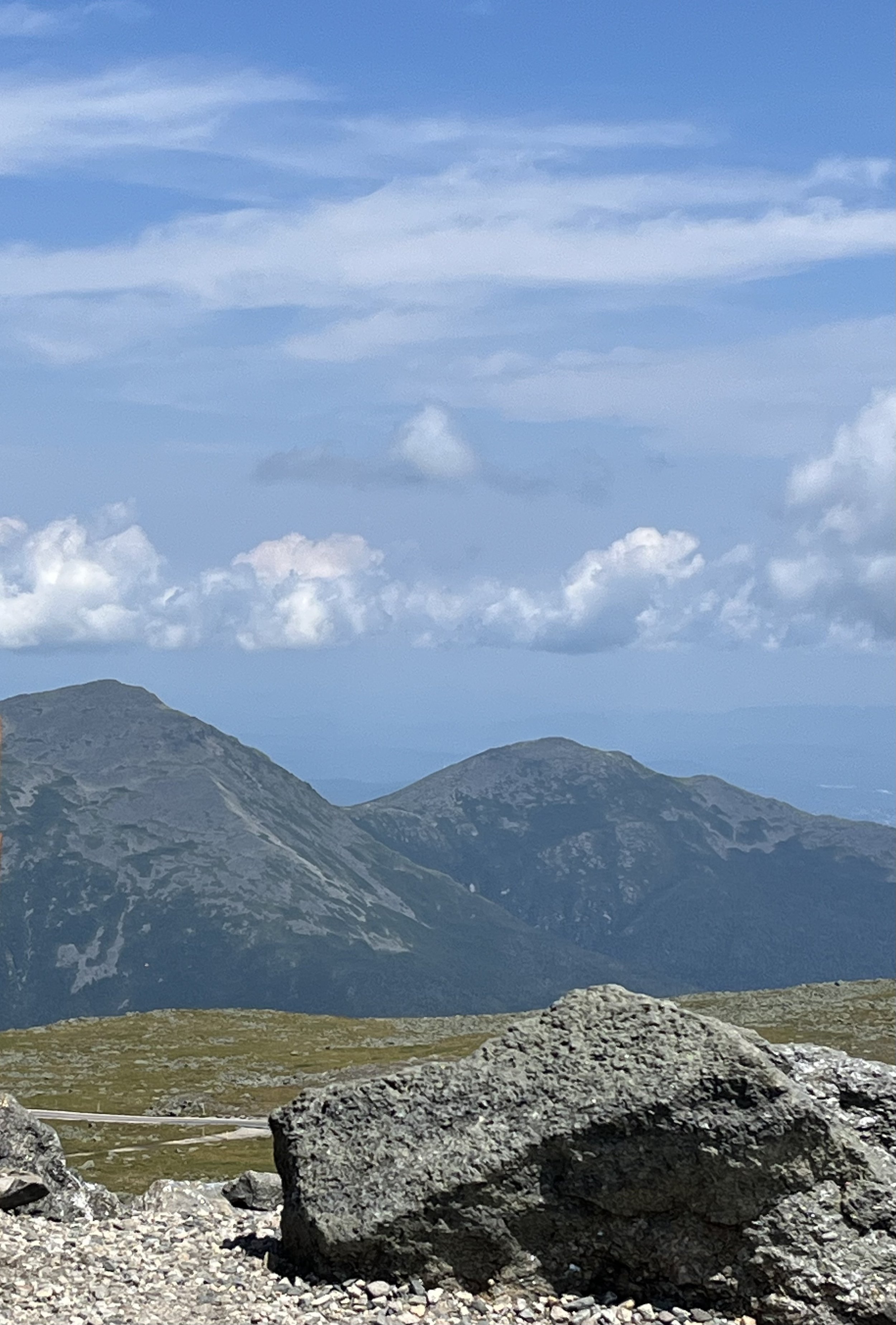
As we set out on trail to summit one of the highest peaks in the Whites, we were feeling pretty positive about this hike and excited to see what this day had in store for us after doing a little bit of studying in the prior weeks leading up. About a mile in there is a great view of the Caps we were going to have to climb. This view is on a granite boulder with potholes from previous glacier activity and is a really cool feature. We hung around this spot for a few and continued the ascent up toward the caps. There are three sets of caps we would have to climb, the first two were not too difficult but the third? Well, we just stood and stared for a few thinking, “FUCK ME!” we have to do that? Thank god it was a little deceiving and wasn’t too bad, actually it was a lot of fun.
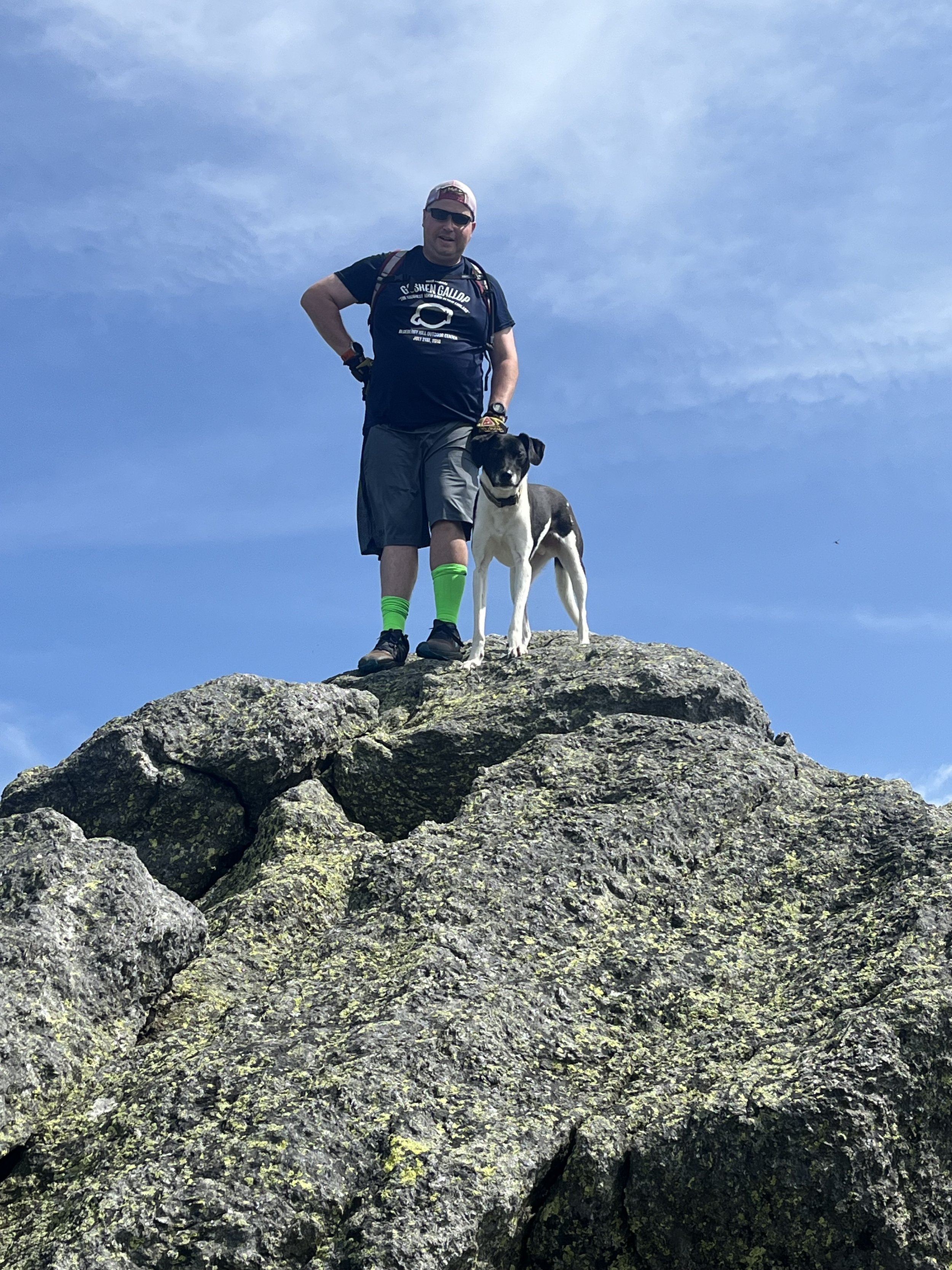
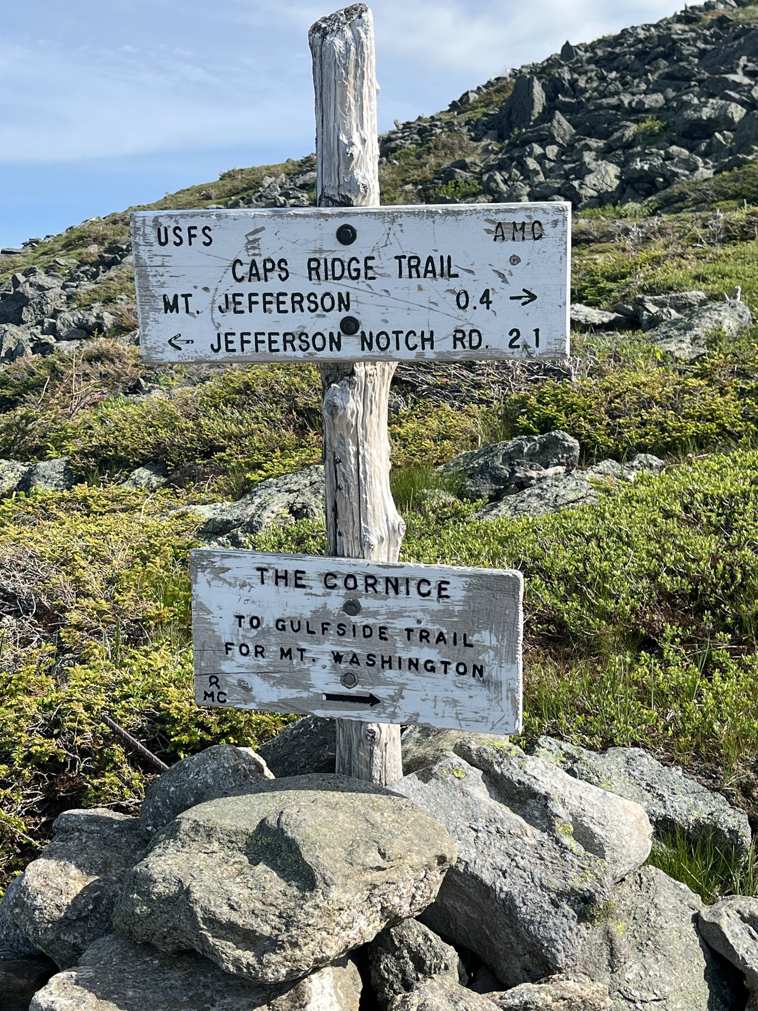
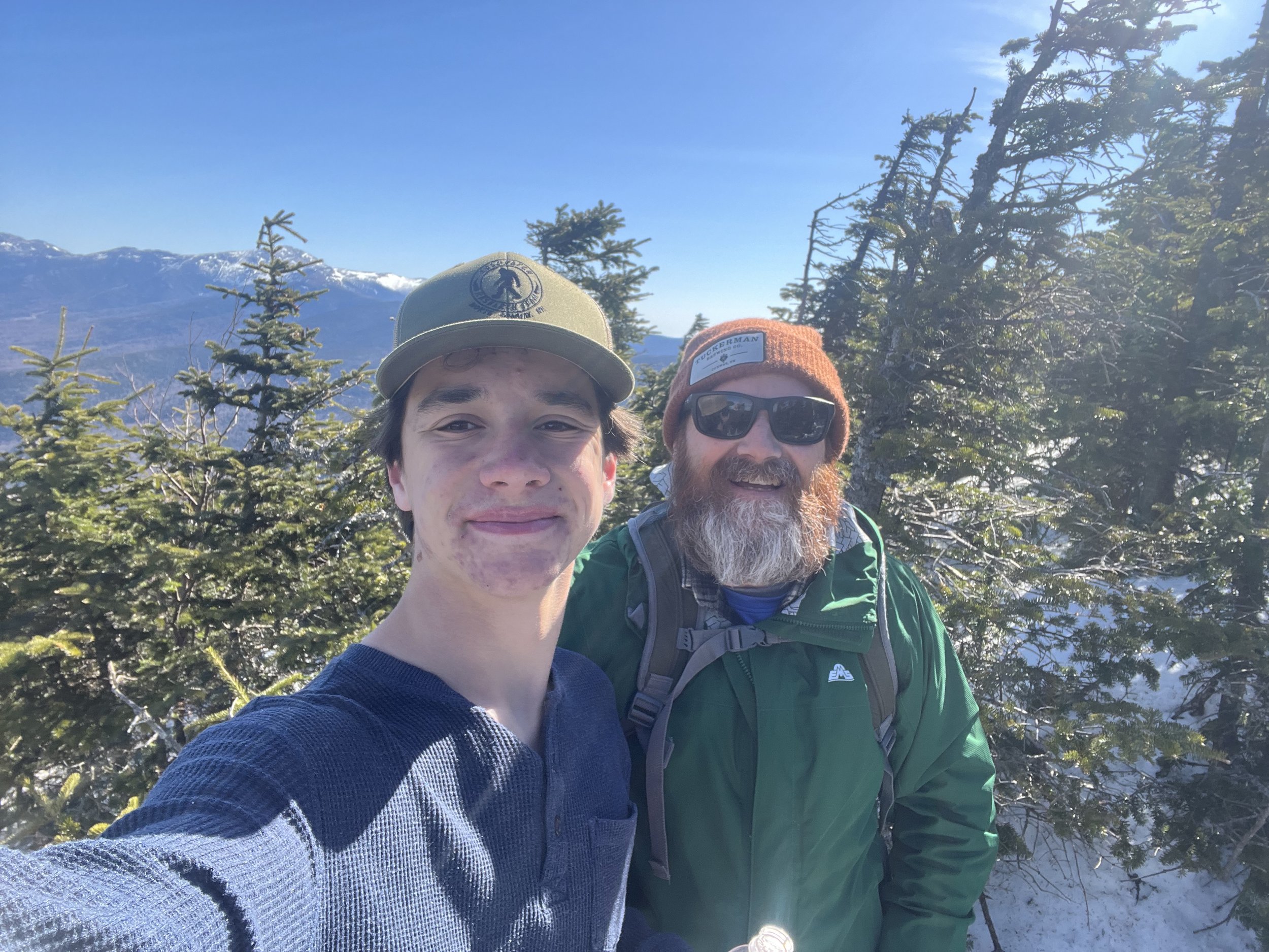
After “conquering” the caps, it was basically a boulder field so let the rock hopping begin! Rocky has been incredible on all these hikes but the one thing that does bother him is the sharp boulders on trails like this. He pushed through and we made it to a sign that read “Mount Jefferson 0.4 miles.” Well, that 0.4 looked like 2 miles but whatever. After some steep, sharp rock, boulder hopping we made it to the impressive 5710’ summit of Mount Jefferson! This was #33/48 and we can start to feel like we’ve almost got a chance at completing this list which was thought to be impossible just a few years earlier.
The descent was a fun filled exploration of this immense field of jagged rocks and after we hit and survived that third cap (1st on descent) we felt like we were home free but there was a catch! The bugs came out and man was it brutal! Kyle literally ran the last mile to the car and BO and I wanted to punch ourselves in the face! We made it down to the parking lot, said our goodbyes, got directly in our cars and took off.

Mount Jefferson/Caps Ridge Trail

Mount Moriah
This is why looking into a hike before you actually do it is a good idea. This was another one of those hikes that was a “smaller” 4000 footer so being ignorant we just went into this one with virtually no knowledge and just showed up. Well this was a learning experience for Kyle and I and proved that we should probably do a little research before we start a hike.
Kyle, his good friend Max, myself and Rocky decided to do one of the easier hikes of the 48 four thousand footers. That took us literally five minutes to figure out this was gonna be a difficult hike. You see when you do these mountains you (me anyway) need to get your mind set, feel confident and get into that zone. This day I just didn’t have a great feeling to begin with hardly getting any sleep the night before and wasn’t feeling it but would push through. This hike starts with an instant 800 foot gain in the first mile and winds up gaining about 3250 feet in 4.2 miles so it is one of the steeper trails. Two miles in we hit the 2200’ Mount Surprise which has open slabs and a fantastic view of Mount Adams, Washington, Madison and Jefferson. Max and Kyle were stunned by the literal “surprise” of this summit before we hit the 4000’ Mount Moriah.
Once we were done chatting with a fellow hiker and grabbed a drink we continued our way up to the Moriah summit. This is where the boys started to have their fun with steep slabs and boulder hopping, those young legs make me jealous but it is just good to see them enjoying time in the Whites. The last 2 miles gains almost 2000 feet and it is steep but it was also fun and time went by pretty quickly with Rocky and the boys. Once we hit the summit and touched down for #32/48 we all took a well deserved break on the peak for quite a while, snapped a few photos, hung out with another couple. Talked about how incredible the views were from the summit. As I continued the conversation with our new friends I watched the boys jump crevasses and didn’t stop them because they were having too much fun. Finally, we gathered our things and headed down the mountain. This was a steep descent and by the time we got to the car again we were all completely wiped out as the boys slept the entire three hour ride home! I was just so happy the boys and I enjoyed this hike and Max is welcome anytime.
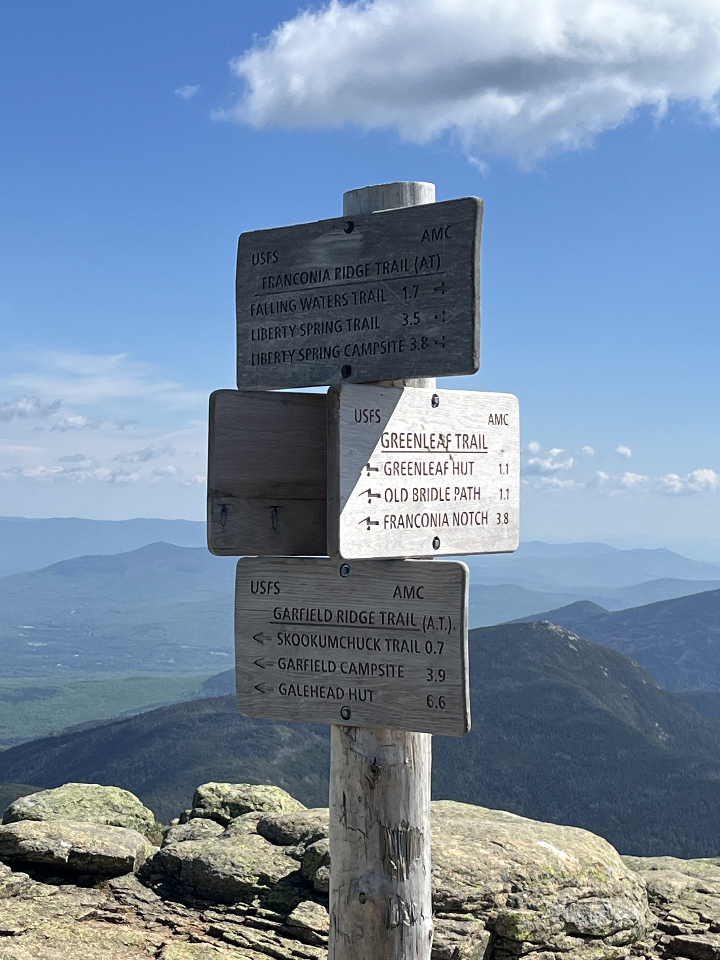
Franconia Ridge via Falling Waters Trail
24MAY2024-
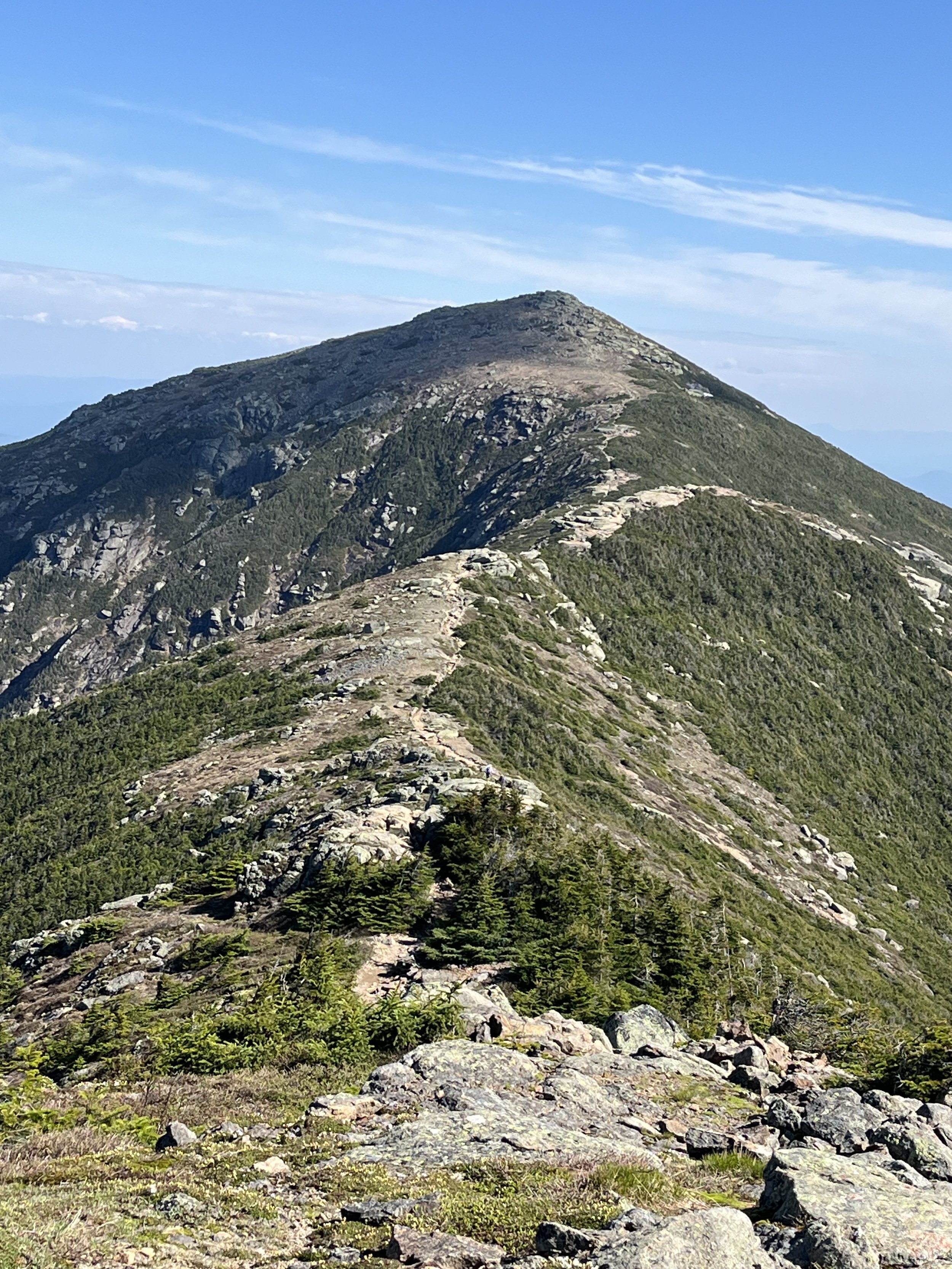
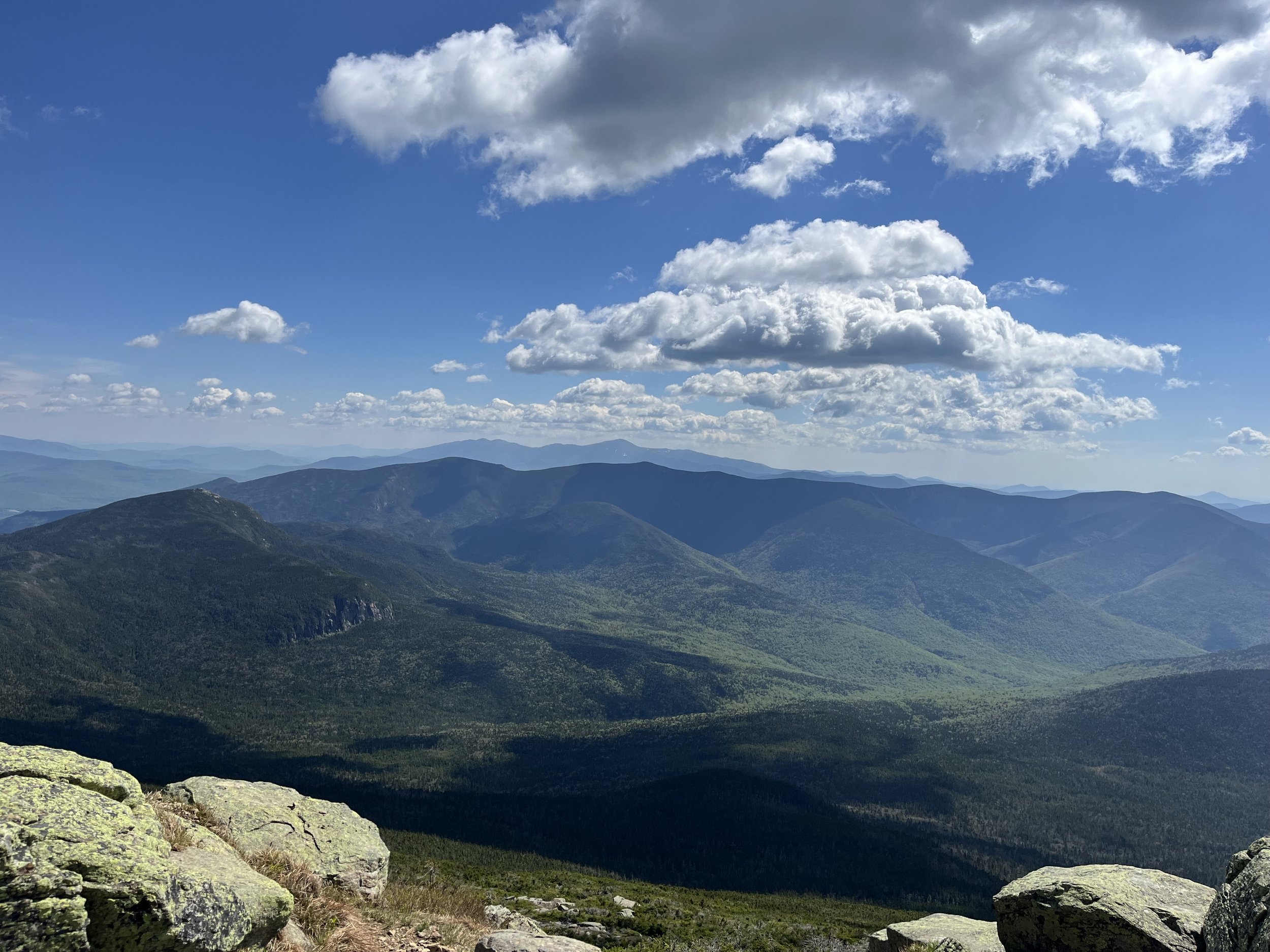
We headed out and were on the Falling Waters Trail by 6am and immediately were slapped in the face by mini waterfalls and constant running water. I think that May is one of the best months to hike this trail with the weather changing temperature wise and the ice and snow melt making for an abundance of heavy flowing waterfalls. This does not take very long to get to the 80 foot Cloudland Falls, which is one of the most beautiful waterfalls I’ve seen. The trail is a constant uphill grind to Mount Haystack, gaining 3000 feet in three miles! But holy shit. Once you hit Haystack and come out to the ridge it is all worth it. This might have been the best feeling we have ever had hiking, just seeing the ridge in front of us and where we were headed left us truly speechless. The smile on Kyle’s face was one I will never forget.
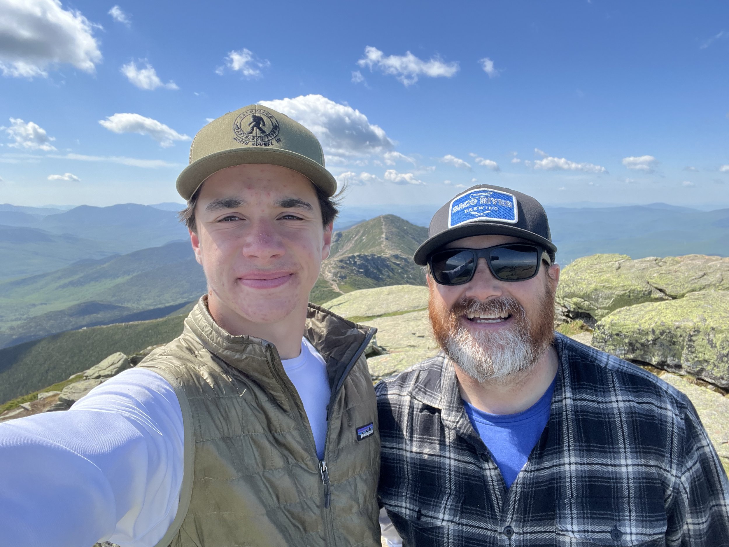
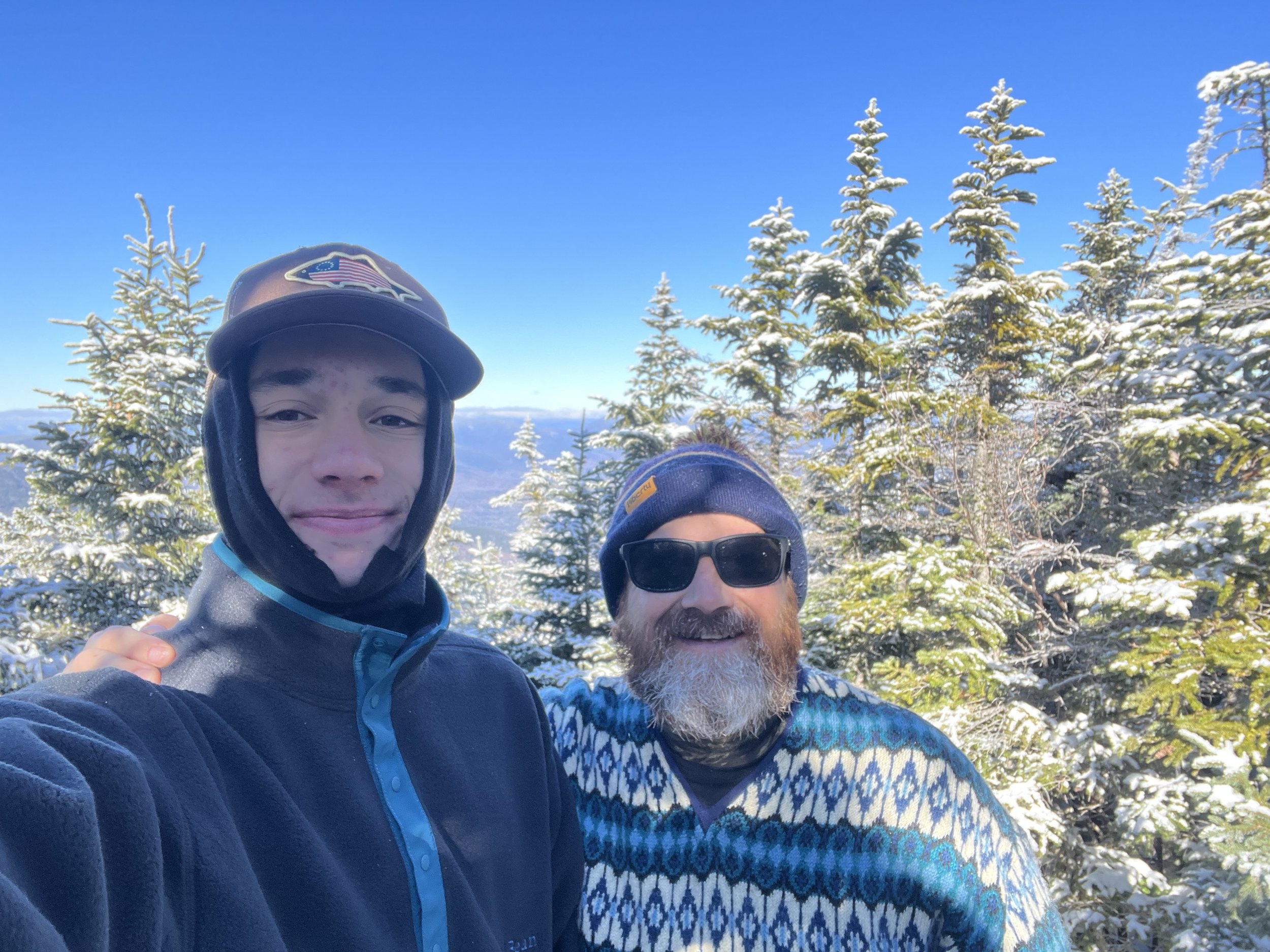
After hanging out with some fellow hikers we had met on the way up, we added a layer and headed across the ridge which would turn out to be the coolest hike we have ever done up to this point. First up, Mount Lincoln standing at 5089’. Hiking this ridge is something we have never really experienced before. We had done Signal Ridge on Mount Carrigain last year and that was one we will never forget but Franconia Ridge is just different, longer and constant views on either side the entire way across. After a few scrambles we reached Mount Lincoln for #30/48 and man was it impressive looking out at Flume, Liberty, Cannon, Garfield, etc. Now, on to Mount Lafayette but first we had to climb over North Lincoln sitting at an even 5000 feet, so we did just that. Chilled for a few and saw the behemoth Mount Lafayette staring at us so we said “lets go!” After climbing another 250 feet we reached the summit of the tallest peak outside the Presidential Range and man was this 4.7 waterfall, view filled hike worth every minute! I will NEVER forget the feeling of being on Lafayette with Kyle as this day was one of those “perfect” days. We both smiled all day, talked about we wouldn’t normally talk about at home and have honestly never felt so close to and proud of my son in his 17 years. You see these kids grow up in front of you and sometimes take it for granted but I am trying like hell not to do this and am so proud who they both are turning out to be.
After lunch at 5250’ we made our way down to the Greenleaf Hut where we would grab our patches and take a short break. We then hopped on the Old Bridle Path Trail down to the parking lot. This was a great trail as well and we enjoyed more stunning views, laughs and fun. I would 100% hike this trail again and would encourage anyone who likes the outdoors to do so also. I want to reiterate how much this hike meant to me as a Dad. Seeing your son smile, laugh and enjoy being with you is something so special, I really can’t put it into words. All I know is that days like these are what life is and should be all about! Below are some fantastic pictures of a day I will never forget.
Blueberry Ledge Trail to Mount Whiteface
This is one where we would say, “let’s just get out there and get this one checked off.” Well it seems every time I say something like that it turns out to be an awesome hike and this one was no different. Jeremy, Rocky and I got to the trailhead around 7 which was an entire hour later than intended. While we were driving to Ferncroft which is where the trailhead exists, from the Maine House in Bridgton, we had to make a tiny detour that would set us back an hour. I had cooked us bacon, egg and cheese sandwiches (mine just egg) which has turned out to be a pre - hike ritual of sorts and usually makes for a good start to the day. So about halfway to the trailhead I looked at Jeremy and said “FUCK!, I think I left the burner on and I won’t stop thinking about it” So I pulled a U-Turn and headed back to Bridgton to find out that the damn thing was off. After apologizing to Jeremy a few times we were on our way.
We pulled in to Ferncroft parking lot, gathered our things, laced up the boots and we were off. Feeling good, other than the stupidity of having to turn around for nothing we started the walk in the woods for the first 2 miles. We gained about 900 feet in two miles and then BOOM! All of a sudden this “walk in the woods” turns into a stair stepping, boulder climbing, steep ledged badass hike as the last 1.5 miles rise over 1800’ and as steep as it is it was pretty damn fun. Rocky was tremendous on the terrain and just as we hit the ledges the one thing that we were trying to avoid happened. Rain. We hustled to the summit, hit #29 and got the hell out of dodge. The way down was a bit of but sliding and pretty uneventful but this turned out to be one of the better hikes we’ve done and would do this one again in a heartbeat. Kyle would have loved this trail so I am positive I will be doing this with him in the near future. As always, good company, good times and another summit touched toward my goal!


Mount Field, Willey and Avalon
Well, it seems like winter has finally come to an end so that means my list of 22 peaks left on New Hampshire’s 48-four thousand footers (NH48) can/will begin to shrink. Although I did do a little hiking this past winter, the numbers on my list should start to dwindle a bit quicker (fingers crossed). My goal is to finish this “bucket list” by November while I am still feeling good mentally and physically. This is indeed a bucket list type of thing but it’s also a “fuck you” to this disease I will be dealing with for the rest of my life, kind of a prove it to myself and others living with similar health issues that this type of stuff can be done. After hiking a few smaller mountains this winter and putting a little dent in my 52 with a view (NH mountains under 4000’ with great views) list I am feeling eager to get out there and getting this going! We hiked such mountains as Potash, Welch/Dickey, Pleasant in Maine, Willard, Pemigewasset and one 4000 footer which was Mount Tom in the Willey Range.
The Willey Range is where we started our quest for 2024 and man was it what the doctor ordered (pun intended). Located in Crawford Notch this range is definitely one of our favorite spots to hike so this was really cool to get out with Kyle and Rocky as it had been a bit since Kyle and I have hiked together. He’s a ski bum so I can’t give him to much shit for not hiking a lot in the winter months. Lucky for me I have a few friends and a dog who love to hike.
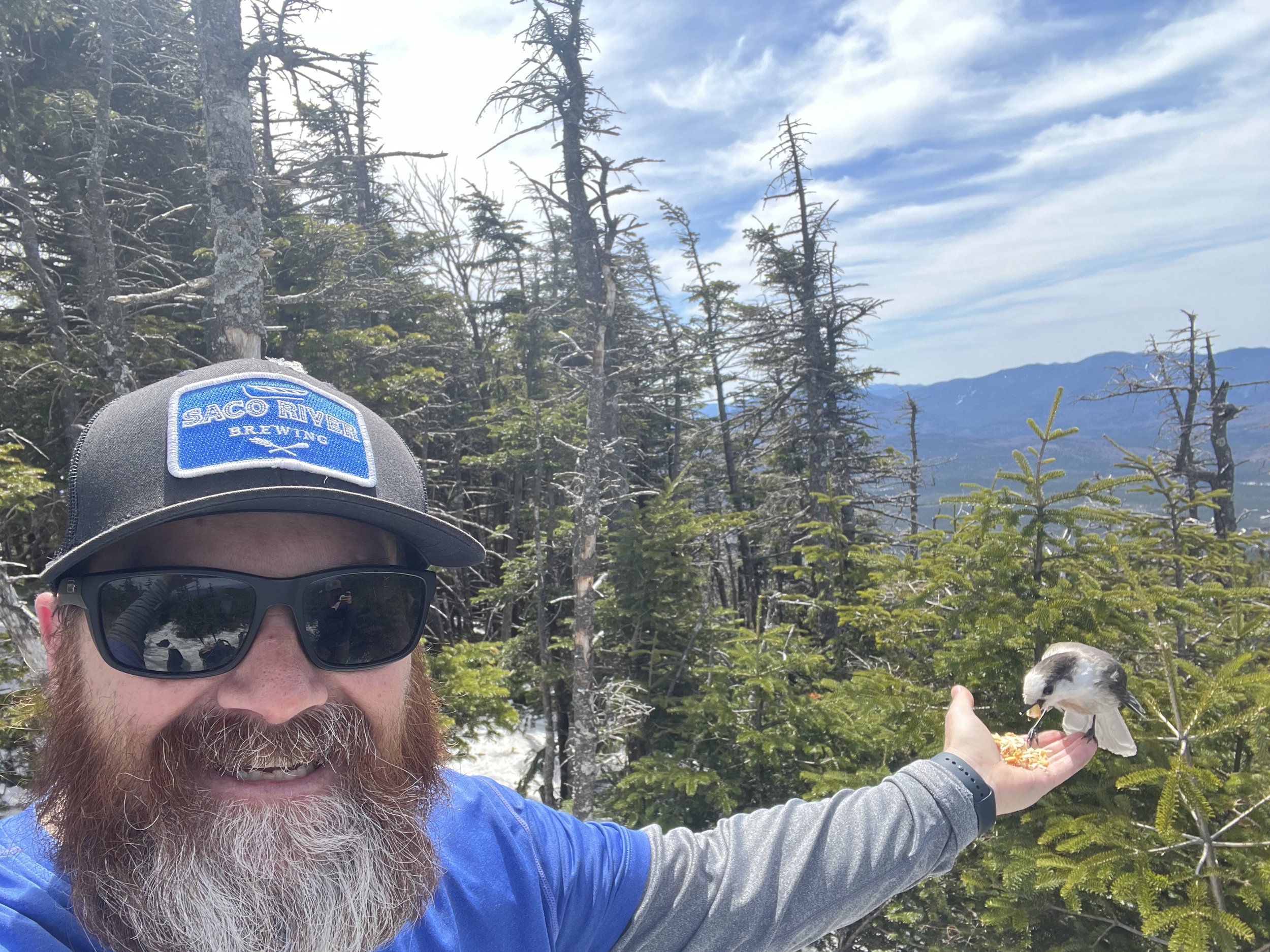
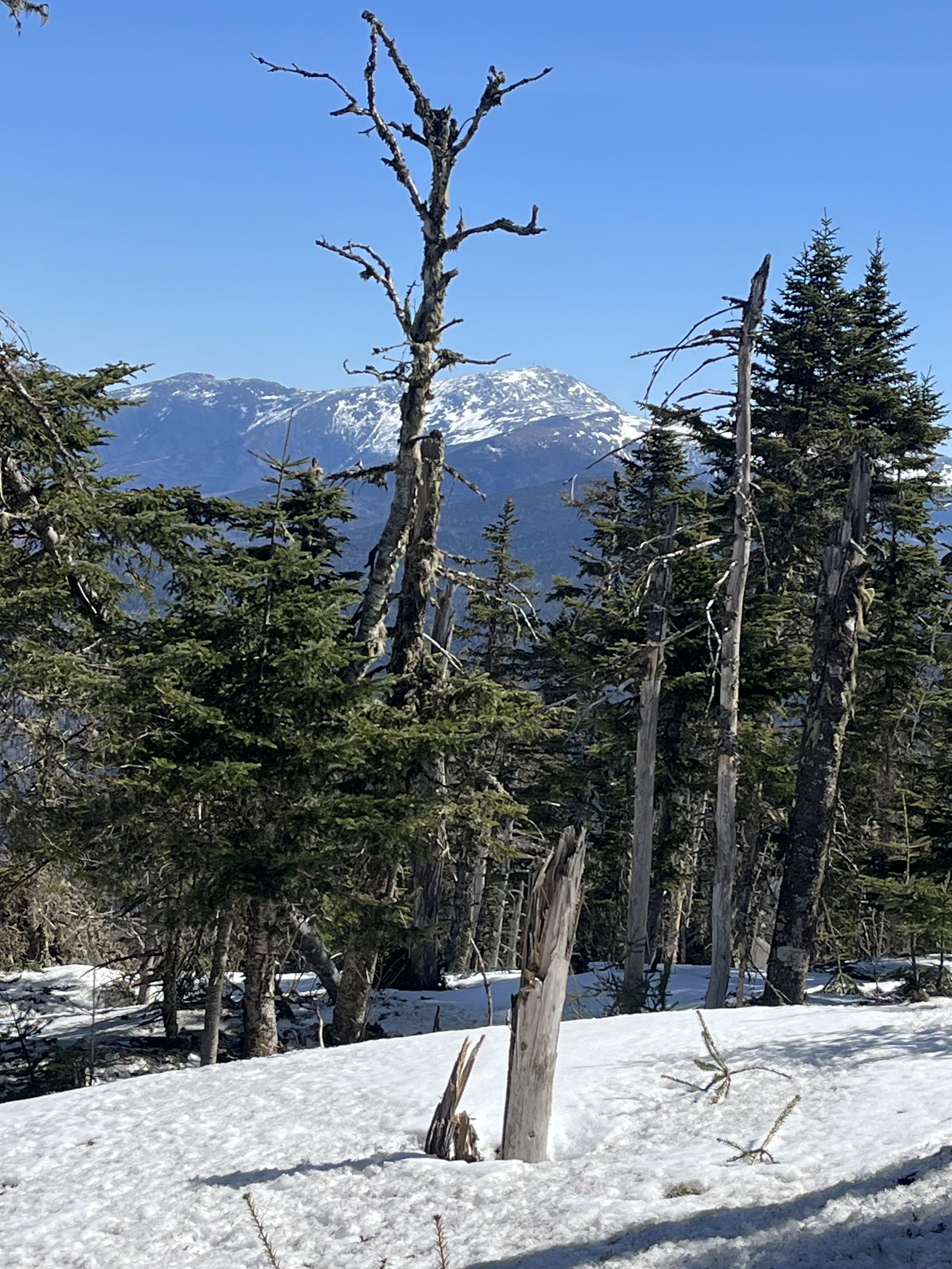
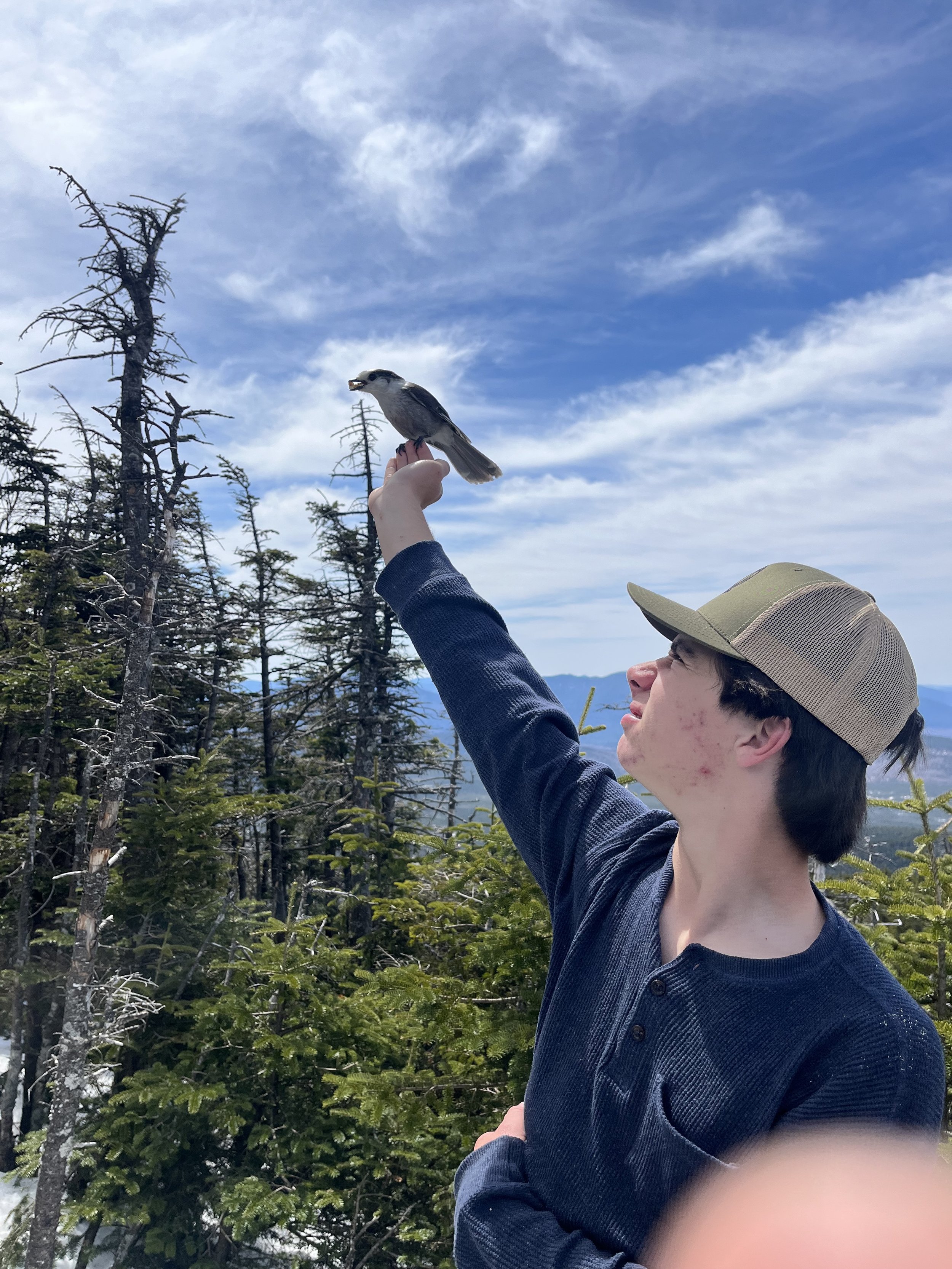
We reached the Crawford Depot around 6:50am and were on trail by 7:10. It was one of those mornings that both Kyle and I were ready to go and feeling great. We started on the Avalon trail, which was fine for the first mile was fine, steady incline but nothing crazy. Well that changed on mile two because not only were we looking at 1000’ of gain but also ice, snow and steeeeepness! I had no idea that the Avalon trail was this steep so it was surprising but still fun and once you hit the junction and find out that Avalon is 100 yards away you feel a bit better. The views on Avalon are out of this world and always helps when you catch any of these peaks on a sunny, clear day. After grabbing a drink and a snack we started our ascent to Mount Field which would be the #27 and the first 4k of 2024. Field is a mile and another 1000’ of elevation gain to bring us to it’s 4269’ wooded summit. Now, all we read and hear about is that Field’s summit is wooded with no views which is 100% true but there are plenty of views to be had on the ascent to the summit and they are absolutely spectacular. There were also Gray Jay’s flying about so we decided to try our luck and see if they were hungry. They were! Kyle was like a little kid again feeding these gorgeous birds from the palm of his hands so obviously I had to join him in the fun. After hanging out on Field for a while we started our trek over to Willey which except for a few up and downs was a fairly flat traverse and again the views when we reached Willey (#28) were absent on the summit but there was a lookout where we hung out, ate lunch and chilled for about 30 minutes enjoying some great scenery.
The start of our descent and trip back to Field was satisfying as we looked out at the Whites and the great Mount Washington but once we reached Field, Kyle got right into feeding the Jays again. This was a blast and nothing beats seeing your kid with a genuine smile on his face! We started the last part of our descent which was three miles on what was now soft, heavy, slushy snow and Kyle had just found out he had broken micro spikes so he decided to “ski” down the steep parts on his hiking boots alone. He got lit up a few times but had fun nonetheless so we kept on truckin and finally hit the one mile to go point where we ran into two hikers (Norwich students) who were questioning whether to road walk 2.5 miles back to their car. These kids were parked in a different lot and were supposed to take another trail down (Ethan Pond Trail) but did not want to go all the way back the other way so we offered them a ride when we reached the car. They hiked the final mile with us. We had conversations about skiing, hiking and fishing and they were good company. After reaching the our car, the Norwich boys hopped in and we gave them a lift to their vehicle down the road. All in all, fantastic day and great to be back in the mountains!
See you in a year!
Since my open heart triple bypass surgery (CABG) on August 31, 2020, there are no other words I like to hear from my cardiologist more than “see you in a year!” I had my annual follow up appointment yesterday (March 25, 2024) and still get nervous going in for these visits even when I am feeling great physically. It’s just a crazy mix of emotions that go through me from happy to be alive, scared as hell, relieved to still a little pissed off this happened, that “why me” kind of thing. I am extremely grateful to my family, friends, all the doctors and nurses whether it be my pcp, cardiologist, surgeon, rehab nurses and all the rest that continue to help me get through everyday life as a heart disease patient. I am doing ok and am still able to enjoy the hobbies I live for like hiking, skiing and fishing.
It’s weird though, you would think that the physical part of this recovery and life would be the most difficult but it’s not even close! It is the mental toll, the scariness of having gone through this. You just can’t get it out of your head but again, I am alive and feeling great and literally got a second chance at life as my wife reminds me of on a daily basis. She is 100% right too and I know this which is why those five words “see you in a year!” mean the world to me.
I plan on completing my 48 NH 4k’s by end of Fall 2024, I still have 22 to go but I know I can do it and am going to try like hell to accomplish this feat and hope to see you on the trail. The hiking community is full of positive vibes, smiles and pure grit. Turns out that this is contagious when in the mountains and why wouldn’t it be? If I don’t finish the 48 by that time, I will make plans to finish in 2025. So following my next appointment with the cardiologist (March 12, 2025 @ 0920) and after I hear those favorite five words of mine I will indeed see you in a year somewhere in the mountains.
-Hike on!

My rock. My wife Erin has been a saint throughout this whole journey. Some would say she was a saint for dating me 30 years ago.

My guy! My partner (son Kyle) on most of these hikes. Keeps everything positive!

The one (daughter Ella) who always puts a smile on my face no matter what!
Can’t wait to get our two nieces on the trail!

Lifelong friend Jeremy has been a blast to spend time with in the mountains. Hoping we can do this for a long time!
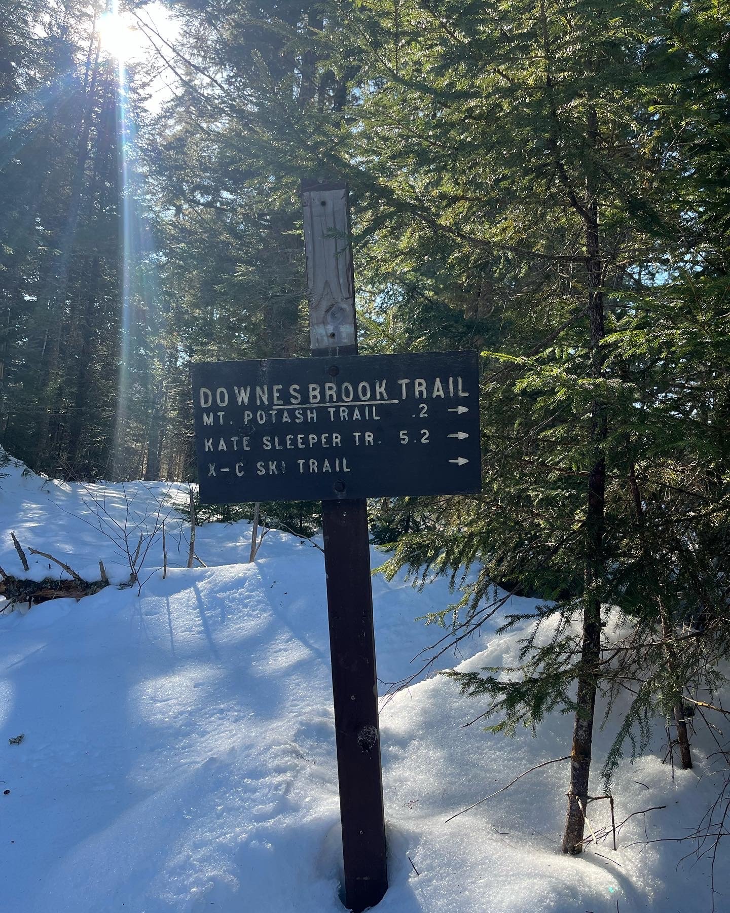
MOUNT POTASH
Good friend Jeremy and I on the outlook just before the summit of Potash
Another window of opportunity to hike in the White Mountains due to warm weather and clear blue skies, so we did just that. Weather calling for 45-50 degree weather in February? Ok, fine with us. I had called my buddy Jeremy the day before and threw it out there that I was gonna head up north for a day hike and was thinking about Potash Mountain, located directly off the Kancamagus Highway. Now again this isn’t a NH 4000 footer but it is on the 52 with a view (52WAV) list so we had that in our favor! Of course Jeremy said yes so we made plans and were en route to Potash Mountain at 5:15am. Jeremy is like me and likes to get out early for parking and less crowds and this has worked out well for both of us on all of our treks.
Once we hit the Kanc, the mountain is about a 14 mile drive on the highway. When we arrived we drove into an empty parking lot, threw on our gear (gaiters, micro spikes and packs) and were on our way. The first mile was fairly flat and gained around 500 feet and it goes by fast when you are with someone. It was around mile two where we started hitting some really soft, deep snow and were post holing like crazy! Now, it had been warm for a day or two but we were not expecting this so as a good friend does (wink wink) I let Jeremy lead the way and be the guinea pig for this one. Rocky (50lb Pointer/Hound mix) was fine but we were having some issues and still having a good time. The second mile was tougher but there were some fantastic views from a lookout before hitting the final climb to the summit. This is when things really picked up as far as views go. The trail opens up quite a bit on the last few tenths of a mile and wow did we pick another great mountain to hike. After we reached the summit we hung out a little, grabbed a quick snack and some photos and began our descent.
Butt sliding! Jeremy made a few runs down the hill on his ass with Rocky chasing him and we were off to the races. Post Hole City!!! This was an easy descent but the post holing was nuts and we were telling everyone on their way up that it would get worse the farther you get into the hike. I stand about 5’5” ( my wife would argue that) so I was going in up to my knees and in some spots my thighs but it was fine because we knew it would be a nice quick climb down. Once we reached the parking lot we had a conversation with a few hikers heading up and Jeremy gave them the information they needed as far as conditions and what equipment would be best (he wished he had his snowshoes) and they were ready to hit the trail as well as the other 20 carloads of hikers. Another great hike with a great friend (and Rocky) and another mountain in the Whites was conquered! Photos and a link for Potash mountain below…..
https://www.alltrails.com/trail/us/new-hampshire/potash-mountain
POTASH MOUNTAIN

Mount Tom
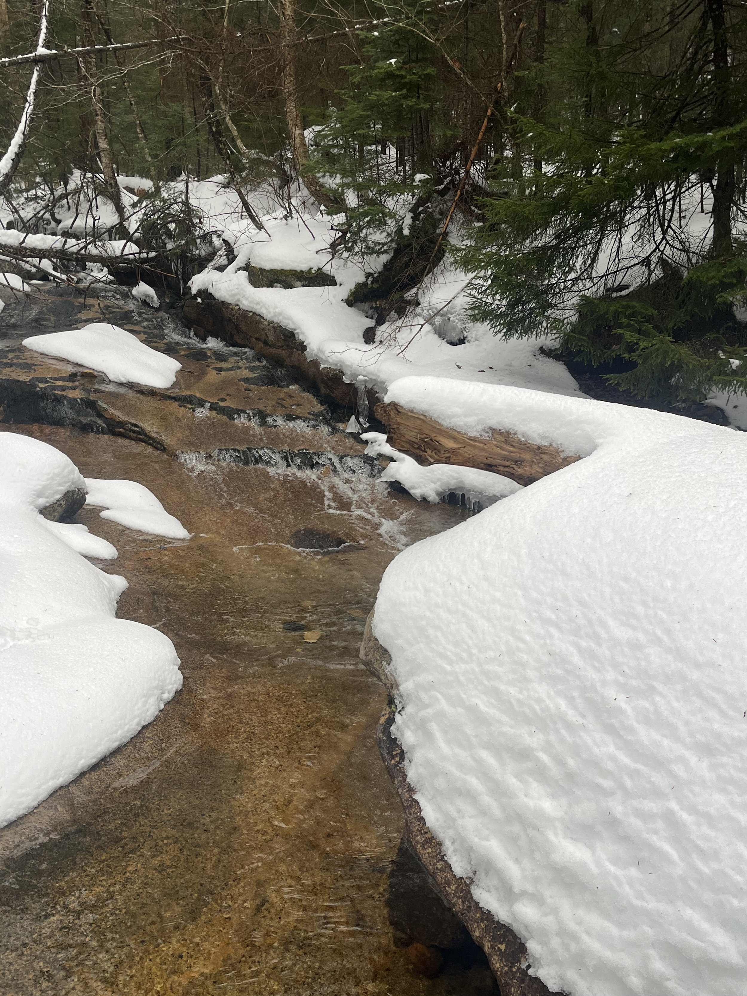
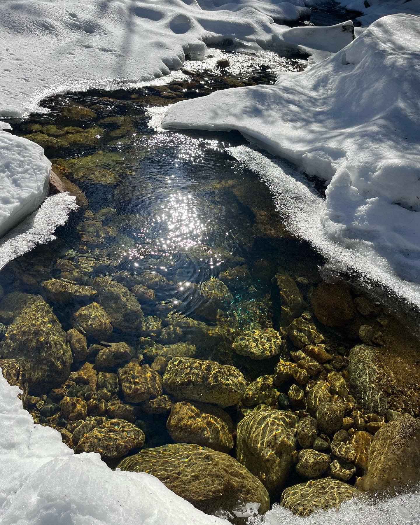
Gorgeous water feature with the snow making it really pop.
Dec 2, 2024 - Mount Tom! This was a day that we sort of just wanted to get a “4K” out of the way. Well, we did that but at the same time it turned out to be one of our favorite hikes. I know for sure from people reading all my blogs (hopefully) that exact line has been used once or twice but it holds true. The White Mountains just don’t dissapoint!
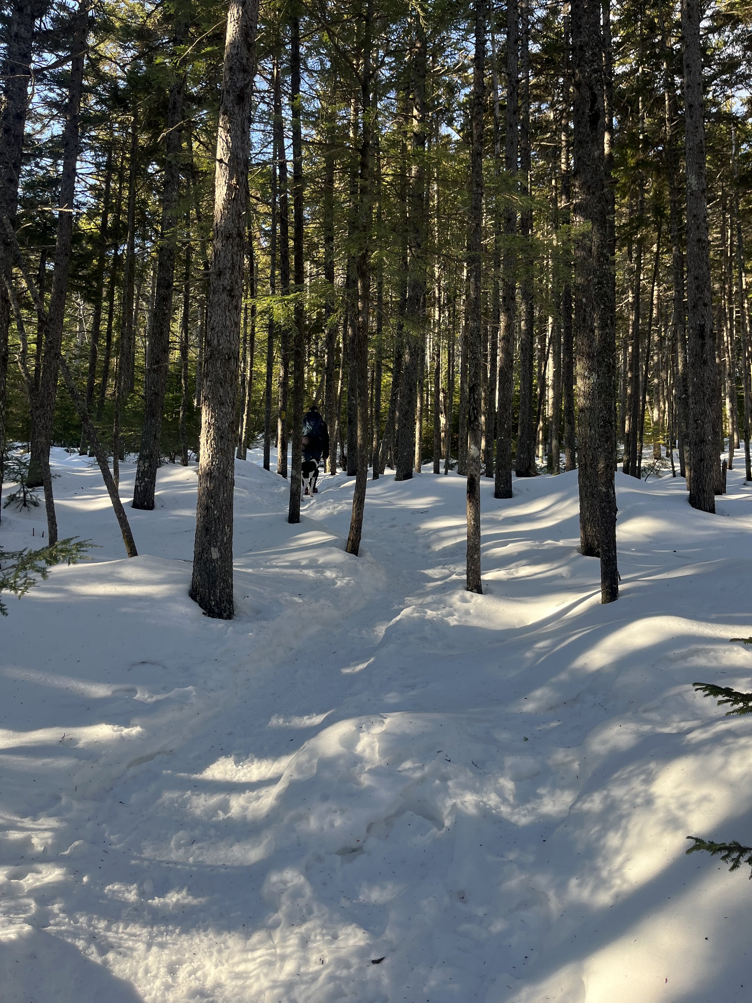
Myself, Kyle and Rocky started this hike later than usual, for one the sun rises later and two, we were just kind of dragging ass in the morning but decided to press on and drive over to Crawford Notch depot in Carroll, NH. This is a fairly quick drive from the “Maine” house in Bridgton as it’s about an hour or so. We got some intel from previous hikers that microspikes and gaiters would be a good idea due to some snow and quite a bit of ice. We started off on the trail at around 8am and immediately found out that the microspikes and gaiters were indeed a good idea. The one thing we have learned thus far on this journey is not to underpack the important equipment, water and first aid. After a small stream crossing or two we started our ascent of what was to be 2169’ of elevation gain in 2.8 miles. This was a fun climb as the snow makes these hikes a bit easier (my opinion) especially on a packed down trail like it was this day.
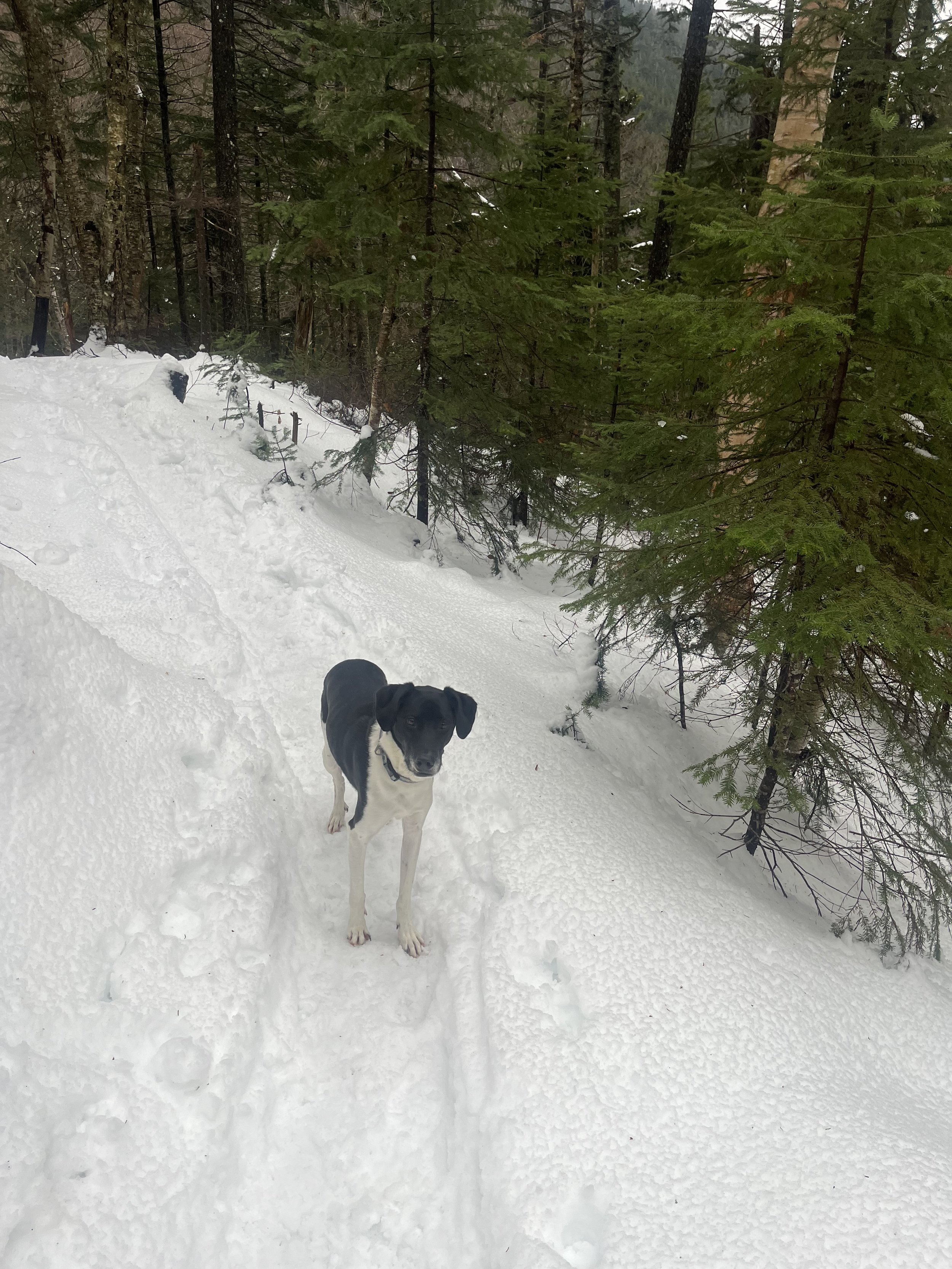
Rocky waiting for the slow pokes behind him!
After hitting mile two we continued up for the last 1.8 miles and ~1500’ more elevation gain. When we reached close to the summit of Mount Tom, the trees were mostly bare of any pine needles, and a few “blow downs” which are trees that have been blown down by wind and/or heavy ice or snow but it was beautiful nonetheless and we kept grinding through the snow for about another tenth of a mile before finally reaching the summit and crossing off #26/48 on our journey. It’s always such an emotional feeling when we conquer one of these mountains.
A few bare trees at the top of Mount Tom.
After a snack and hanging out a bit on the summit of the 4052’ Mount Tom, it was time to head down the mountain and grab some lunch and park our asses next to the wood stove back in Bridgton. This was really a fun hike and would highly recommend if you are just doing a short trip up. Most people do Tom, Field and Willey as a lop but due to time constraints it was a smart move to just hike Tom. We will be back for Field and Willey in the Spring. Here are a few links to Mount Tom.
https://www.alltrails.com/trail/us/new-hampshire/mount-tom-spur
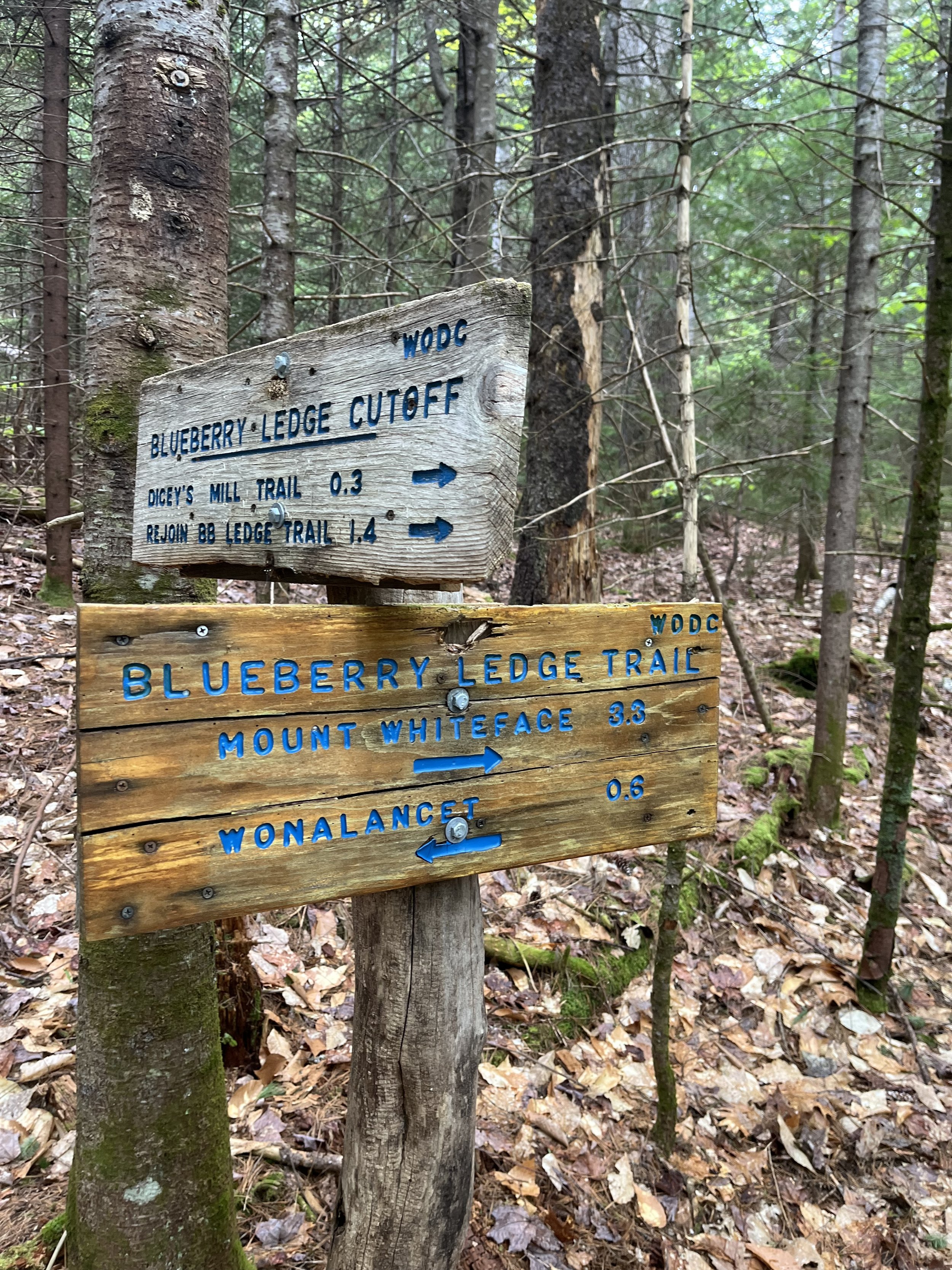
Mount Passaconaway
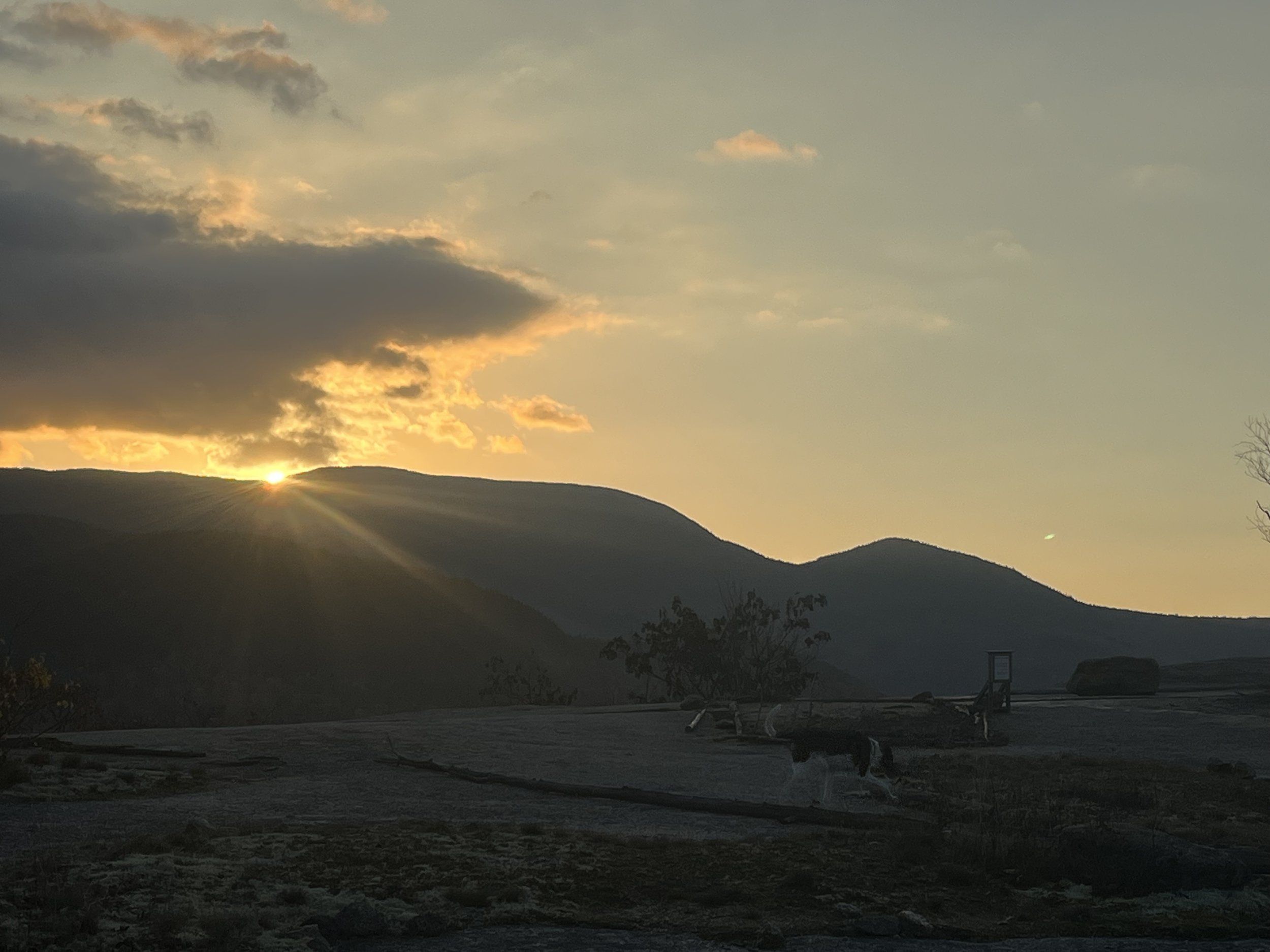
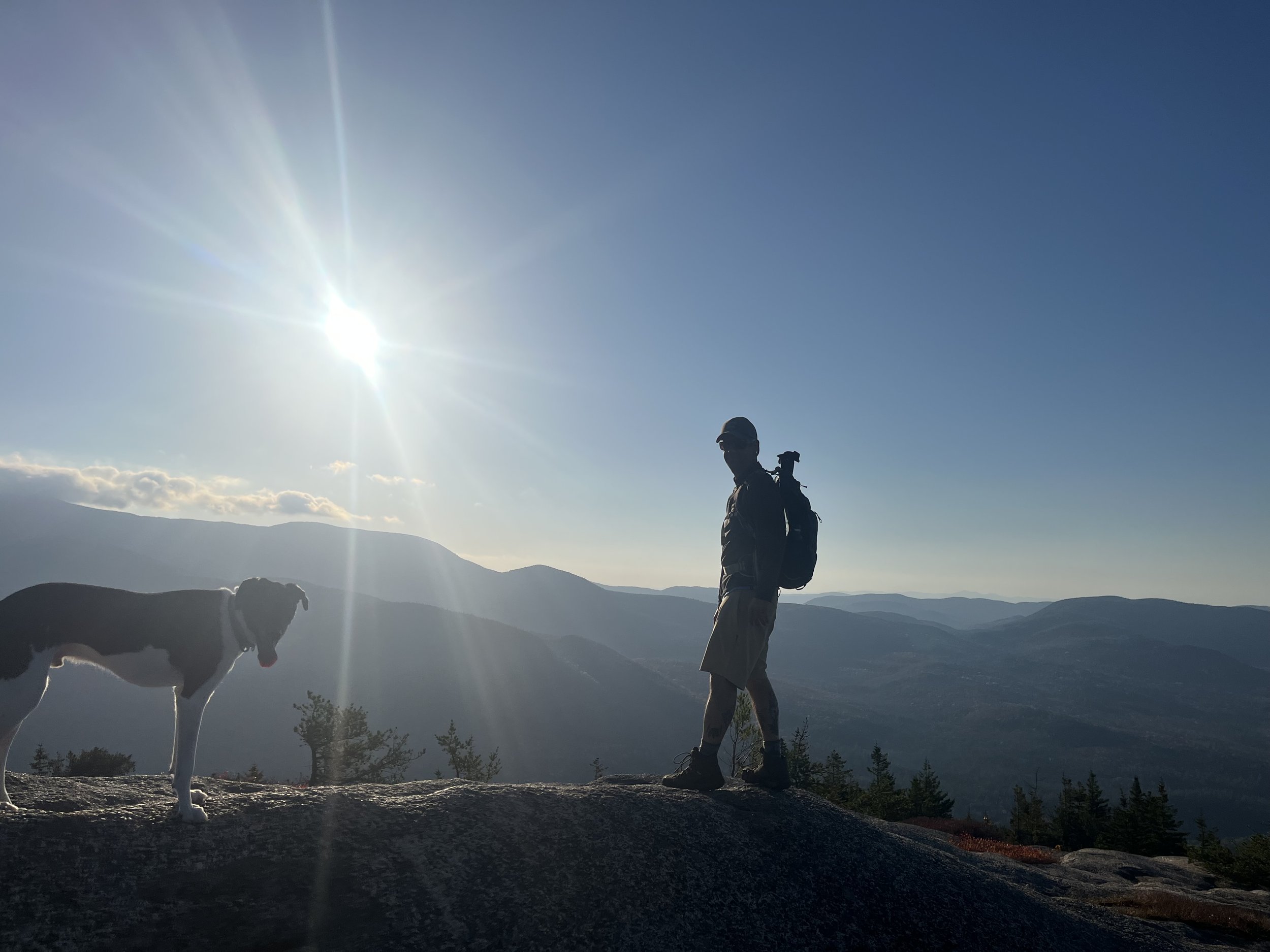
We heard winter had arrived in the White Mountains of New Hampshire so we decided to find out for ourselves. The weather called for 37 degrees, sunny and clear blue skies so we were in for a treat. We started the morning off a tad later than our usual 6:30-7am start but that was ok, the extra hour of sleep would be beneficial to both Kyle and I due to us both feeling like crap and the cold morning weather. I felt like it would be best to hop on the trail a little later than usual so we would catch the “warmer” air mid hike. This actually worked out well as we hit the Dicey’s Mill Trail around 8am and saw about 1000 feet of elevation gain in the first 2.2 miles. This was fairly easy and at about 2500 feet we saw a bit more snow and it was hard packed which made for an easy ascent. It was so cool seeing snow for the first time all season and automatically makes us both excited for ski season.
Kyle on our climb up Dicey’s Mill trail.
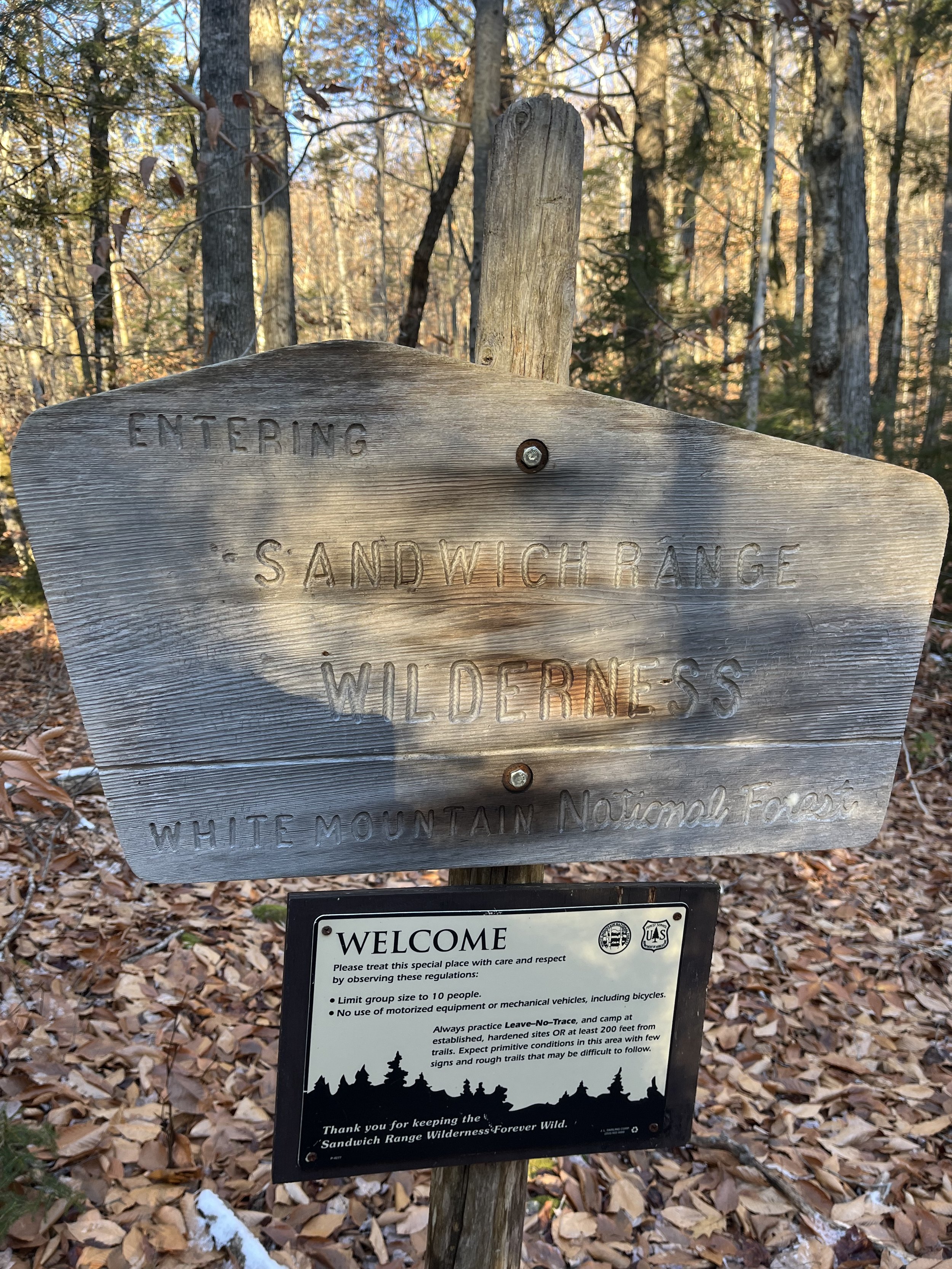
After mile three the trail definitely gets steeper (not crazy steep) and between the steepness and a few large ice patches that we hit we were finally on our last half mile descent to the summit. We decided not to use our spikes (we did have them in our packs) with a just a few ice patches it wasn’t that bad so they stayed packed away for now. The last portion of the hike was really cool as you were basically walking on a snow filled trail with all the trees covered in snow as well. A mini winter wonderland if you will. There is something about being 4000 feet up and looking out at the Sandwich Range wilderness that just puts a smile on your face. In our case a couple of smiles. This was probably the happiest I have seen Kyle on a hike, the kid loves being outdoors and the minute he sees snow he gets overjoyed and all he can talk about is doing hikes like these and skiing. Nothing makes a father happier than doing something with my son that he truly enjoys.
Lunch break and a view!
After hunting for the actual summit for a few minutes we found it, snapped a photo and went back to a small viewpoint to each our lunch. This lasted about a total of 10 minutes and we were getting pretty chilly just standing around so we decided to start our descent. It’s weird, you go from sweating your nuts off to freezing in the span of minutes. This was one of our easier descents of all 25 of these 4ooo footers and we just shot the shit about how cool the hike was and more ski talk. After a few miles it was out of the snow and back on the leafy, slippery and rocky terrain which was a nuisance but at least it was all fairly flat at that point. Finally got back to the parking lot at around 1:30pm, changed clothes and hit the road to home. This was one of my favorite hikes mainly because of the day I spent with Kyle. We were both in good moods and just enjoyed each other’s company. I would 100% hike this mountain again and would tell anyone to get out and hike this one as well.
ICE!
Heading toward Passaconaway.
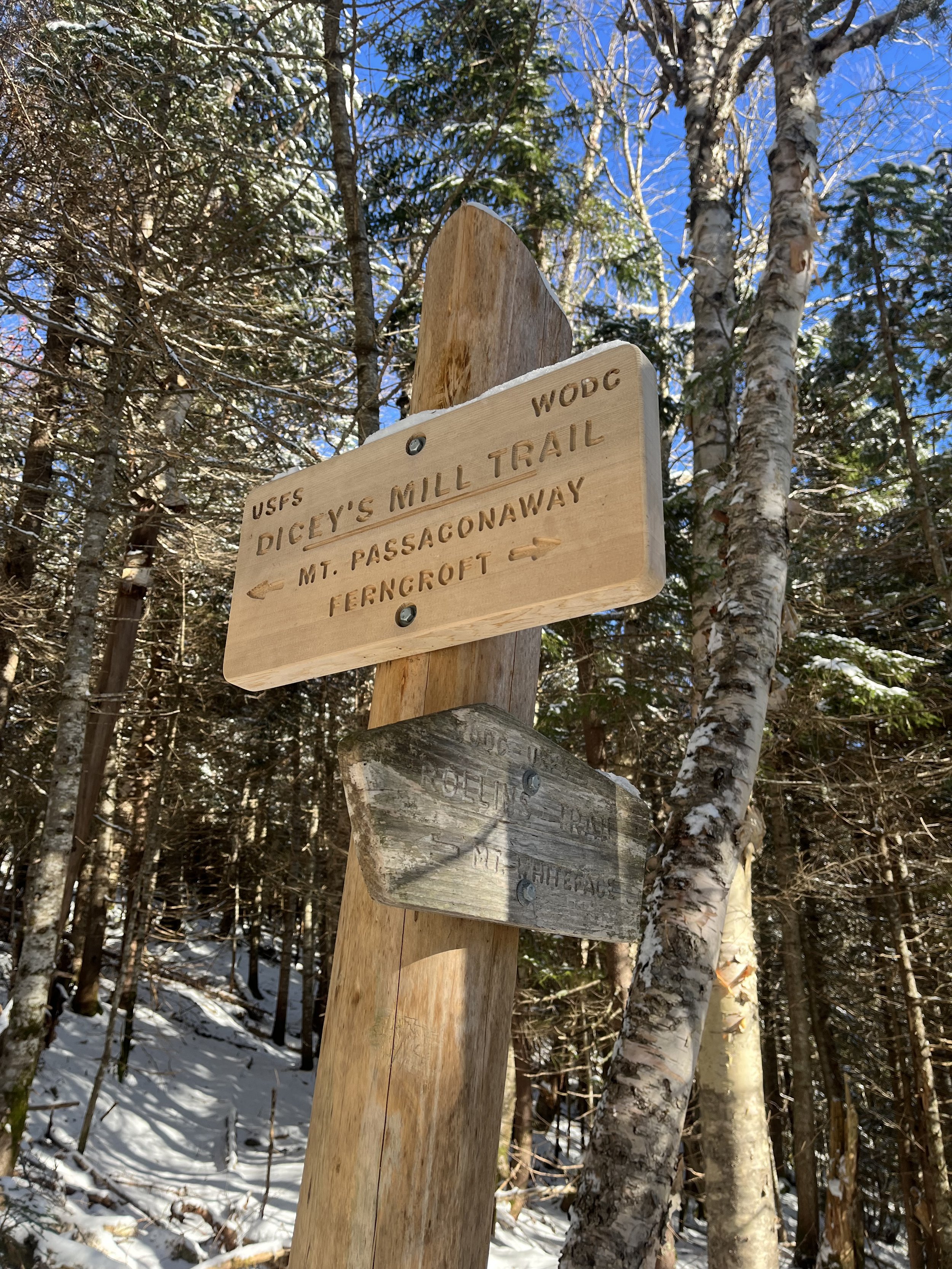
Sign at a junction. Rollins brings you over to Whiteface.
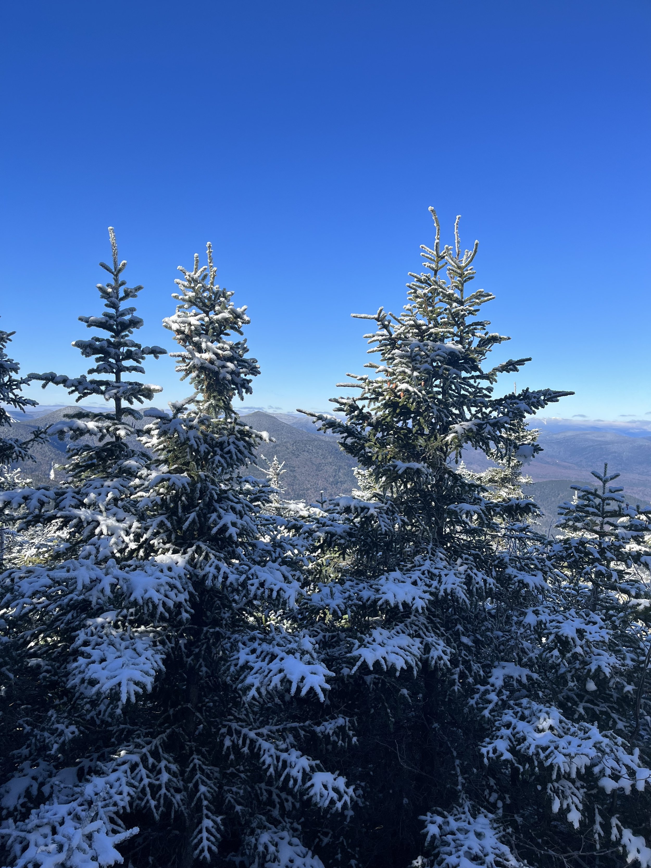
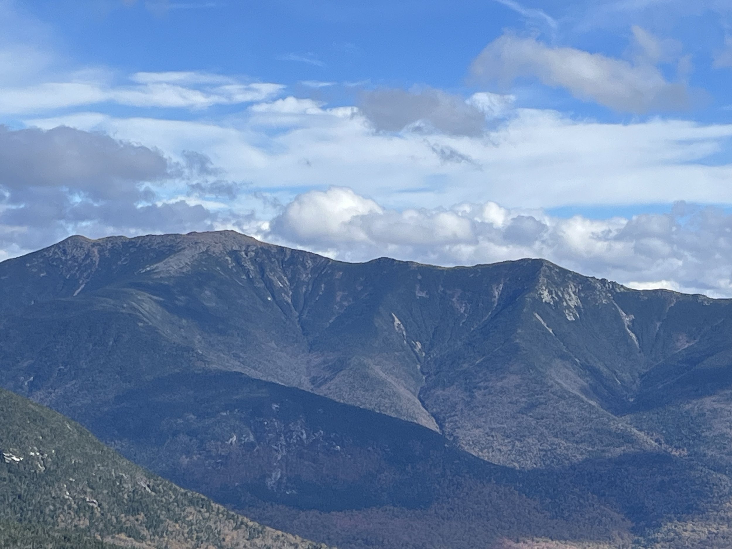
Sandwich Range. Spectacular!
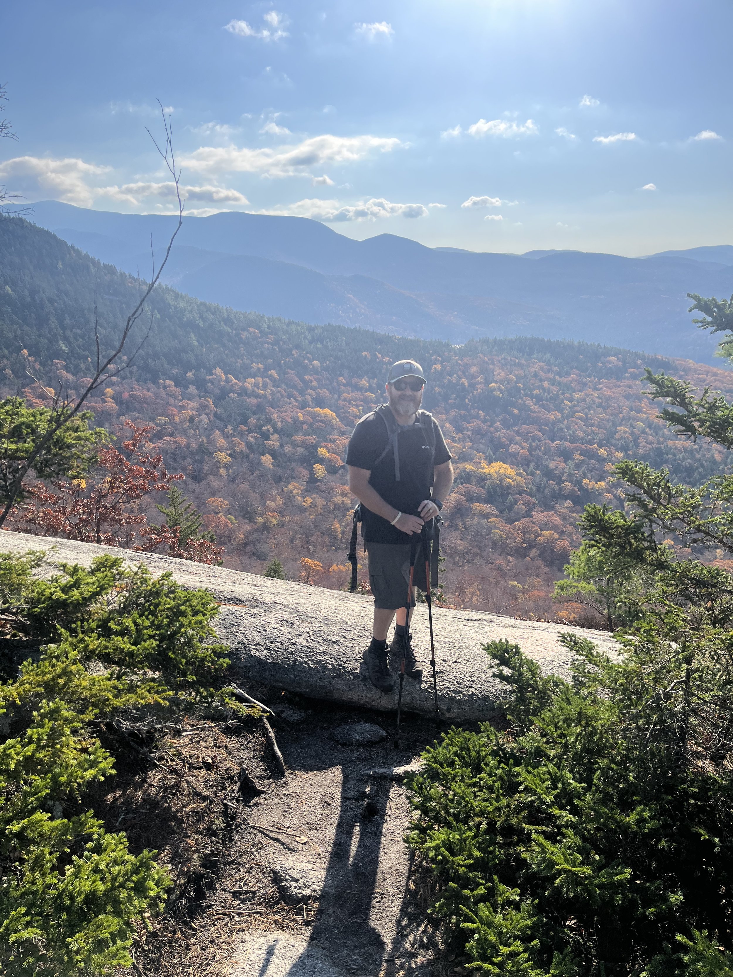
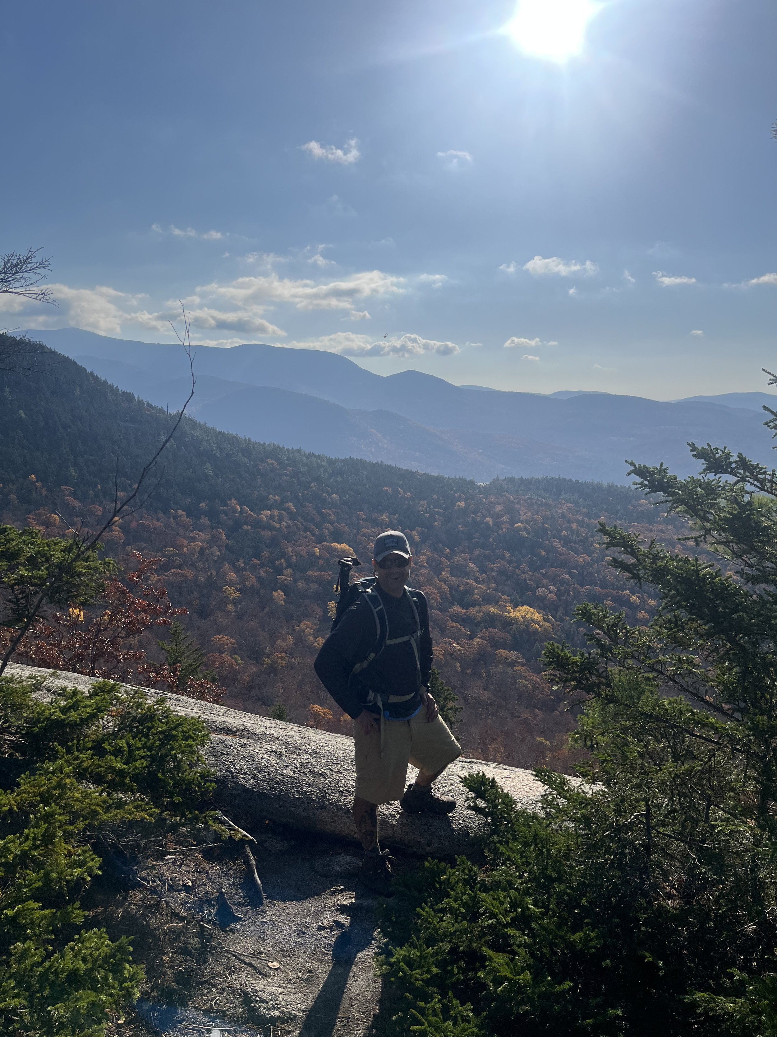
WELCH-DICKEY
Not a NH/48 but we got out and did our thing. We decided on the Welch-Dickey loop trail on a dry soon to be sunny day in the whites. It would be myself, Jeremy and Rocky again and earlier in the week we were thinking Owl’s Head but again my foot and knee were most definitely not ready for the 18 mile out and back hike. We will have to wait to climb that one next year but for now it was all about just getting out hiking and having a few laughs along the way.
Started out on the trail at around 7-7:15ish after a smooth two hour ride up from Mass. The feeling of being happy, emotional and just damn lucky to not only be alive but to be alive and doing something you truly love to do can’t be beat. There is a certain feeling of freedom and calm when you hit these mountain ranges, a feeling I want to last and take advantage of while I can. After a short hike of 1.3 miles and 800 feet of elevation gain we came upon a giant slab of rocks. All I heard was “John, holy crap you gotta see this!’ That would be Jeremy hitting this view point first and he was not exaggerating his excitement. WOW! What a view indeed and just think we were only at the first view point of many more to come. We actually witnessed the sun coming up over the mountains and this just made the views that much better.
After shooting the breeze with a woman on her sixth hike up this loop trail we decided to get on with it and head up to Welch’s summit which was another 700 feet of gain in 0.6 miles. This view rivaled the first and we were both just stunned by the beauty of the colors of Fall and the sun still coming up. Absolutely amazing.
We sat down, shot the shit and had a snack before ascending our final peak which is Dickey. This trail is loaded with slabs so we were happy to do this on a dry day. This would absolutely suck on a wet day. After climbing slab after slab with views virtually everywhere we looked, we made it to Dickey which was every bit as stunning as the last two stops. The lesson learned on this hike is that we only went four miles and gained 1800 feet but got some of the best views to date on any mountain. So if you pick the right mountain on the right day with the right weather, than holy shit you get what we got and didn’t have to climb 4000 feet to get ridiculous views. That is obviously why this trail is listed on the 52 with a view (52WAV). These are 52 mountains under 4000 feet with great views. There is a patch you can receive by hiking all the mountains on the list. That is another patch I intend to get at some point!
Now for the descent. It was quick going down, mostly open slabs and fantastic views. I recommend this trail to anyone who likes to get out to the mountains and grab a quick view of the white mountains without getting exhausted or bored. Again, was great to be in the company of a good friend which always makes the hike more enjoyable.
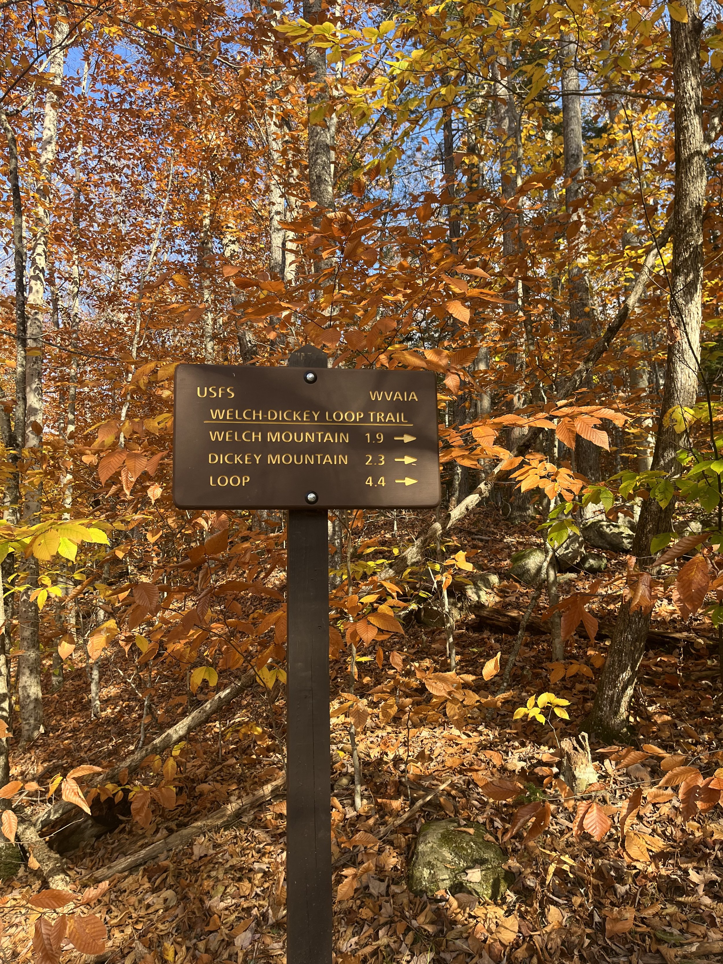
Trailhead leading to the loop. This one will be hiked again!!
The Kinsmans
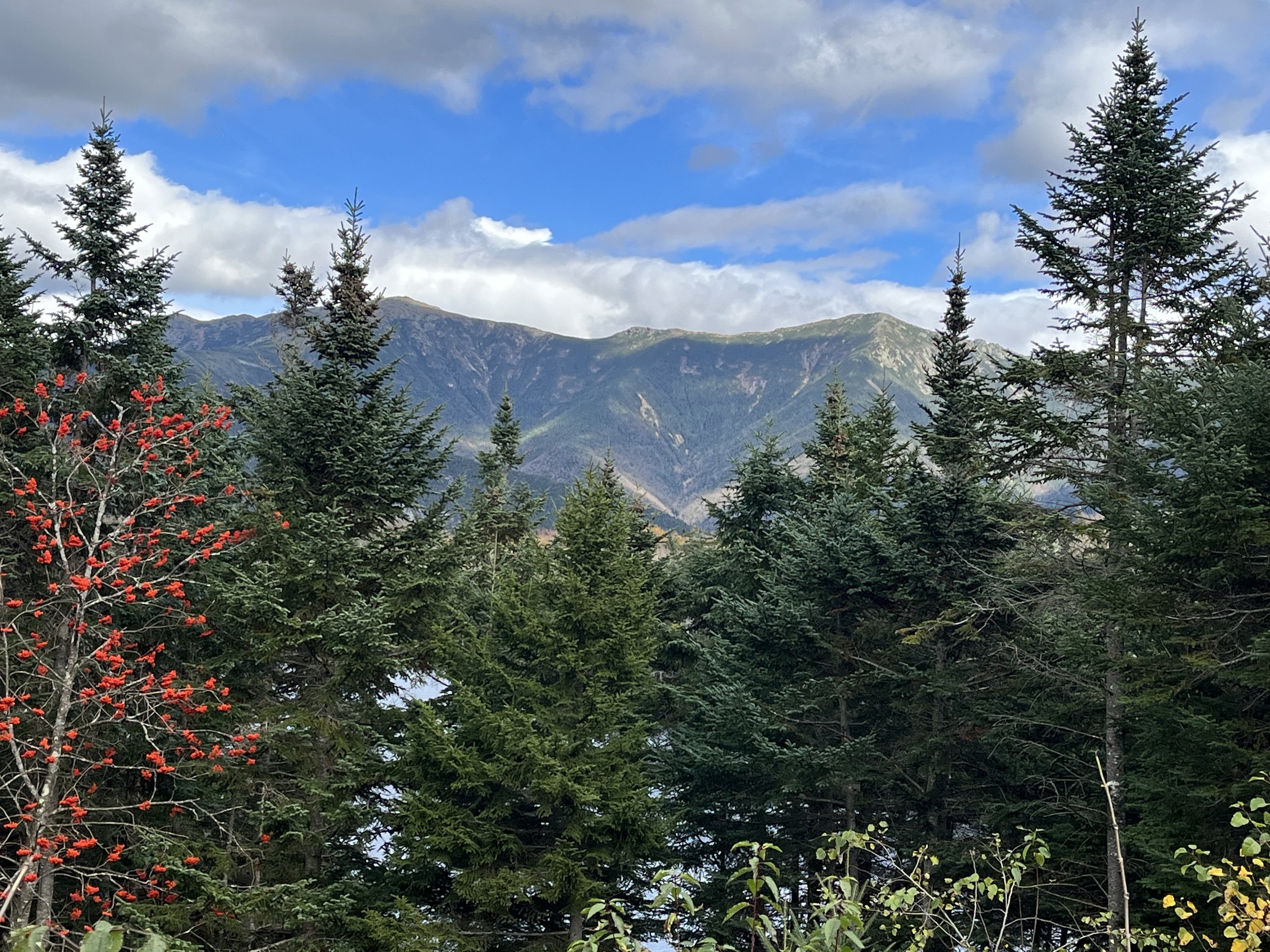
View from the outlook on North Kinsman.
There was a last minute decision as to what particular hike we were going to complete this time around. Kyle would not be present on this hike but good friend Jeremy would come along. After talking it over about which hike to do we decided on the Kinsmans. Originally we were thinking Moriah or Cabot but ultimately it was the Kinsmans in Franconia Notch. This would be Jeremy’s second time conquering these two peaks but he had no problem with climbing these again. He currently has nine peaks left on his own journey so for him to suck it up and do this for me meant a lot.
We spent the night at our “Maine House” located in Bridgton as this made for a shorter ride over to the notch. We hit the trail (Rocky included) at around 7:30am and started our climb up to Lonesome Lake via the Lonesome Lake trail. This is a steady grade of elevation gain from the start. The gain is roughly 1000 feet in the first mile as the lake sits at 2700 feet. Then you hop onto the Cascade Brook Trail for a quick 0.3 mile jaunt up to the hut. After stopping at the Lonesome Lake Hut for a quick snack we headed up the Fishin‘ Jimmy Trail. This trail is named after a gentleman James Whitcher who spent his entire life in Franconia and became a caretaker to the hut after the original owners had passed away. This trail along with the Kinsman Ridge Trail, which you hop on at an intersection was rough, steep and hard on the legs.
We were on the Fishin Jimmy trail for about two miles before connecting on to the Kinsman Ridge Trail for the push of a mile or so to these two 4000 foot peaks. We hit North Kinsman first which was a great place to stop and eat lunch so we did just that. After a well deserved break we started up again for the second of these two peaks. North had some views from a lookout that we would check out on the way back, we couldn’t see anything earlier due to clouds. Once we got moving again it was a short haul to South Kinsman. We got fooled by a false summit and quickly figured out where the real summit was and once we got there it took my breath away. Clear skies at this point and these views were some of the best I’ve seen to date. There was also a path off the summit that brings you to another lookout where the 4800 foot Mount Moosilauke stares directly at you. After having one more snack, sitting on the “throne” which is a handmade throne of rocks on the summit and losing my bottle of nitroglycerin we began our descent.
We both knew the descent was gonna suck as we would be going up and down for a few miles. This is a bit annoying because you climb so much but also dip down quite a bit too so after hiking the initial 5 miles you know what is coming on the way down. After climbing up and down with what seemed to last for hours we finally reached the hut again, took our last break and descended the final mile to the Lafayette Campground parking lot. All in all this was a fantastic hike and had a ton of fun with Jeremy who I look forward to continue hiking with. It was a bit hard for me as my plantar fasciitis is still lingering and my left knee gets really sore just on the downhill but as much as I hurt it was still an awesome day and would recommend this trail to anyone. The views are spectacular and you work really hard for them as well. These were number 23 and 24 for me and that means I am halfway to 48!!!!
Sitting on the “throne” atop South Kinsman.
Outlook on North Kinsman during our descent.
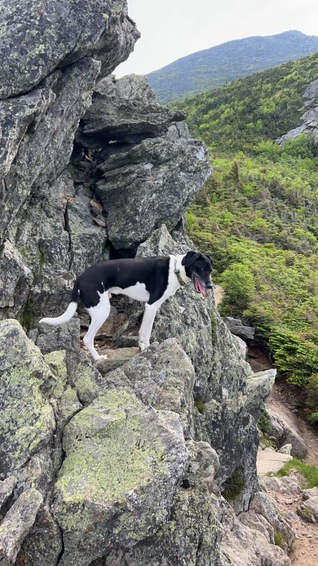
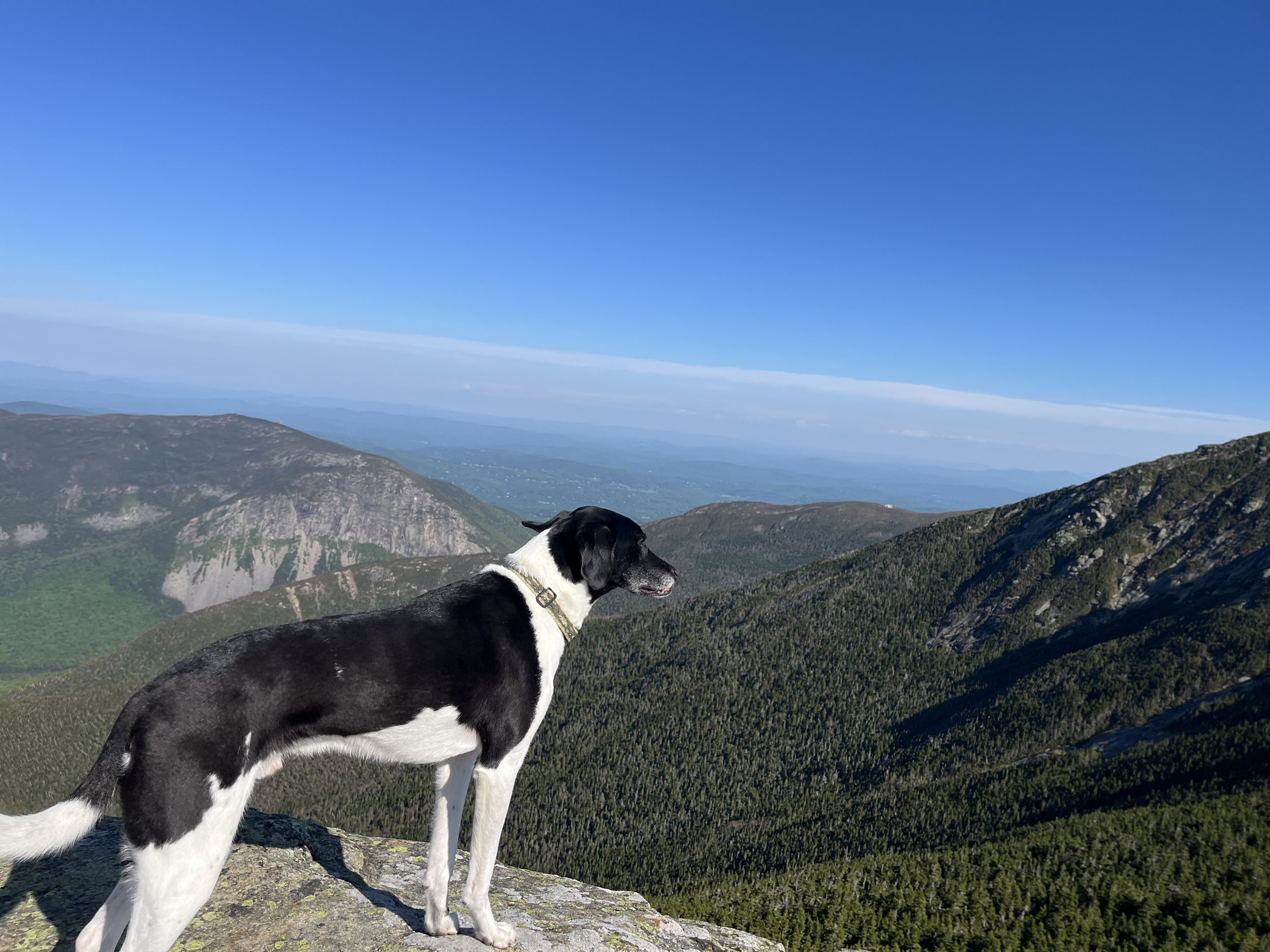
Rocky on North Kinsman.
Steps!
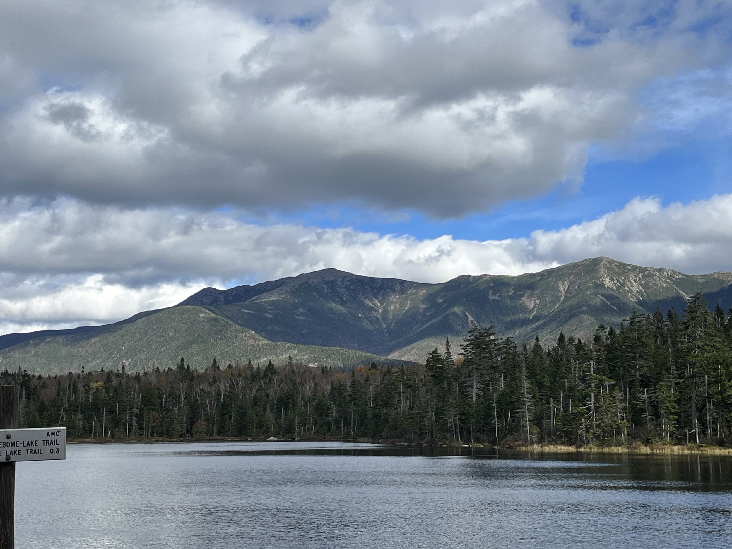
View from Lonesome Lake. The lake sits at 2700’
View from the Lonesome Lake Hut.
Mount Carrigain
Let me start off by saying WOW! When I say WOW, I mean in every way shape or form for Mount Carrigain. It has been known that many NH48ers have waited to end with this one and now that I have hiked it I can see why. Absolutely stunning! We started out on the trail around 7:15 am sort of knowing this would be a tough one, for one thing Kyle was feeling like crap and my foot was still bothering me but it was going to be a clear day with sunshine from morning through the evening so we had to take advantage mostly because we have had one clear hike all damn summah!
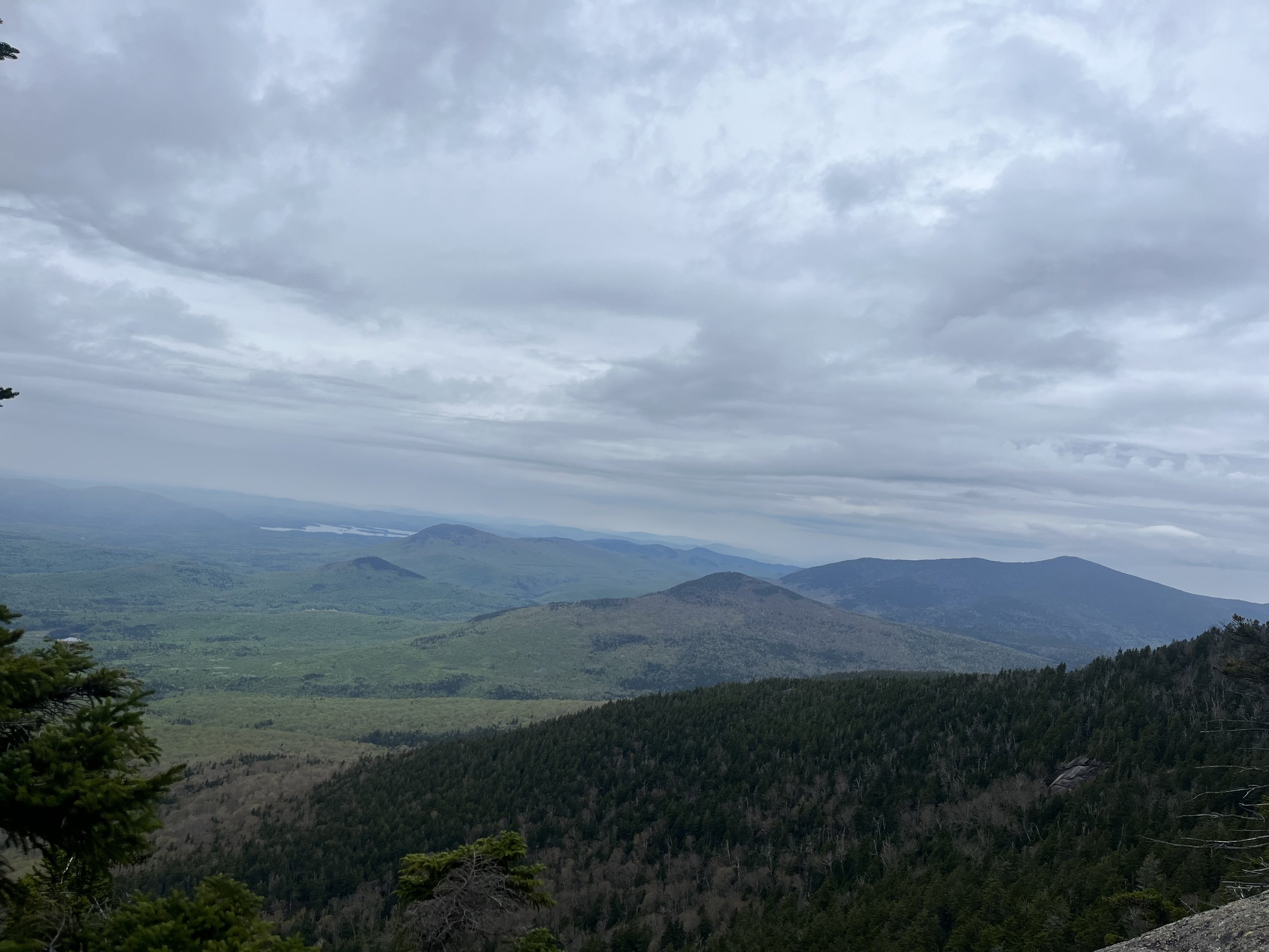
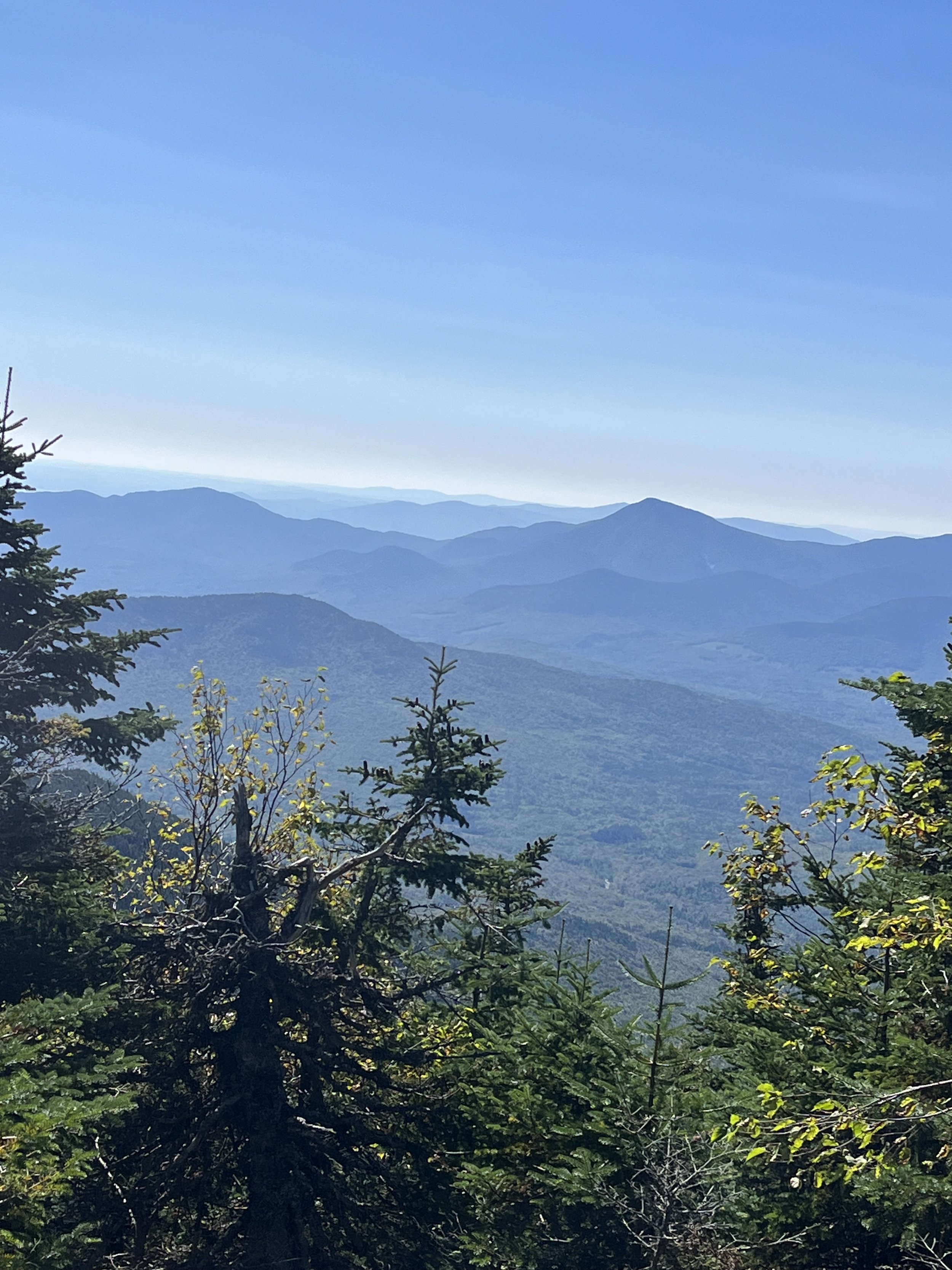
The Signal Ridge trail starts off very flat for the first two miles then begins to get steeper, then steeper. We kind of knew this buy doing our research so there was no surprise a few miles in but when you begin to climb it seems like the last 3 miles are never ending and absolutely relentless. Both feeling like crap we probably took more breaks on this hike than any other, it is just a constant climb from mile 3 to mile 5 which is the summit. After a good number of breaks and meeting about 5 other black and white dog (we and fellow hikers jokingly called it black and white dog day) we finally made it to the ridge. Although windy this was absolutely amazing! I just love ridge trails and traverses and this one was at the top of the list. This ridge stands at about 4200 feet. Just looking out at the presidentials on one side and all of the mountains in the Lincoln/Franconia range from the other side. I mean this was just surreal! We took a few pictures, saw the fire tower in front of us rising another 400 feet and were pretty anxious to get up there to summit #22/48. This was a pretty easy ascent and you meet the summit directly in front of the tower. HOLY SHIT!!!! I can’t actually come up with the words to describe this view. Well I guess I just did. It is so impressive, we then climbed up the fire tower to see what all the fuss was about. You are literally in the middle of the white mountains surrounded by ranges like The Presidentials, Franconia, Crawford Notch, Tripyramids, Osceola’s and the Pemigewasset wilderness including the Bonds, Owl’s Head, Lincoln, Lafayette and the list goes on. This view catches 43 of the 48 4000 footers. It is the most impressive view to date and Carrigain did not disappoint!
After a steady, steep descent for 3 miles we finally hit the flats again and although it felt like it lasted forever the last two miles were what we needed. Flat, dirt and straight. We definitely found a few swimming holes within Whiteface Brook on the way up and down and will be back to use them on a hot summer day. This was a tough hike, granted we both felt like shit but it is a tough hike no matter what. We were so glad we conquered this one and the views will be etched in my brain for life!
Summit of Carrigain.
View from Signal Ridge.
Kyle looking out from the ridge.
On our ascent!
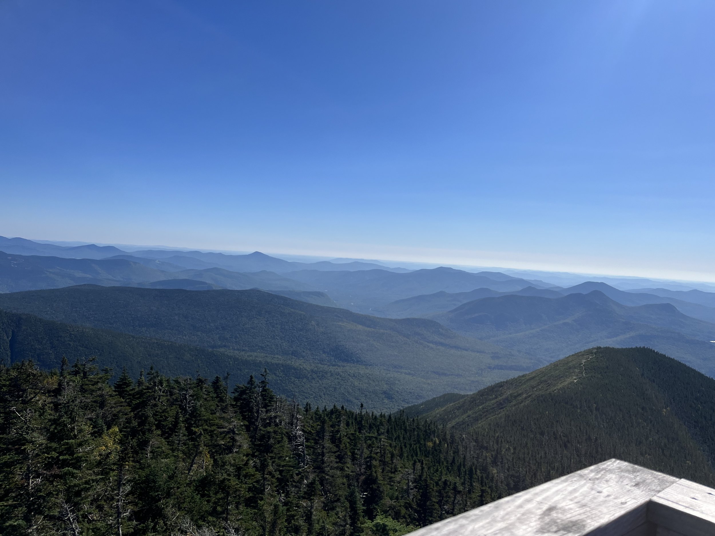
View from the tower. This has a 360 degree view. Stunning!
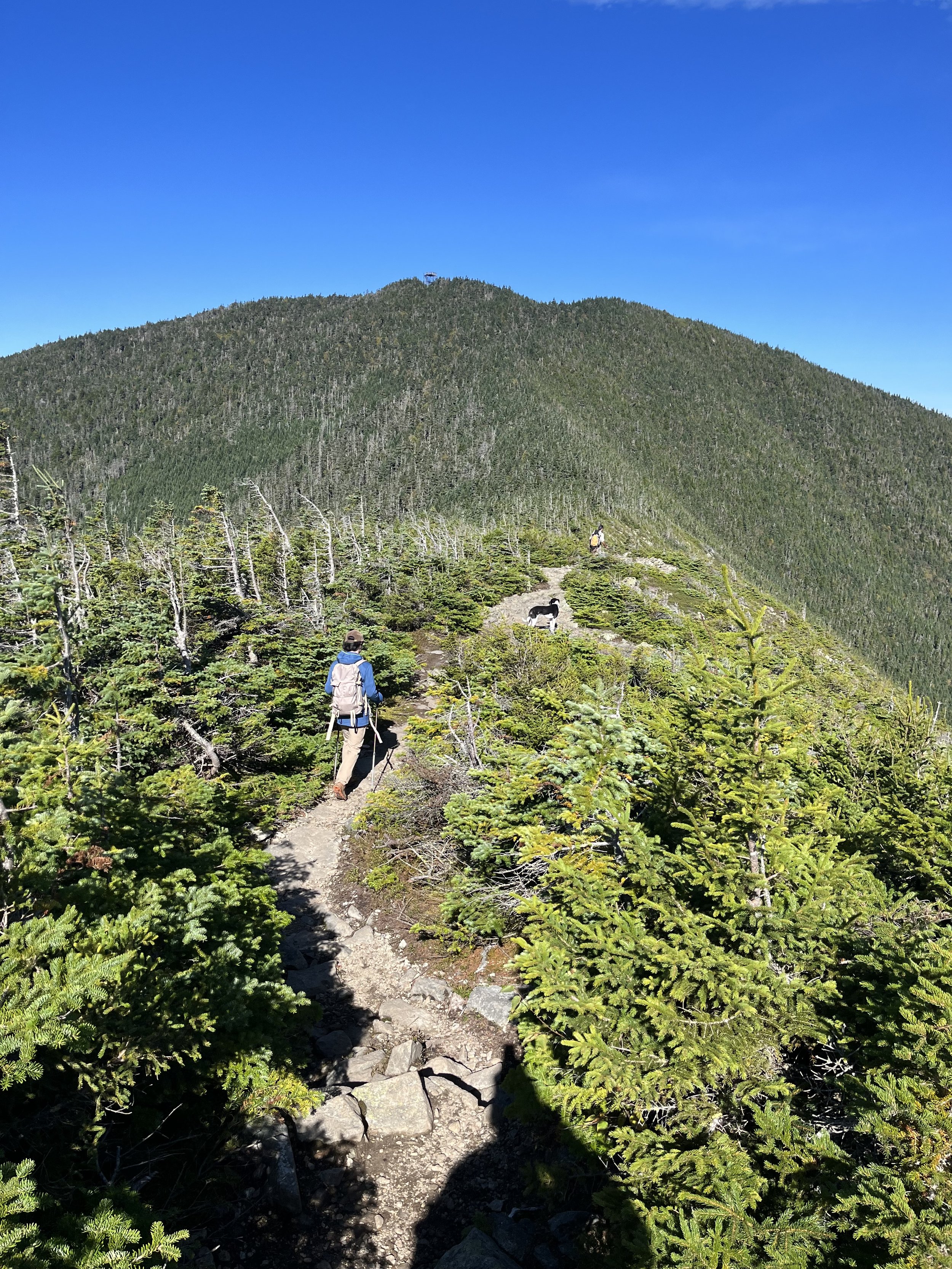
Kyle and Rocky walking the ridge and heading up the last 400 feet to the fire tower at the summit of Mount Carrigain.
Mount Waumbek
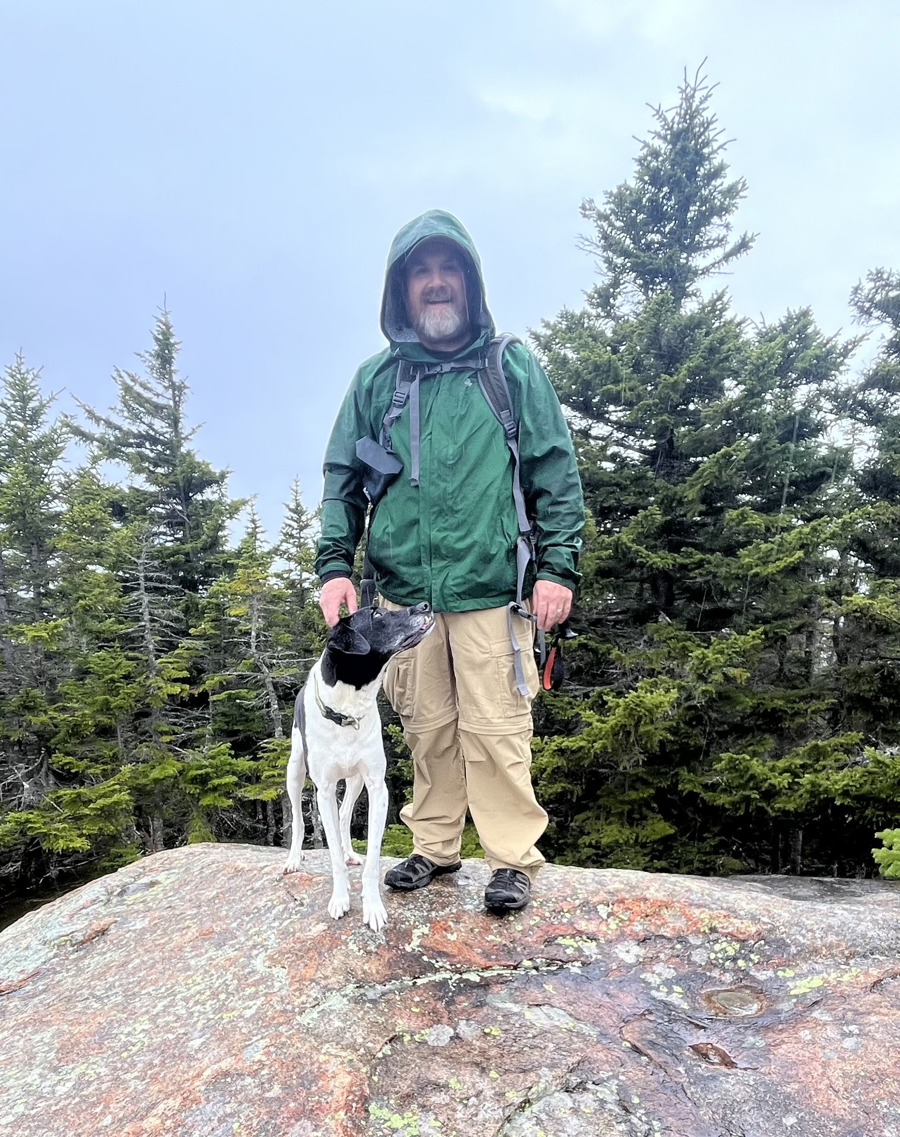
This was a last minute decision on where we were going to hike this weekend. The last few weeks (since Mount Washington) my right foot has been bothering me so we decided to go for an “easier” New Hampshire 4000 footer, not that there is such a thing from my point of view. It was either Waumbek (6.7 miles), Cabot (8.8 miles) or Moriah (10.4 miles) so we decided to go for the shortest hike mileage wise but more elevation gain per mile. We were to meet up with a friend of mine at the trailhead parking lot around 6:30-7am but before he arrived we started chatting with a fellow hiker who was organizing a hike for Flags on the 48. This is a hike to honor the deceased and the families who lost loved ones on 9/11 with a tribute of flying the American flag on all 48 NH 4000 footers. I will 100% be a part of this going forward. This is such a phenomenal way of showing support and love for the people who lost their lives and to the families still dealing with the devastation of that day.
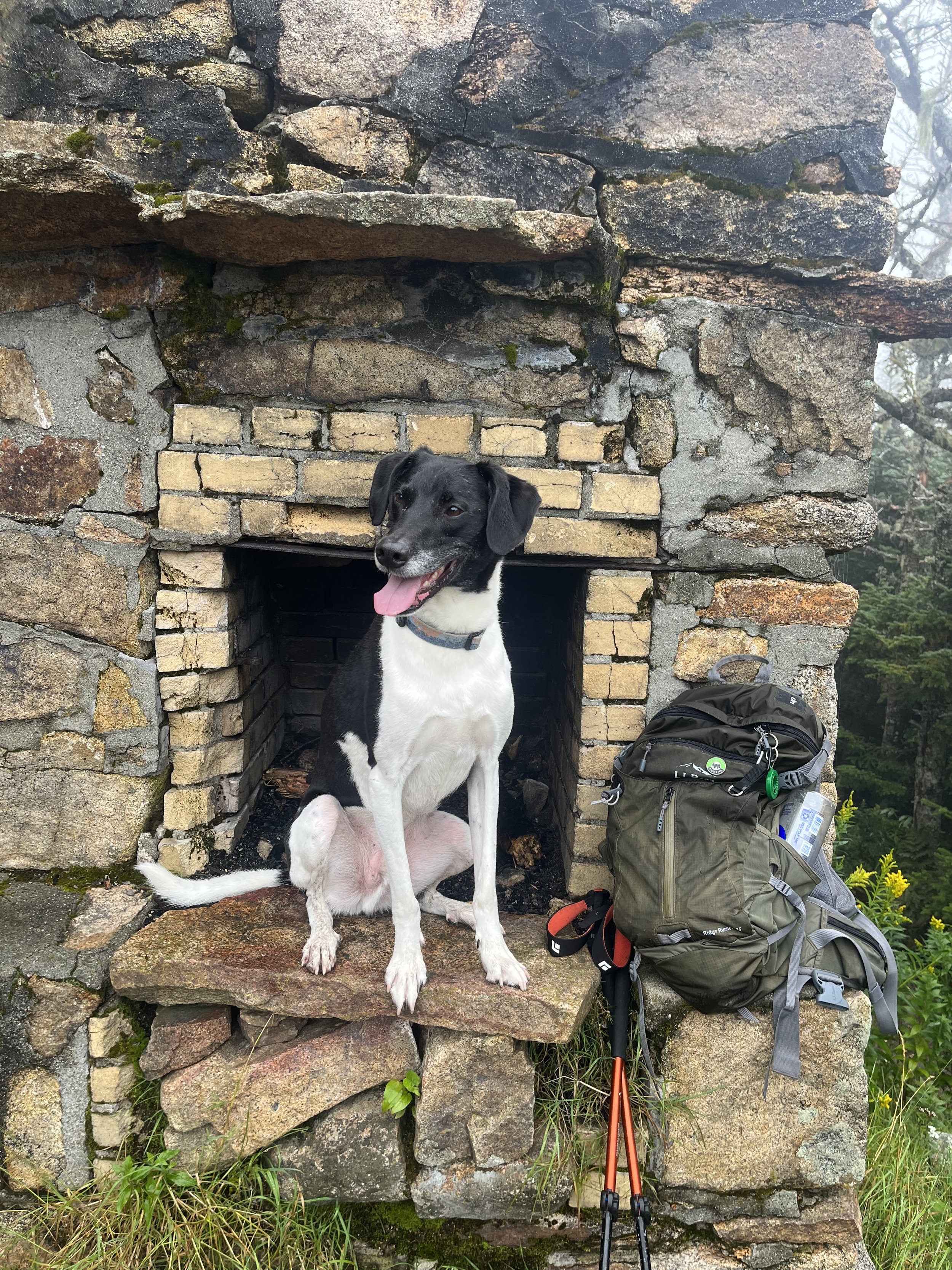
After a great conversation about hiking, electrical work (Kyle is in the electrical program at his High School) and heart disease, my friend Bryan pulled in to the parking lot ready to go. We jumped onto the trail around 7-7:15am on yet another dreary day in the Whites which at this point was no surprise to Kyle and I since we’ve only had one sunshine filled hike all summer. Not complaining, we are getting out and hiking but someone has to throw us a bone at some point! The trail actually starts with a steep ascent for the first mile, it is 1000 feet of gain in that initial mile then begins to turn into a more gradual climb for the next two miles. At mile 2.5 we hit the summit of Starr King which stands at just about 3900 feet. There is a fireplace that sits on the summit which is a remnant of a shelter that was built in the 1940’s and removed in the early 1980’s. Hikers actually still use this to build fires from time to time. There is also a fantastic view from this summit as well. It is part of the NH 52 with a view aka 52WAV. Not on this day though! We took a short break on Starr King and made our way over to the summit of Waumbek which was just one extra mile of mostly flat terrain. Waumbek sits at 4006’.
We hit Waumbek (#21) after an easy trek from Starr King, took a few photos and had a bite to eat. We could hear the gray jays in the pines above us but they would not come and eat out of our hands today. We met a fella named Andrew up top where Bryan, Kyle and I struck up a conversation with. He was working on the “White Mountains Grid Challenge” which is all 48 4000 footers in each month of the year. This is absolutely nuts and give this guy all the credit in the world. This winds up being 576 peaks. This is mind blowing to me. Bryan talked about his 35/48 peaks and they wound up knowing some mutual hiking buddies. We also talked about my journey and shot the shit a little more , all wished each other luck and started our descent down the mountain.
It was a very quick descent and thank god, because my foot was killing me at this point so I popped a few ibuprofen and that was that. We made a plan to grab a beer and some food at One Love Brewery in Lincoln, NH on our way home. The best thing about today was the people. Whether it be the gentleman from the parking lot, Andrew the Grid Guy, the people carrying the flags up or having the company of my buddy Bryan. To me, you can’t really have a bad day hiking when you are constantly surrounded by good people. We learn a lot from fellow hikers whether it be their own story or journey or finding out about trails and waterfalls that are not known to us at this point. I love having Kyle out there as well to socialize, and get some exercise even though he is a very active kid. In my opinion this is a huge deal and more kids of his generation should be doing the same. It doesn’t have to be hiking but our youth should be interacting and socializing a lot more than they do. It’s just healthy! Pictures of our latest adventure can be seen in the Gallery portion of the website.
The (very) underrated Hancocks
Ahhhh. The Hancocks. Possibly the one hike I have been avoiding due to the many negative reviews and constant piling on of how bad this hike is. It’s long, it’s muddy, it’s boring, it’s steep, it’s a “cross off” if you are working on completing the NH48. Well, after hiking to these peaks yesterday I will probably never take much advice from anyone when it comes time for our next hike. This is an amazing hike (my opinion) and some of what I mentioned in my opening statement about length, conditions, terrain and such is kind of what most of the White Mountains are all about. The only thing I can kind of understand is that the entire trail is wooded. Is that so bad? In my opinion, having that feeling of seclusion is one of the reasons I love to get out and hike.
Sunrise on the “Kanc”
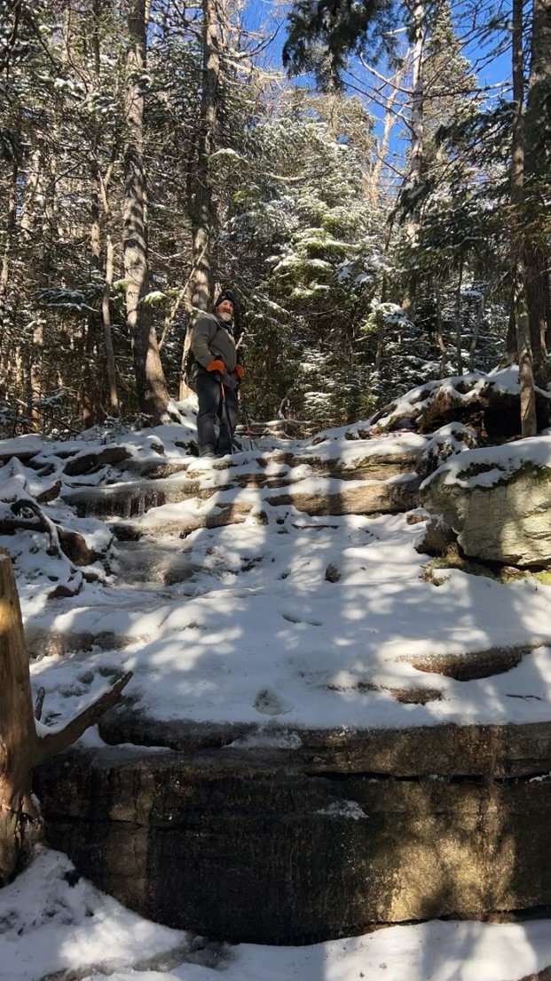
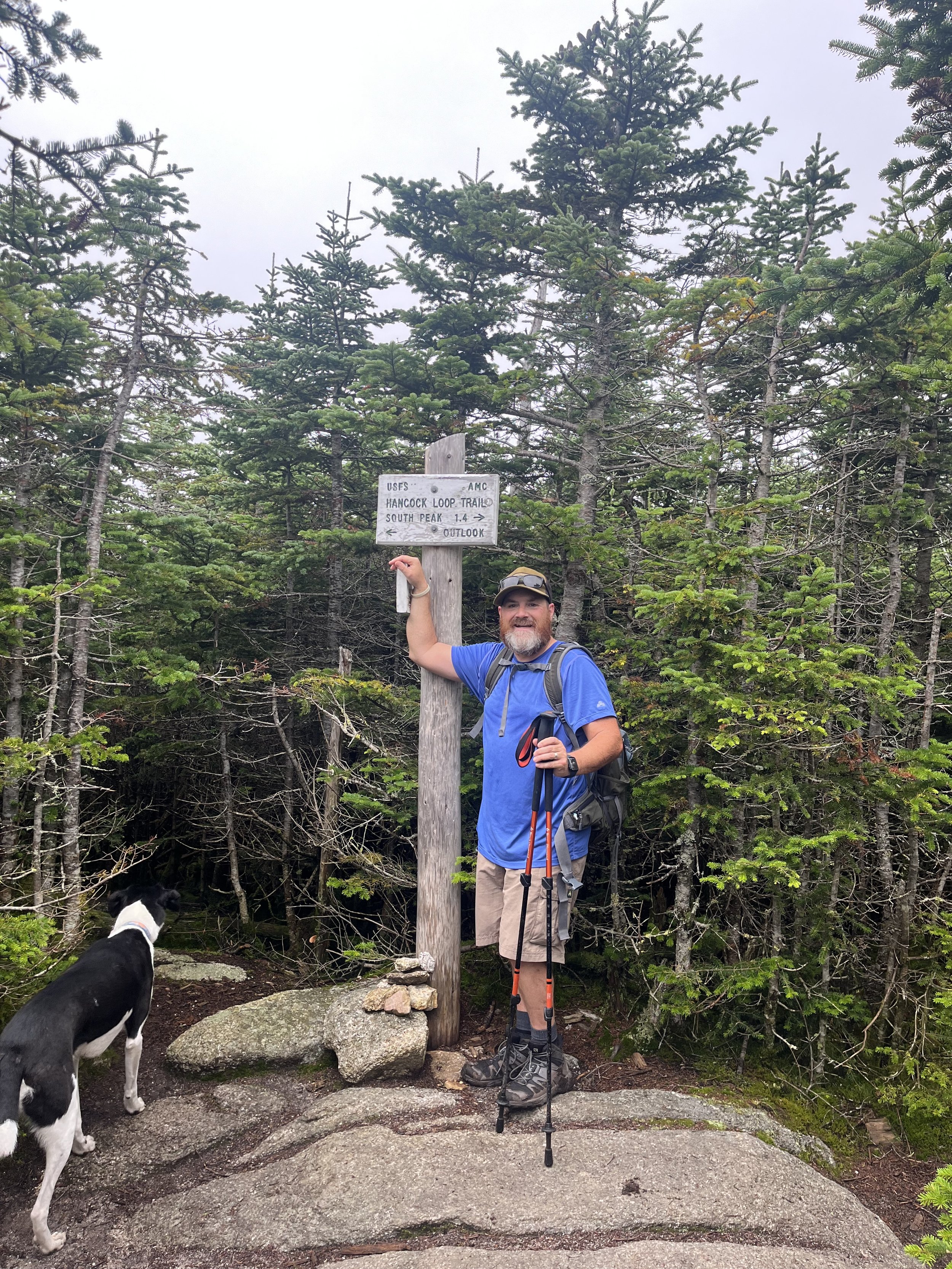
We started out by pulling into the Hancock parking lot just off the Kancamagus Highway (The Kanc as us New Englanders call it). After parking the car, crossing the Kanc we headed into the woods to start what I thought was going to be a crappy, boring, long hike. As we walked the first mile or two of the flat but rooted trail we felt a sense of being alone deep in the woods of NH and loved every minute of it. Kyle loves this sort of trail also so it was a nice hike thus far knowing it would be getting fairly difficult soon. At around mile 2 you merge onto the Cedar Brook Trail where the trail stays fairly flat but gets rocky and through the trees you can see North Hancock taunting you as you have already hiked close to 2.5 miles and you get the feeling you are not close!! After 0.7 miles on the Cedar Brook Trail you merge onto the Hancock Loop Trail where the actual ascent to the summit starts. This is about 400 feet of gain in a mile until the real steep scramble begins.
Kyle heading off to South Hancock.
The junction gives you the option to go left toward North Hancock or right to South Hancock. We knew North would be steeper going up so we opted for that rather than coming down the steepest part. This climb is approximately 1100 feet of elevation gain in 0.7 miles. This was pretty tough as it was basically a scramble of very loose rocks but was fun at the same time. We reached the summit around 9:10am where we took a few pictures at the sign and went over to a lookout and had a snack. This lookout would be very cool if we weren’t socked in by the clouds. After resting for a few and summiting #19 of 48 we began our trek over to South Hancock which is 1.4 miles. This was just a cool traverse of wooded, flat albeit muddy terrain but it was definitely a cool part of the hike. There is something about being in the fog deep in the woods that I think is fantastic! After reaching South Hancock (#20) and chatting with a very nice family, we started our steeeeep descent down the 0.5 miles portion of the Hancock Loop Trail. You have to stay focused on this part or you could be seriously injured. Steep, loose, slippery rocks. Our dog (Rocky) is very good on the mountains and all terrain but if you have an older dog or small size dog this is probably not the trail for them. After meeting back up with the Cedar Junction trail we hiked the rest of the “down” and then had a 2 mile flat walk out. All in all it was another great day in the Whites and we had a blast. I want to reiterate my feelings about The Hancocks. Very underrated hike and we will do this one again for sure on a clear day because there are views to be had.

Rocky enjoying some rock scrambling!
North Hancock. #19 before summiting #20 on South Hancock.
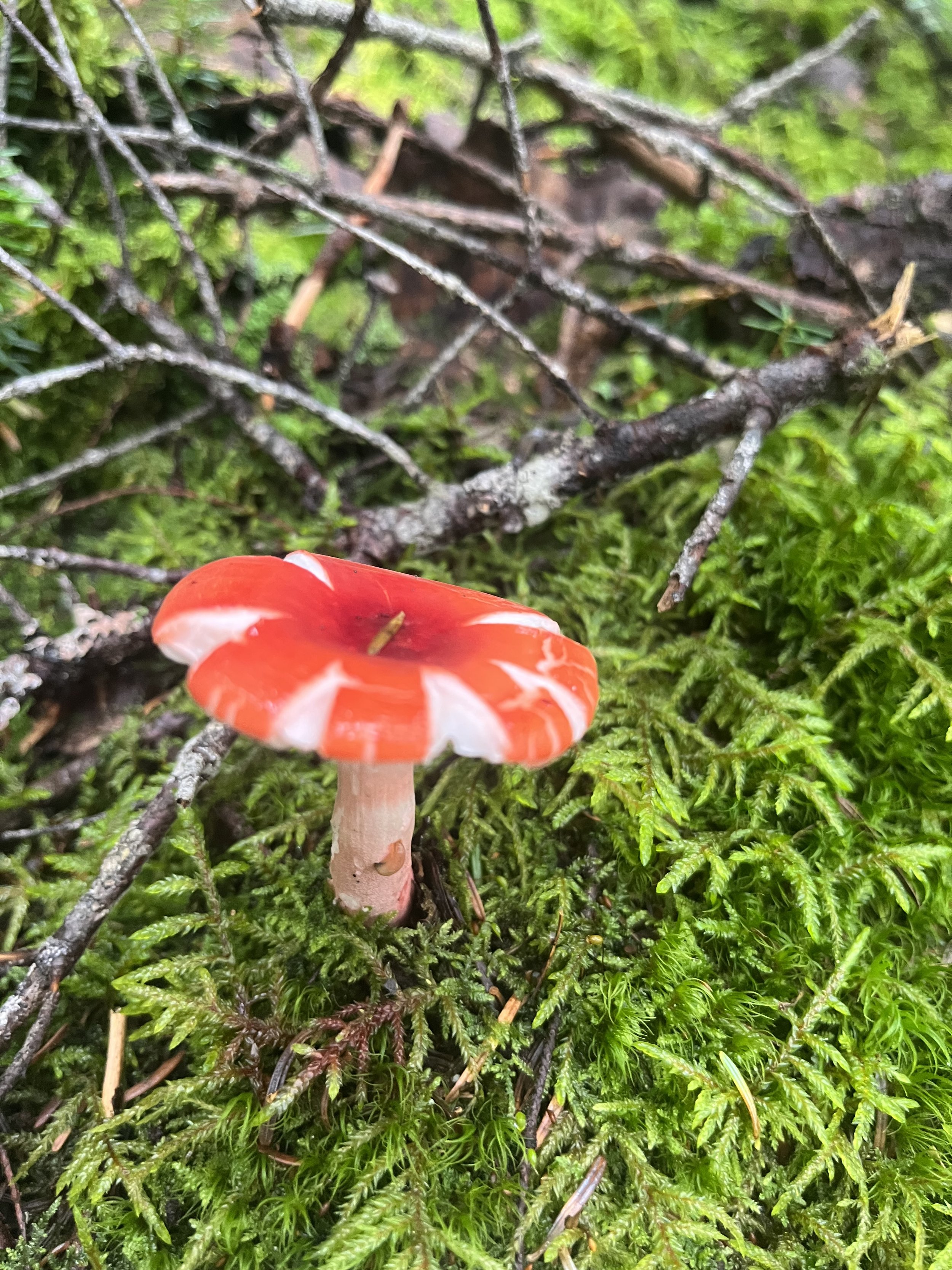
Cool looking mushroom.
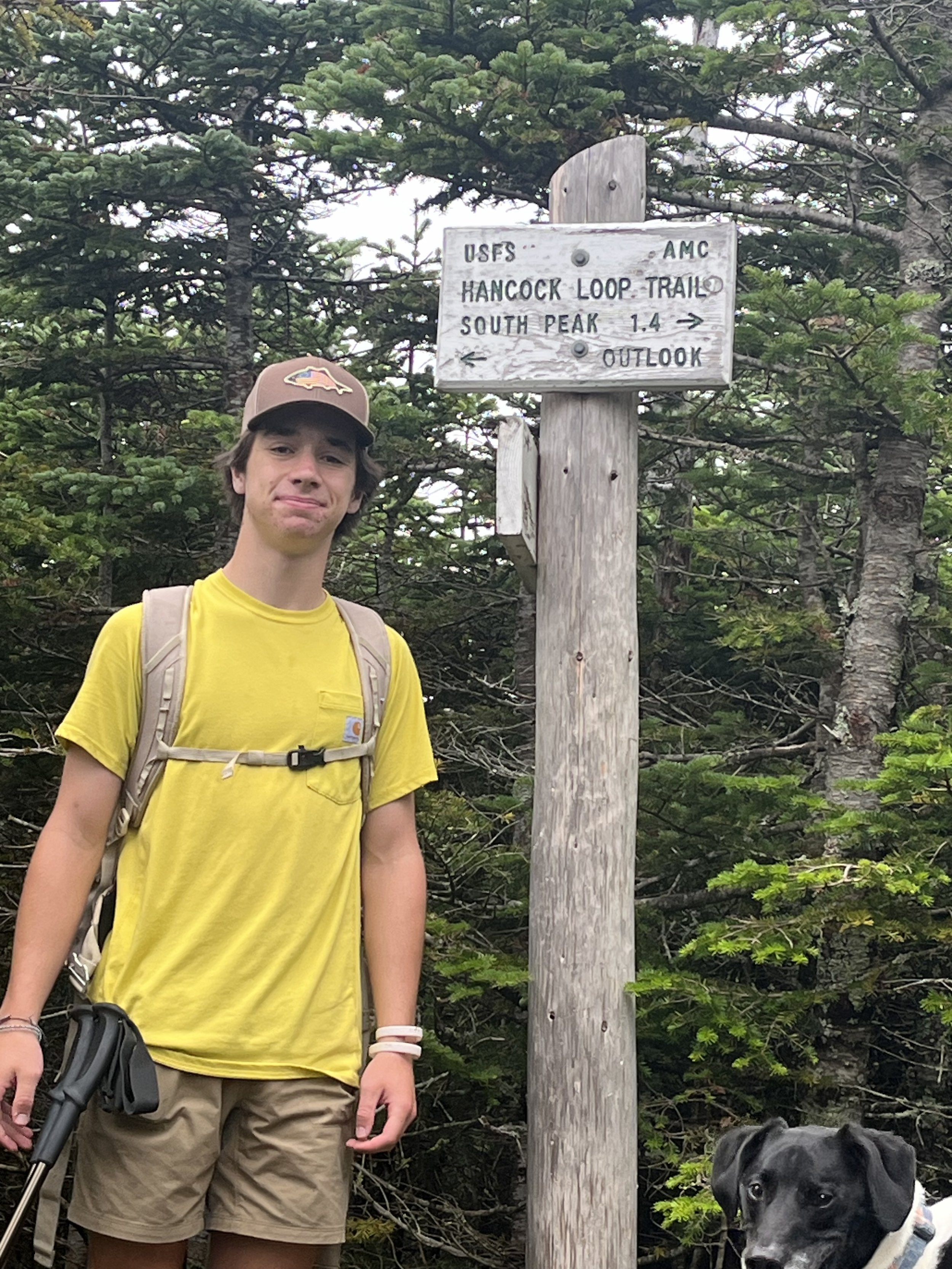
Kyle on North summit.
Monroe and Big George
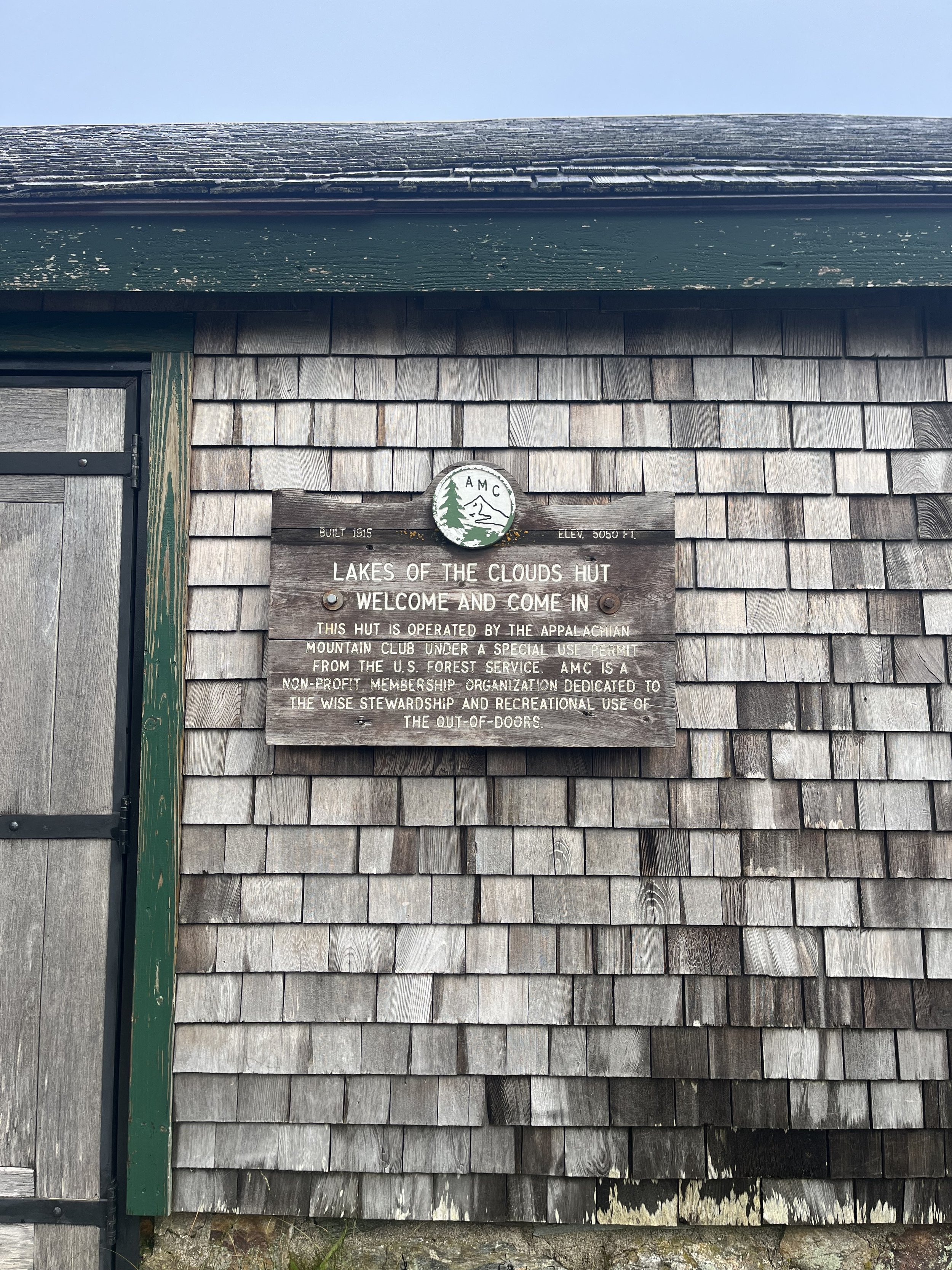
We did it! The long awaited hike up the Ammonoosuc Ravine Trail to Lakes of the Clouds Hut, Mount Monroe and Mount Washington. I have been thinking about this hike for a very long time now, even before my surgery it was something I always wanted to do. To me it would have been a huge accomplishment before I was sick but to do this hike post bypass surgery is second to none as far as emotional hikes go.
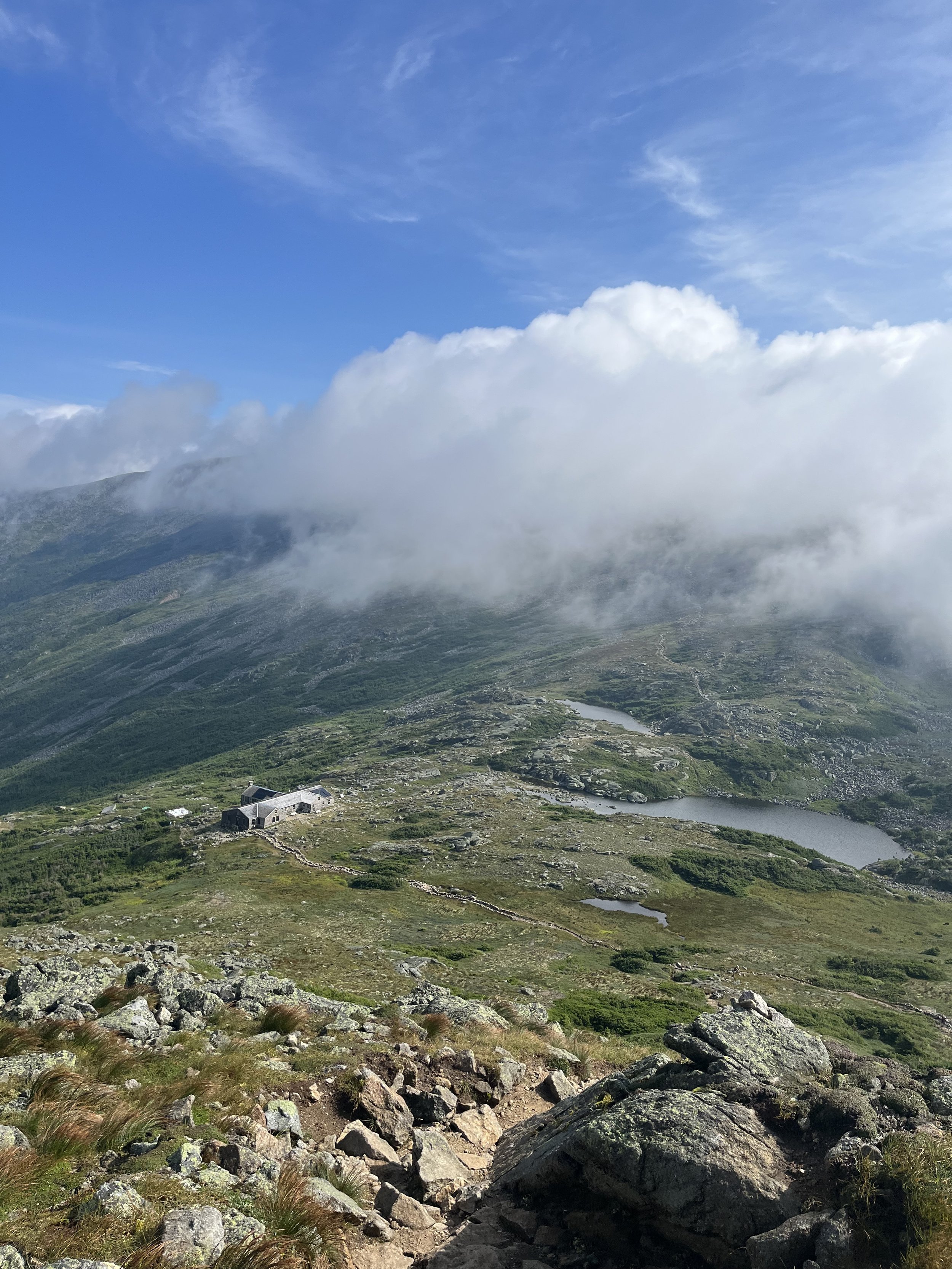
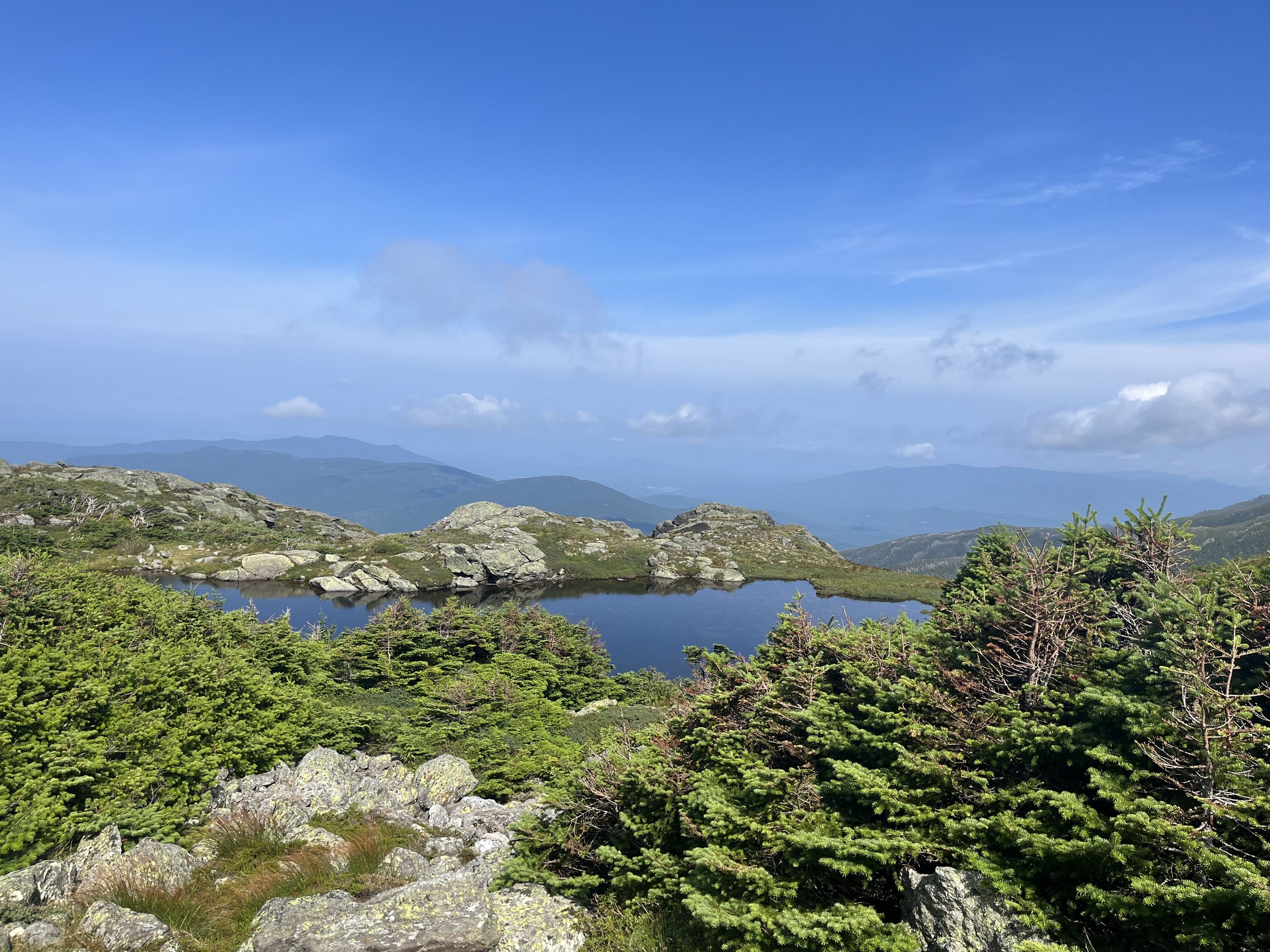
We started out at the Ammonoosuc Ravine Trailhead at 6:15 and were pleasantly surprised by nice weather and clear skies hoping this would last throughout the hike. I know this is a lot to ask in this area of the Whites so we both (Kyle and I) just agreed to enjoy this day no matter what. After about two miles of fairly flat terrain we hit the Gem Pool which was absolutely stunning! I actually had reception so I FaceTimed Erin and showed her what we were looking at. We then had a bite to eat and a few swigs of H2O and got on with the next part of the hike. The last mile is a ridiculously steep ascent up to the Lakes of the Clouds Hut which went by fairly quick due to the insane views and water features. Some of this didn’t even look real. Amazing! When we made it up the last 1600 feet of elevation gain in just one mile we came up to the Hut and the lakes and again our reaction was priceless. Just looked at each other and smiled and were shocked by the beauty standing before us. We decided to take another little break, bought our Hut patches and began our ascent to Monroe. After a few steep scrambles we made it to the top of the 5305 foot beast that is Mount Monroe. Fantastic views, no wind and #17 on our quest for 48.
Our stop at the Lakes of the Clouds Hut before summiting Mount Monroe.
View just before the summit of Monroe.
View starting our ascent to Mount Washington.
Looking back at Mount Monroe. Always nice to catch a glimpse of what you just accomplished.
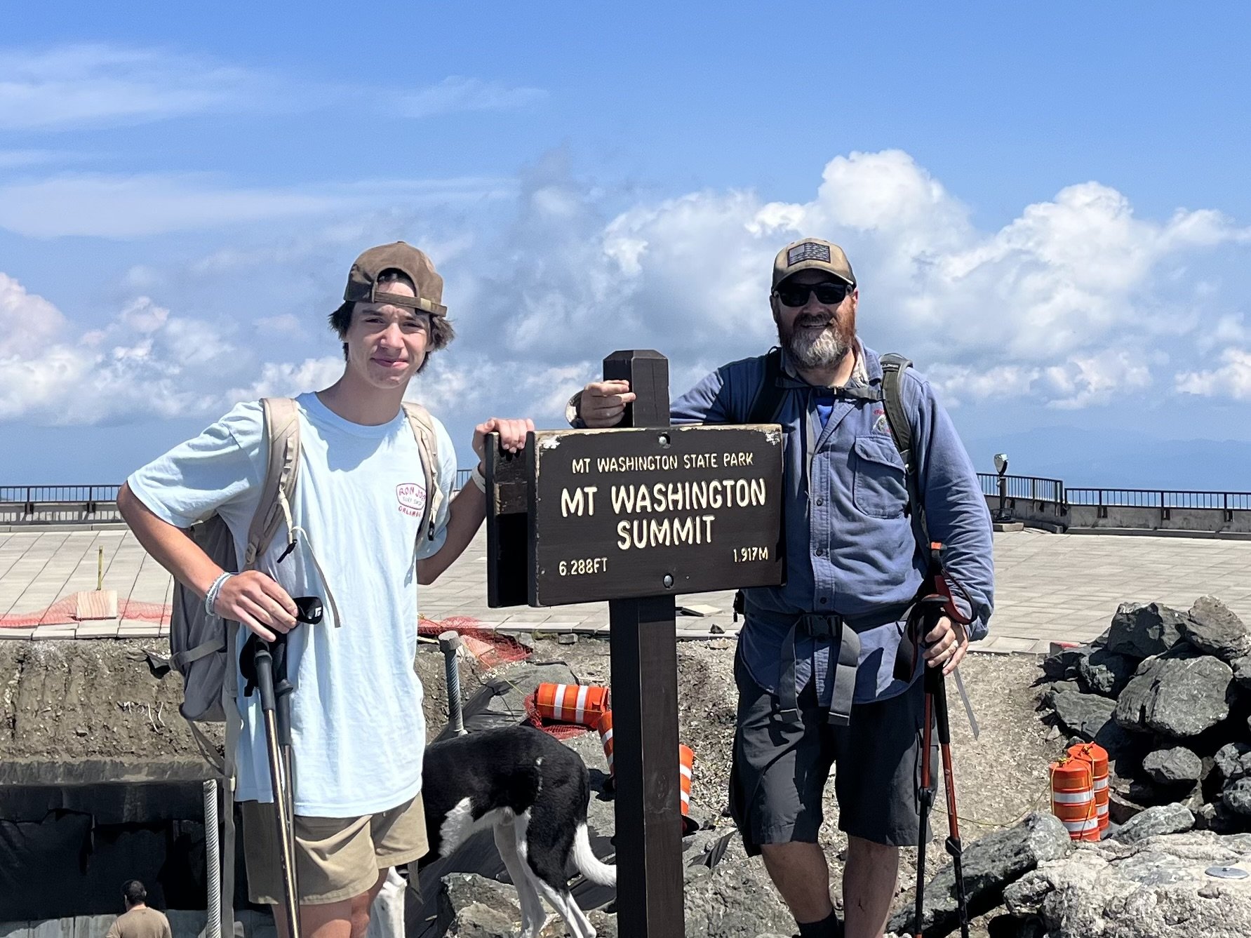
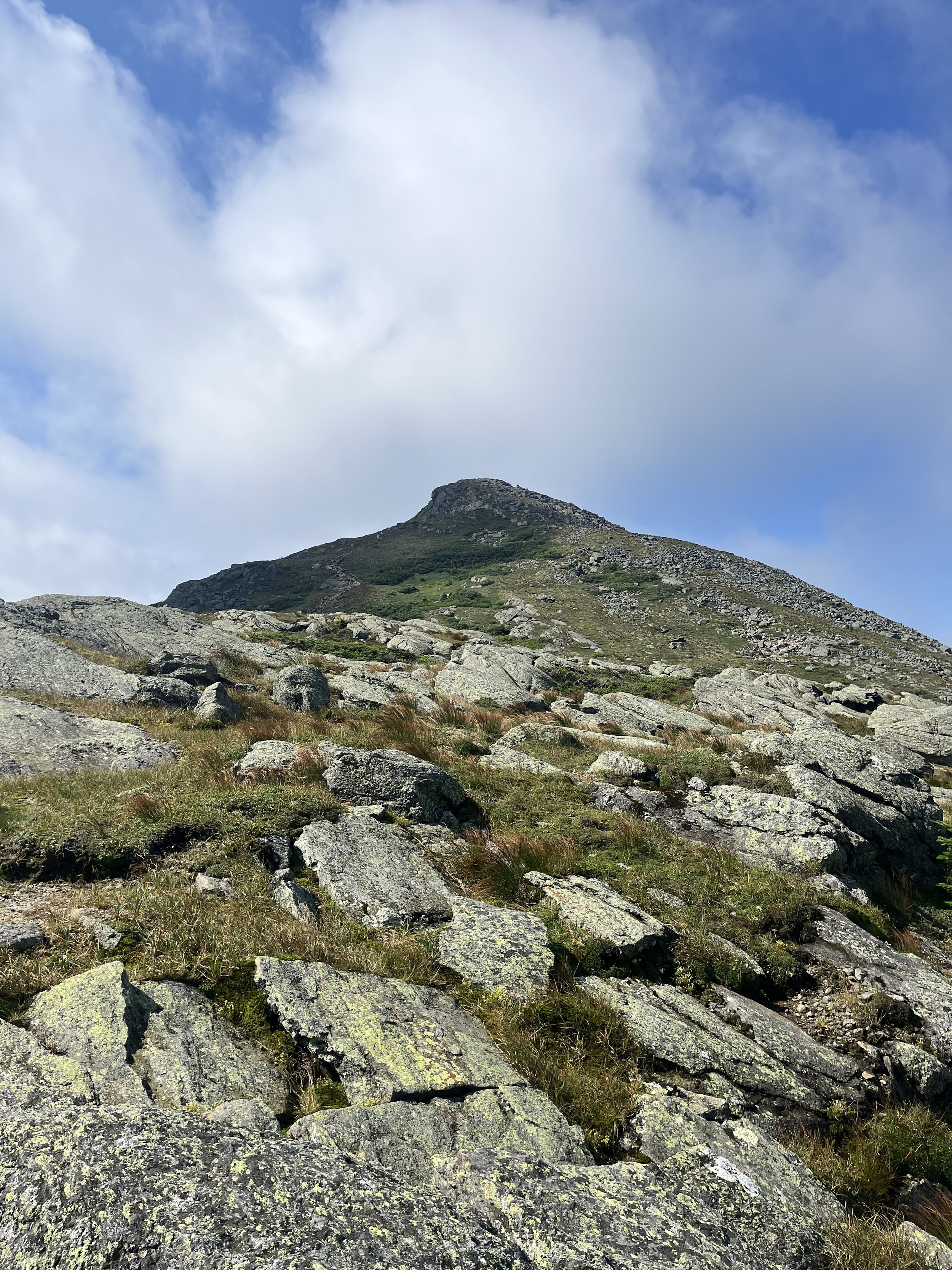
Here we go! After summiting Mount Monroe we were eager to get going and start the climb to Mount Washington. This was a cool part of the hike with views of the lakes and Washington in front of us and Monroe behind. We had 1.5 miles up the Crawford Path to the summit of Washington but looked way longer than that staring at the peak the entire climb. This is a steep climb but again, the views were amazing and helped make this part feel shorter and a tad easier than it is. The amount of people on the trail is kinda nuts but everyone is super friendly and we had many conversations on the way up. Finally we had reached the last 0.1 mile mark and pushed through to the summit for #18. HOLY SHIT!!!!!!! I looked at Kyle and said “we just summited Mount Washington,” he gave me a fist pump and the rest is history. This is a day I will NEVER forget. We bought two more hiker patches at the gift shop and ate our lunch at 6288 feet, enjoying the views of Jefferson, Adams and Madison. While sitting atop the tallest mountain in the northeast and the most topographically prominent mountain east of the Mississippi River, I shed a tear or two and told Kyle that these were tears of joy and just had crazy emotions going through my head. What a feeling this was.
Not a bad view while eating lunch.
Now for our loooooong descent down the Gulfslide Trail and then connecting to the Jewell Trail. This was fantastic at first when on the Gulfslide Trail, views were amazing and it is kind of a gnarly stretch but well worth it especially in perfect weather. Once we hit the Jewell Trail things got a little annoying. This is just a very long trail after a very strenuous climb and we had to step over jagged rocks a good portion of the descent so this was not the best part of our hike. After finally breaking into the woods things felt normal again. Feet felt better, softer terrain and a gradual downhill climb which was in need at this time. Another two miles of gradual downhill and we finally hit the Cog Railway Station and walked back to our car to end this absolutely tremendous day. Headed back to the house and cracked a cold Tuckerman’s Pale Ale (no beer more fitting for this hike) had a campfire with a few good friends and called it a night.
Jefferson, Adams and Madison from the Gulfslide Trail on our way down.
Thankfully no worries about bad weather on this day!
Cannon Mountain
After the boulder climbing rock scramble we made it to the summit with zero view.
What we thought was going to be a clear day to see some of those Cannon Mountain views turned out to be quite the opposite. Now don’t get me wrong, any day in the Whites is phenomenal but it has been a rough stretch of weather and bad luck.
The alarm sounded at 4:30am and hopped right out of bed, made a pre hike smoothie and an egg sandwich. I then woke Kyle and Rocky up and got them going as well. We departed the house at just about 5am and planned to be on trail by 6:30-6:45. On our drive over the Kanc we saw the sun coming up and blue in the sky so we thought this would be a good day weather wise. Ummm…Franconia Notch had other plans just like our hike up Liberty and Flume two weeks prior. The one thing you learn pretty damn quick in the Whites is that the weather could not give a fuck about you and your plans but like we do in these situations, just make the most of it and have fun. Now this wasn’t horrible weather that made the hike less pleasurable, it was more the nuisance clouds and fog rolling in as we were halfway up.
We hit the Lonesome Lake trailhead at 6:45 and began our trek up to Cannon. We would take the LL Trail to Kinsman Ridge Trail and end up at the tower on Cannons summit. Started out steep (~1000 foot gain) the first mile then you get a nice 0.6 mile flat section to get that heart rate down for a few. We checked out Lonsome Lake and it was spectacular as it was still clear skies and sunny at this point. After the flat we start to go up again about 700 more feet of gain in a half mile before meeting up and getting onto the Kinsman Ridge trail. This was the steepest but actually the most fun throughout the hike. The gain here is about 600 feet in 0.4 miles and most of it is rock scrambling over huge boulders. You definitely have to keep your focus at this point of the hike. We had to grab tree roots more than a few times to get from rock to rock. After a grueling 0.4 miles we were at last back on some flat terrain. The last 0.1 to the tower was easy and we went headed straight to the cafeteria at the tram station and grabbed a snack and sat out on the deck looking at nothing but fog and clouds! Couldn’t see anything!!! Luckily we have skied Cannon multiple times so we were aware of some of the view points but never have been on the other side of the rim trail to check those views out. We hit Lonesome Lake Hut on way down, purchased a few patches for our packs, had a drink and continued to the car. Bottom line, it was a fun hike and we will do it again on a clear day. 🤞

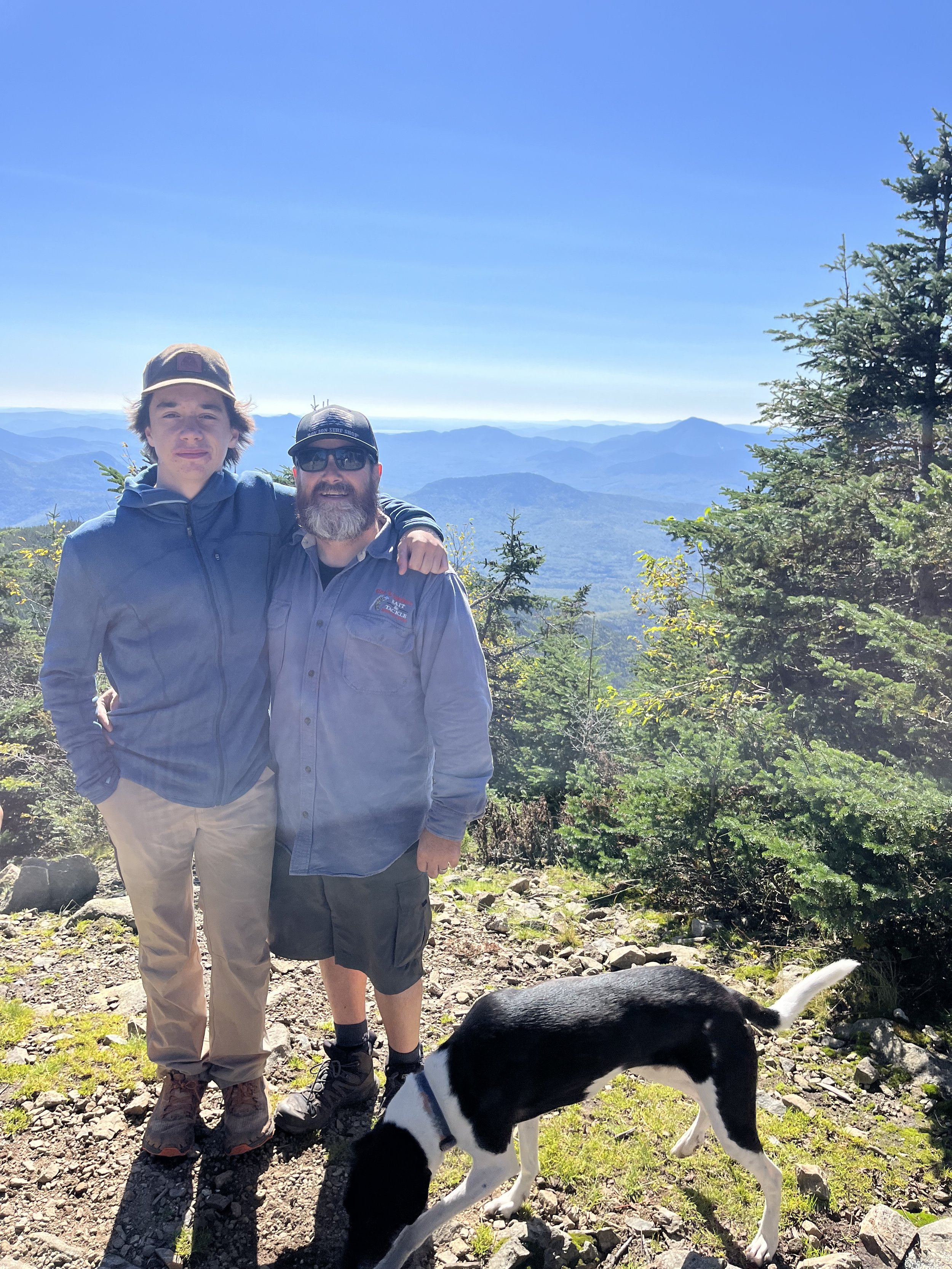
Kyle and I all smiles after completing #16 on our journey to 48!

Lonesome Lake early morning before the clouds rolled in. The lake is almost 3000 feet above sea level.

Our spectacular view (sarcasm) from the rim trail on the summit of Cannon.

The crazy steep scramble on Kinsman Ridge trail.
First Hike of 2023 and overcoming yet another obstacle
Let me start out with telling you that six weeks prior to this hike, I was out taking my normal 4 mile “after work” walk and starting feeling pressure in my chest. This was eerily similar to the feeling I was having before my bypass. I gave it a few days (dumb on my part) hoping it would go away or I was overthinking it. Well, sad to say that was not the case and I called my cardiologist who immediately got me in for an appointment.
I told him the symptoms I was having and scheduled an appointment for a stress/echocardiogram for a few weeks later. The stress/echo looked good but I was still having symptoms. So.. back to the Cath Lab for another angiogram. They found the culprit and put a stent in my Ramus Intermedius artery. I immediately felt better and after two days I was back at work.
I had my follow up appointment a few days later with my cardiologist. I want to be honest about my feelings while I write about this situation. It was a huge kick in the nuts! I felt defeated, depressed, pissed, confused. I broke down in the doctors office. I am not afraid to say it. I cried. I was scared but again got the assurance I was ok and can get on with my life. My first question after my breakdown was “can I get back to hiking?” Well you can look below for the answer.

Galehead Hut. Stopped for a quick break before reaching the summit of Galehead Mountain.

The wooded summit of Galehead. 4024’

Kyle and Rocky on the summit of Galehead.


Completed 12 of the NH48 in 2022
It all begins with an idea.
What a year in the Whites!!! Along with Kyle and Rocky (our dog) we successfully reached the summit of 12 of the NH48 and two others which were Mount Guyot which is not counted toward the 48 due to it’s prominence and Old Speck in Maine.
This was an absolute blast and also so damn emotional. Just knowing I was able to get back out in the mountains again and enjoy doing what I love was an amazing feeling. My family’s support was the biggest boost to get me back out there and live life. I look forward to 2023 and knocking off a few more mountains.
https://www.summitpost.org/mount-guyot/710504
http://4000footers.com/oldspeck.shtml
https://www.alltrails.com/trail/us/maine/old-speck-mountain-via-appalachian-trail

My first 4000 footer!
It all begins with an idea.
5/26/2022
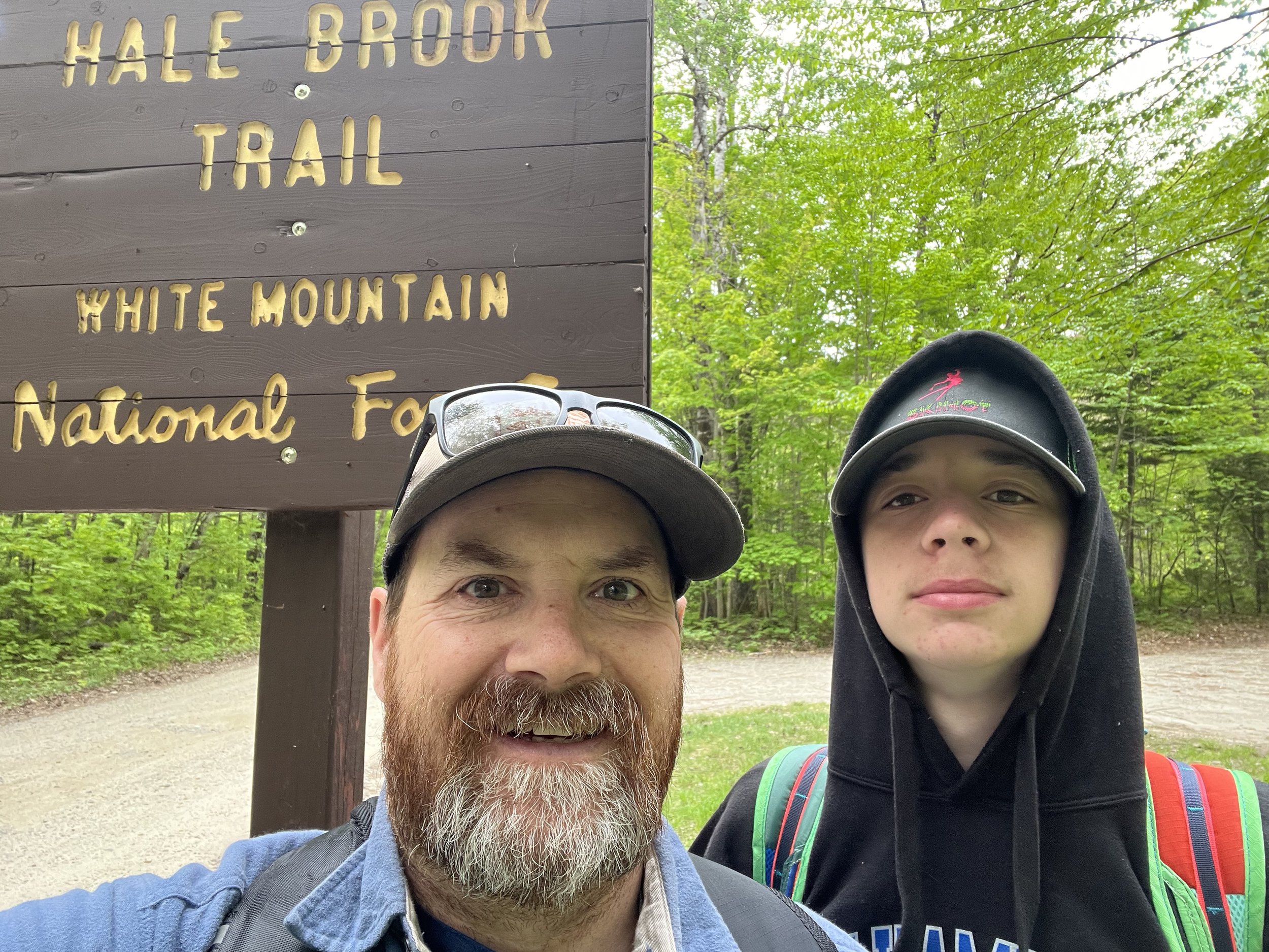
I actually did it!!! I must admit, I was nervous as hell to try this for real but had assurance from my doctors and all the support in the world from my family which made this a lot easier. Kyle and I decided on Mount Hale for the first of the 48-4k’s.
This was a fun hike. Good one to complete first, although steep it was a short enough hike so we were glad we chose this one first. It was also very emotional for me as well as Kyle but the bottom line is that I completed my first of many more to come. The hike itself is pretty secluded but that’s not a bad thing. We saw maybe five other hikers all day and met a gentleman at the summit who we had previously talked to over at Pleasant Mountain (Maine) and he had told us to take the longer route down to the car. We wound up taking his advice and took the Lend-A-Hand trail to Zealand Falls then to the Zealand Trail and finally came out on Zealand Road. This was a bit more than expected as we had to walk at least a mile back to the car on Zealand Road to Hale Brook parking area. All in all it was a great day and will never forget my first 4K!
https://nicholethenomad.com/hiking-blog/easiest-4000-footers-in-new-hampshire
https://www.alltrails.com/trail/us/new-hampshire/mount-hale-via-hale-brook-trail

Completed the Belknap 12!
It all begins with an idea.
April 2 - April 30, 2022. Finished Summiting eight of the 12 peaks in the Belknap Range (NH) and along with our son Kyle and dog Rocky, we earned our first patch! We started hiking the Belknap Range prior to my complications. We had completed four of the eight so it was nice to pick up where we left off as there is no time limit on completing all twelve summits. The summit views from this range are unreal with Lake Winnipesaukee on a few. A bunch of the summits were wooded but nonetheless still very cool. My favorites were Mount Major and Piper. Finishing these in a short amount of time and feeling great physically while doing it gave me the confidence to actually try hiking a 4000 footer. The Belknap Range is a great way to get started and get a confidence boost to realize what can be accomplished.

First hike following bypass
Black Cap Trail -North Conway, NH
August 2, 2021: This was a great way to just get back out in the mountains and see how I felt. This trail is very short with a few steep parts but the best thing about this day was being together with my entire family.
Black Cap Trail -North Conway, NH
August 2, 2021: This was a great way to just get back out in the mountains and see how I felt. This trail is very short with a few steep parts but the best thing about this day was doing it with with my wife. We brought the kids back to Black Cap a few weeks later as well. There are fantastic views from the top and a ton of blueberries to pick as well so we took advantage of that of course.
Kyle and Ella on Black Cap. This was one of our first hikes after my surgery. Good day and one that the whole family was part of. Erin and I did this same hike a few weekends earlier along with Peaked Mountain.